
* This article groups together the different Québec national parks described in the various articles
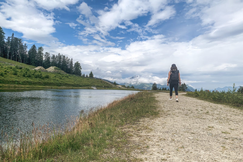
Vastness territory where nature is omnipresent, Québec represents a world of discoveries. During our road trip in the province, we focused on this wild natural side of the region, which led us to explore several Québec national parks.
Quebec national parks are grouped under the name “SEPAQ”, literally “Société des Établissements de Plein Air du Québec”, administered by the Quebec government, although some of these parks are part of the Canadian national parks network. Only three parks in Quebec are given the appellation of “Parks Canada”.
With over twenty destinations located throughout Quebec, according to the organisation’s official website, these parks list more than “6,995 km² of protected areas”.
We took the opportunity to explore six of them to discover their fauna and flora. Whether hiking, canoeing or driving, we loved to venture into these incredibly rich places where nature is utterly authentic. Each park has its own particularities, and I’m going to write about a particular one for this article.
However, before starting, two small clarifications should be given.
Firstly, what is a national park?
Here are the terms used by SEPAQ:
« A national park is an area representative of a natural region and whose vocation is to preserve natural and cultural heritage. The ecosystems thus protected from logging, mining, and hydroelectric exploitation can develop according to their natural processes for the benefit of future generations.
A national park also must make the territory accessible so that everyone can discover the natural and cultural resources it protects. Discovery programs and low-impact activities, such as hiking, canoeing and camping, are the preferred means of discovering these areas.
The national park concept is everywhere in the world, and Québec is no exception. The actual network meets all of the international standards defined by the International Union for Conservation of Nature (IUCN). In this context, Québec’s national parks are managed to maintain the balance between the conservation of natural and cultural heritage and public access.
The concept of a national park is present all over the world and Quebec is not to be outdone since its national park system meets all the international standards defined by the International Union for Conservation of Nature (WCU). In this context, Quebec’s national parks are managed to maintain a balance between the conservation of natural and cultural heritage and public accessibility. »
A speech that shows the desire to be attached to these places where only nature matters. If you are interested in their projects or actions, you can visit their website www.sepaq.com.
Also, each national park is subject to a daily fee. Many parks offer seasonal passes, and SEPAQ offers a full pass for 67.70 CAD, about 50 CHF, which allows entry to all the national parks they regulate.
As we were not going to exceed this amount, we chose to pay for the entrance to the parks individually. We chose to, especially, never spend the night in one of them, since this logically increases the admission fees. Of course, camping sites, bungalows or even typical chalets are available in all national parks, but it is mainly travellers who stay several days in the parks who sleep in these places.
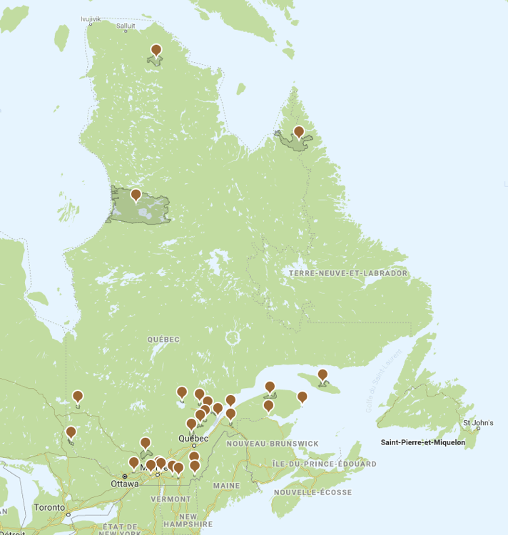
Here is a map of our road-trip with the national parks we visited, as well as the one we could have seen, the Miguasha National Park:
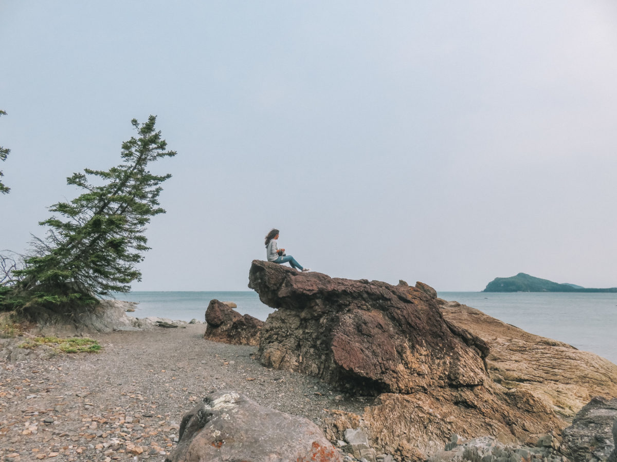
Québec National Park: La Mauricie
As soon as we set foot on the Canadian territory and rented a car, we took the road directly, after 7 hours by plane, to La Mauricie National Park, which was the first stop on our road trip. It took us about two hours from Montreal airport to reach the town of Saint-Mathieu-du-Parc, where we spent two nights exploring the park. This location is one of the park’s gateways, but above all, it is the closest place to the hike we had planned to do.
La Mauricie National Park, which was created in 1970, is one of those administered by the Canadian government, so it does not appear on the map above. Located in the region of the same name, it covers nearly 536 km² and offers a concentration of Canadian nature and its authentic heritage.
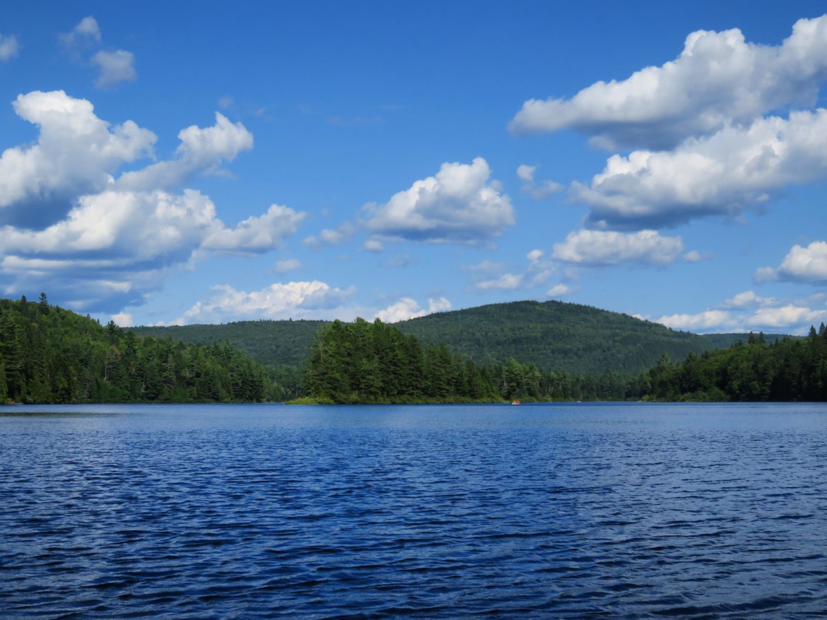
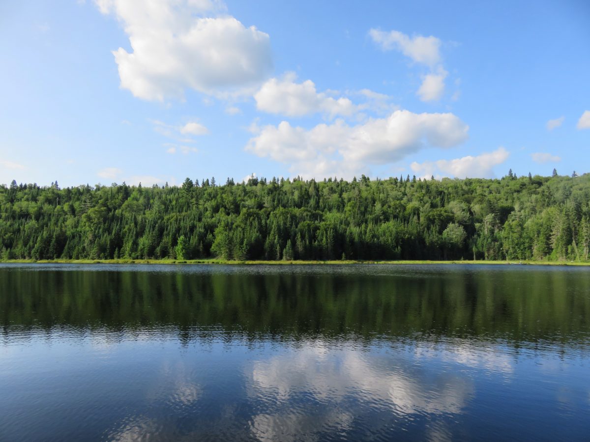
It is full of coniferous forests but especially of lakes! I must say, I’ve never seen so many in such a short time. Indeed, more than 1,000 lakes of all sizes are scattered in the Mauricie area.
This park is located in the heart of Quebec, halfway between Montreal (200 km) and Quebec City (190 km). The most efficient way to get there is by car since the park is not served by public transportation.
Québec National Park: Daily rate in 2018
Adult 7,80 $
Senior (65 years and more) 6,80 $
Young (17 years and under) Free in 2018
Family 15,70 $
ACTIVITieS :
This national park is full of all kinds of activities! There is something for everyone: swimming, hiking, fishing, kayaking, and many more activities. In any case, it is impossible to get bored and you can spend a whole week there without having had enough adventure.
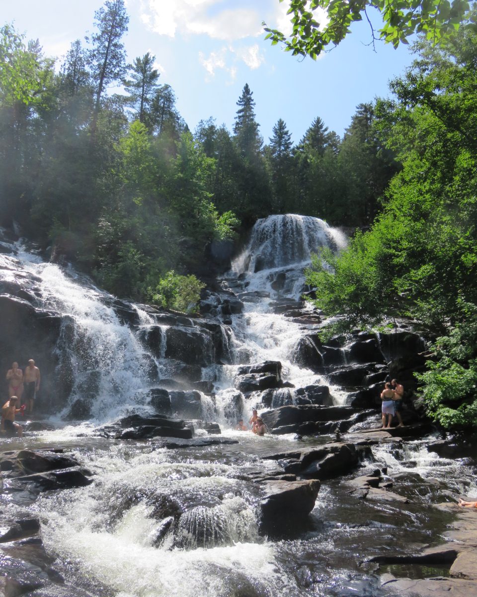
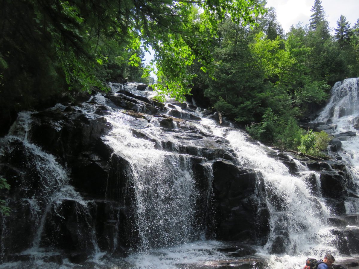
Our host advised us to do the most famous hike in the park, the Waber Falls one: 9.2 km by canoe (round trip) and 7 km by walk (round trip). That’s a lot to just see waterfalls, but we wanted to surpass ourselves and they are catalogued among the prettiest in Quebec. Besides, I had never been in a canoe before.

For the printable version, you can go to the official website, here.
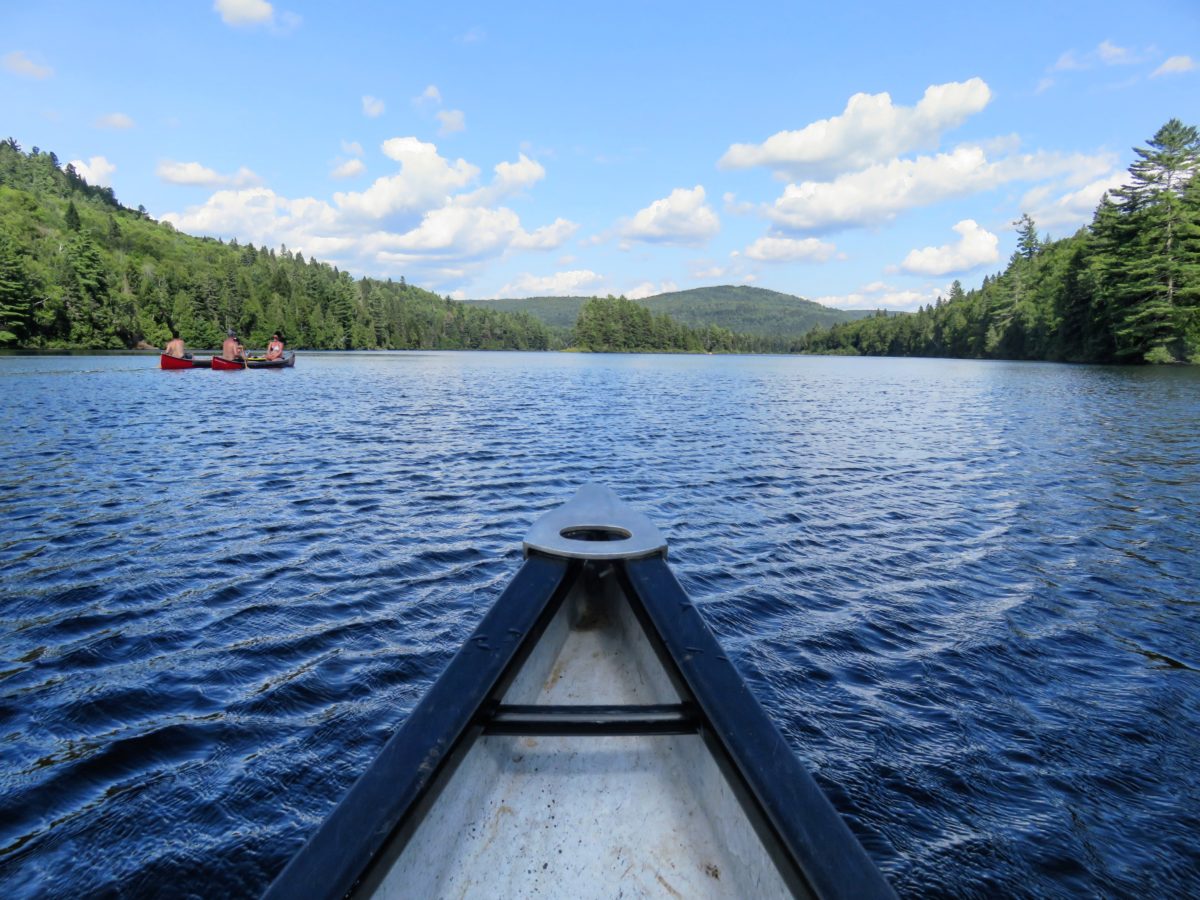
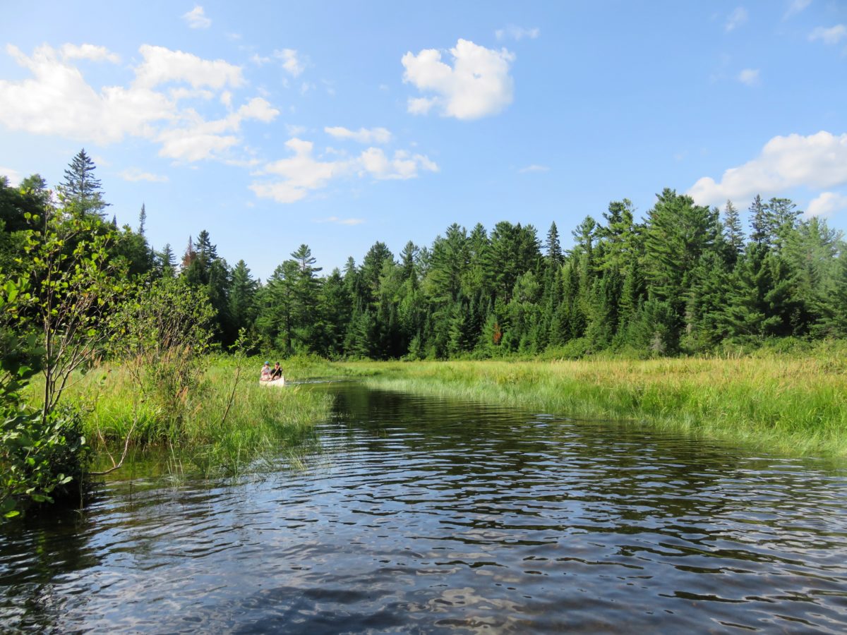
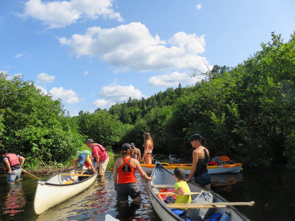
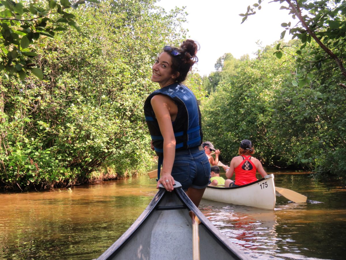
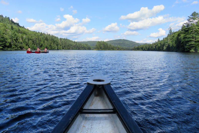
We started this adventure by renting a canoe for the day at the Wapizagonke Lake picnic area. Having never been in a canoe before, I really didn’t know what I was getting into…
Before renting the canoe, a short questionnaire was proposed by the concessionaires in order to learn more about our level. We answered almost all the questions by deduction except the last one, which was: “Have you ever sailed (canoe, kayak, etc.)?” When we clicked on “no” and the term wrong answer appeared on the screen, I thought we wouldn’t be able to rent a boat. Well, that was not the case! After paying $55 (renting or some activities in the parks are somewhat expensive), we started our 5 hours adventure in the park.
In the canoe, we discovered life jackets and oars. After being equipped, we found ourselves a little confused next to our canoe, since we didn’t really know how to handle this boat. After a few moments of observing the people around us, we literally threw ourselves into the water.
I must admit that the only fear I had was to capsize, not for myself but for my camera, even though it was well protected in my waterproof bag (so not many pictures will be taken during the time in the canoe).
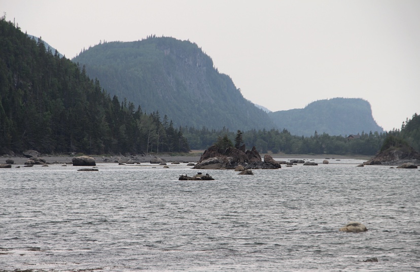
So, canoeing is a pretty nice activity, no previous experience is required and we were getting our bearings. After crossing a bridge, we entered basin number 3 of Wapizagonke Lake where a vast expanse of water opened up for us, an impressive sight.
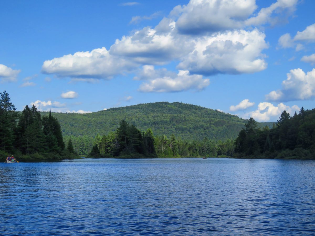
We found ourselves in the middle of a typically Canadian landscape! As the water was mirroring, it allows the reflection of the surrounding forests. While observing this magnificent landscape and paddling with enthusiasm, I was, at that moment, completely delighted to be canoeing. The return wouldn’t be so idyllic.
However, after about half an hour in the canoe, it was necessary to pass some old beaver dams, in other words, get off the canoe, soak our feet in the muddy water and carry the canoe. Exhaustion guaranteed when you are not used to it. After that, it took us about half an hour by canoe to reach the starting point of the hike.

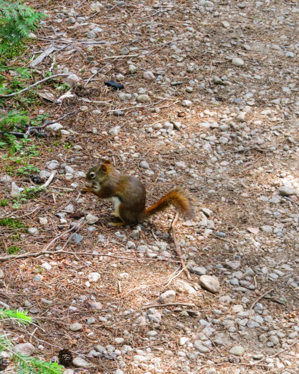
After an hour of hiking on a semi-developed trail through Canada’s conifers and without meeting any animals that didn’t look like squirrels or birds, we finally heard the sound of the water flowing, gently at first, then after taking a wooden stair ramp, above the racket.
The Waber Falls are quite small but the natural effect is present and allows you to soak up this pretty place for a picnic around noon. It is a very popular excursion in the park, we were clearly not the only ones enjoying this beautiful Quebec jewel.


We left with a lighthearted step after having recharged our strength thanks to the lunch prepared by our kind host, however, the tiredness was gradually starting to be felt and add to that our bodies still a little bit under the jet lag, the return was not restful and I was clearly less happy to paddle for an hour.

Despite a return a little more difficult, this escapade in the Mauricie Park will remain one of my best moments in Quebec.
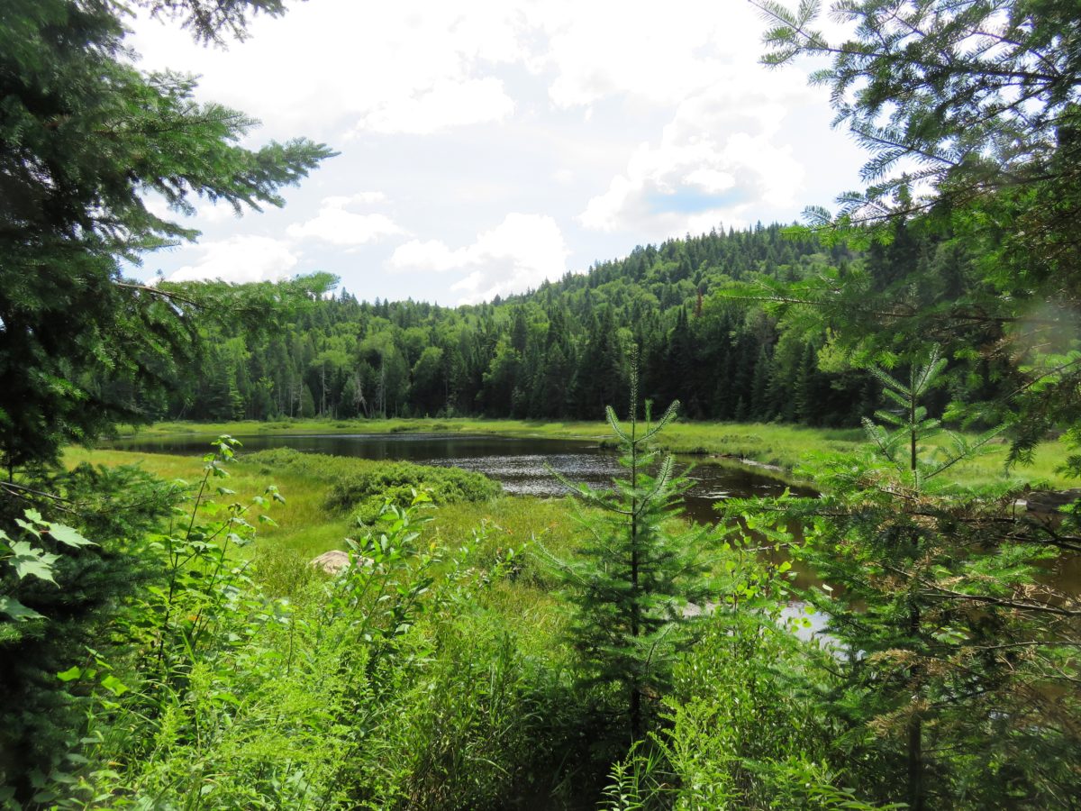
We left by taking the only paved road in the park that offers wonderful views on the park and the lakes. We did not venture further than Wapizagonke Lake, being too tired and dreaming only of a good shower. However, if you continue on this road, magnificent panoramas of lakes, forests or cliffs are revealed to the visitors.


« stars » of the park:
Several animals have made Mauricie National Park their home. However, the best way to observe them in the wild is to be attentive and perceive them in the early morning or late afternoon. Many behaviours are to be adopted if you encounter any but rest assured, everything is explained in the official park guide given at the reception desk.
This park is particularly famous for its bears, Canada geese, red foxes and even wolves. Moreover, about ten activities with naturalists are proposed to discover them.
And then, stay on your toes, since another predator is prowling around La Mauricie National Park… The mosquito! And this Canadian “bibitte” (little beast in Quebec) is very stubborn even when we are covered with mosquito repellents!
accommodation :
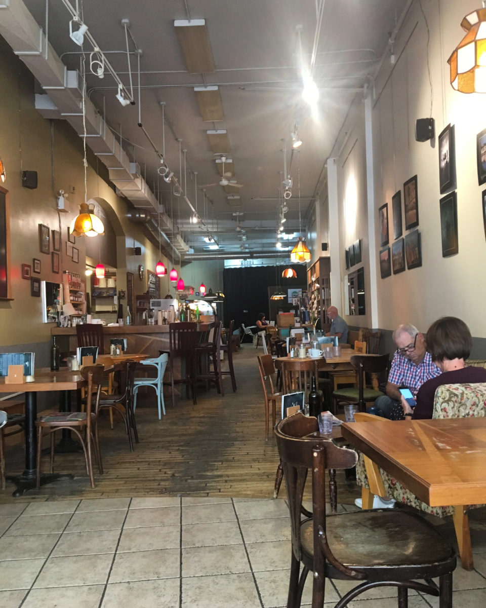
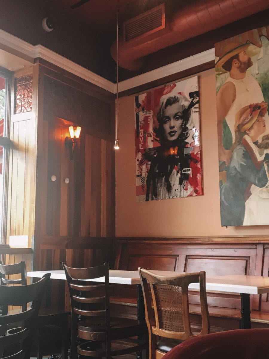
We spent our two nights at Suzanne‘s who runs guest houses with her family. Through Airbnb, these cottages are very welcoming and allow us to meet people, our first Quebecers (cultural shock guaranteed but only nice encounters). In addition, the family also has a charming bistro where the food is delicious and the atmosphere is authentic.
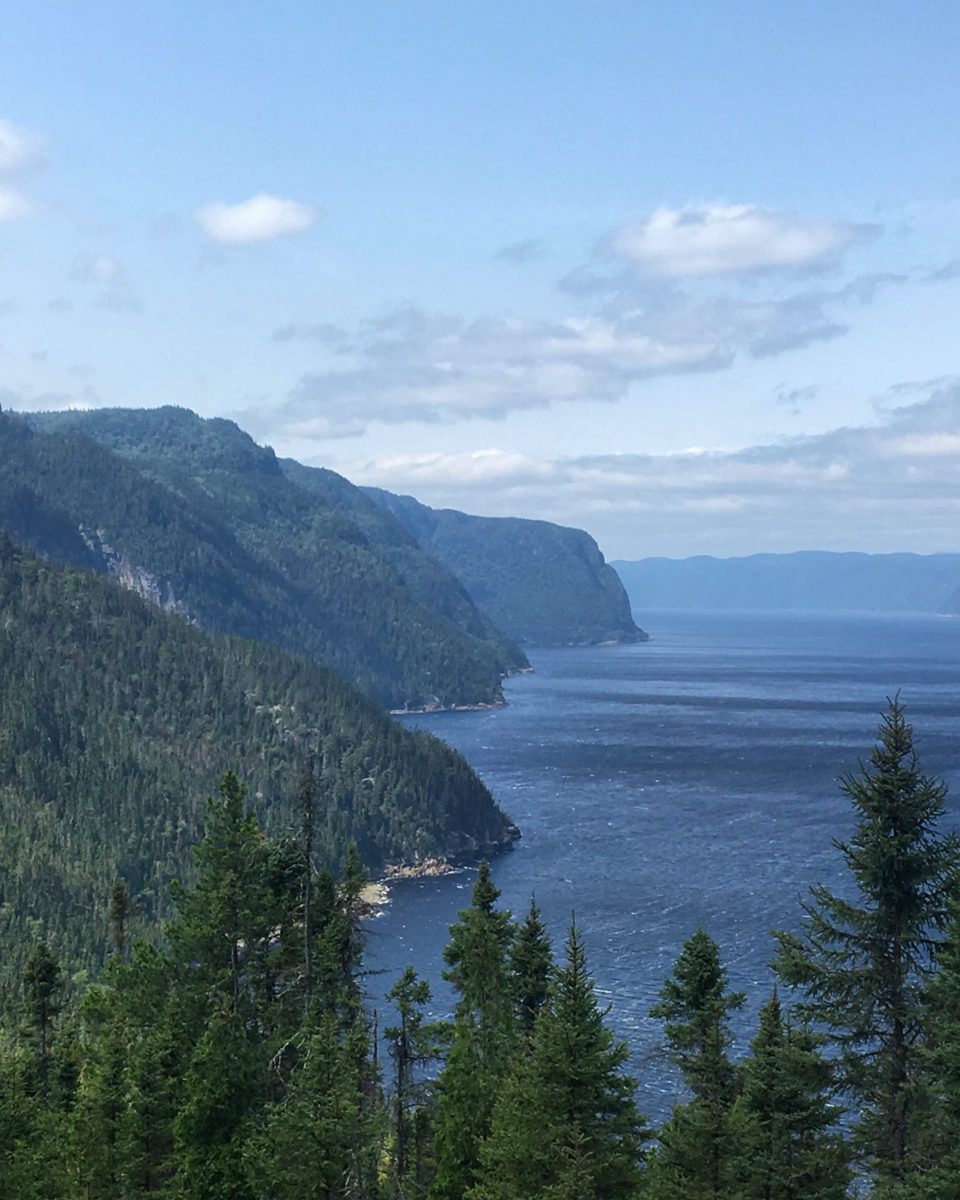
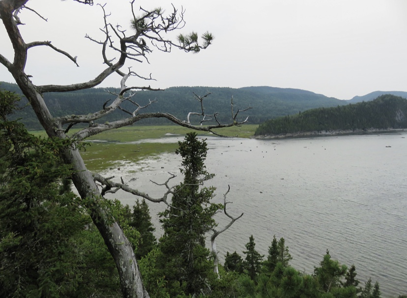
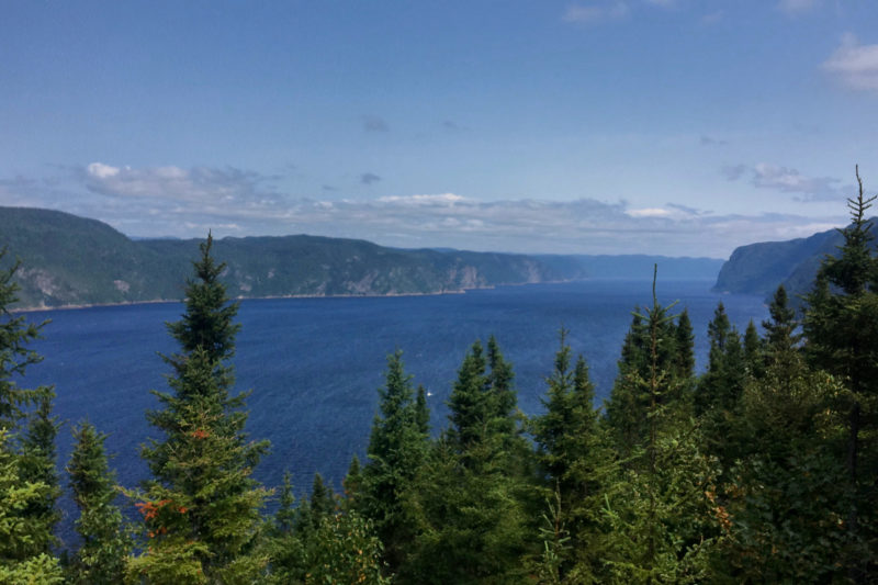
Québec National Park: FJORD-DU-SAGUENAY
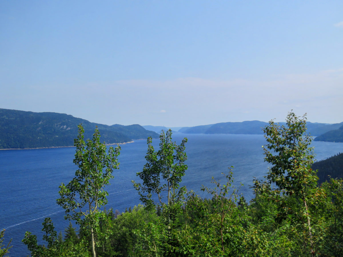
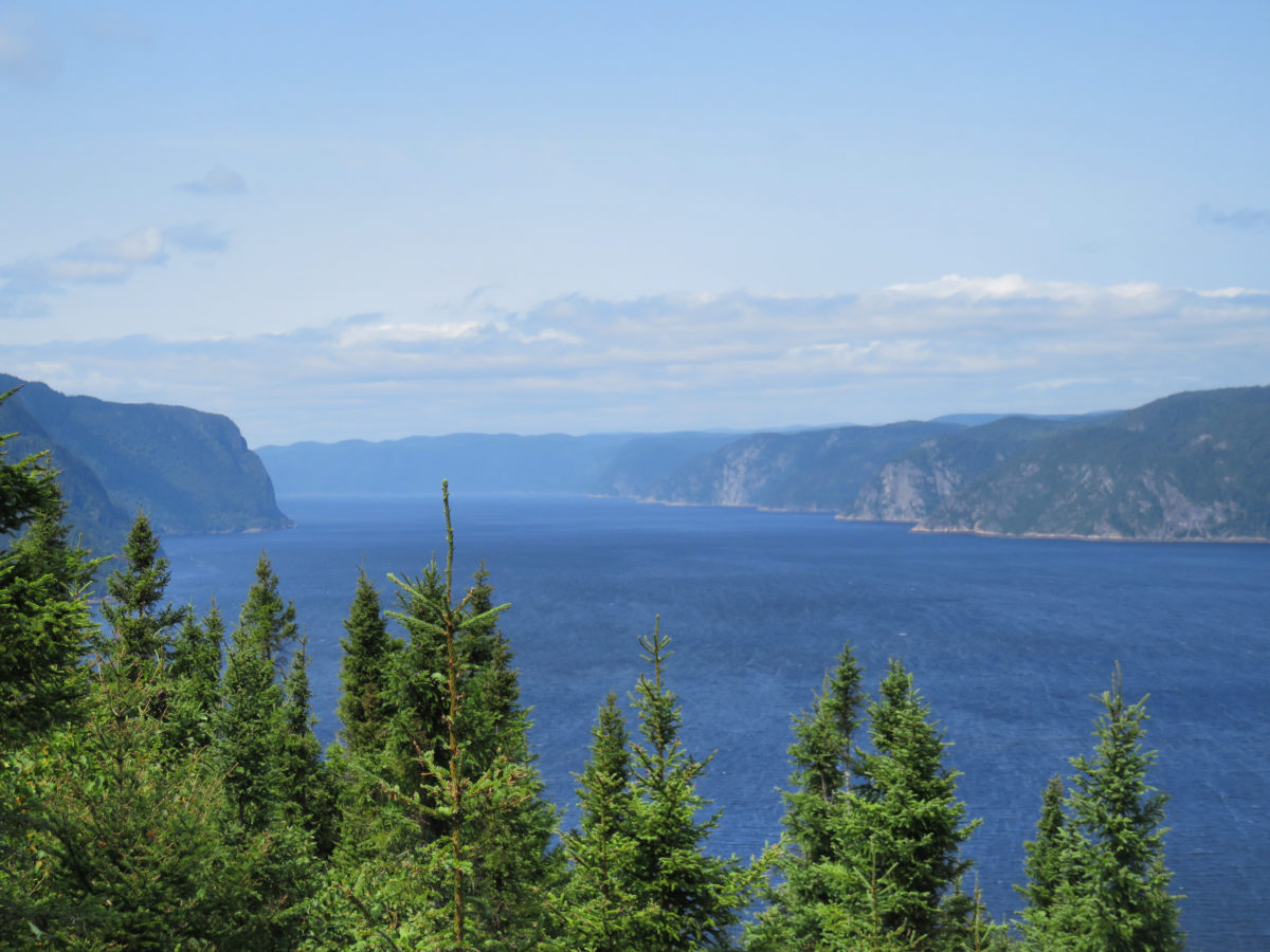
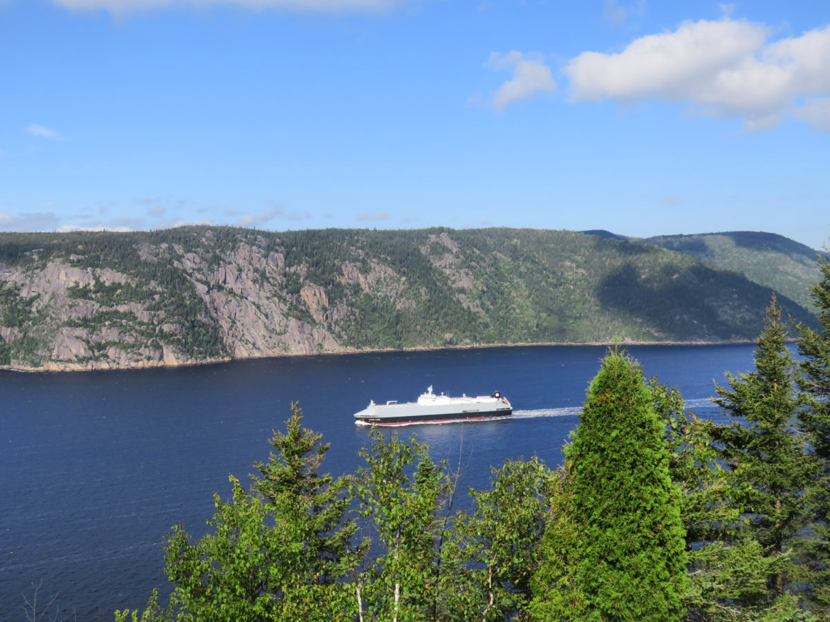
Our earth has more than 2,000 listed fjords, the best known of which are located in Scandinavia. So, imagine my surprise and then my desire to discover Fjord-du-Saguenay national park when I knew that Canada was counting one of these fjords.
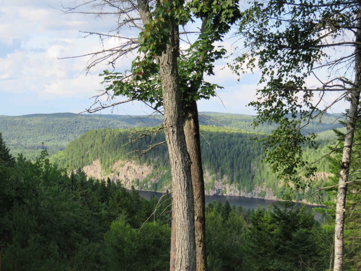
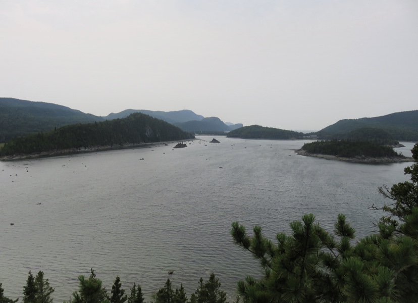
Rising majestically at the trough of mountainous areas, the Saguenay Fjord flows for more than 100 km before finishing its journey in the St. Lawrence Estuary. That only fjord in southern Quebec is, according to its official prospectus, “the longest fjord in the world at such a low altitude.” Thus, “this notch is the result of a fault excavated by the passage of glaciers, then invaded by seawater”.
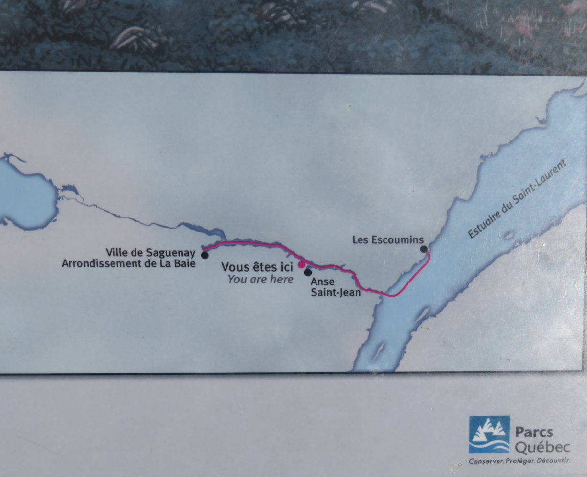
The park is divided into three sectors, the Baie-Éternité, Baie Sainte-Marguerite and Baie de Tadoussac. The park is located on both sides of the fjord, so it is utterly important to identify the activities or points of view you would like to do/see beforehand, as there is no possible passage (except by kayak or boat tours) between the two shores. The park is located over a hundred kilometres between the cities of Saguenay and Tadoussac on the banks of the fjord.

Québec National Park: Daily rate
Adult 8,60 $
Young (17 years and under) Free
ACTIVITieS
Many activities can be planned in the park, including the renowned via Ferrata during the summer period on the rocky walls of Cape Trinity. A great diversity of fauna and flora can be found in this natural refuge since the coves and bays are precisely proper refuges for animals but also for human beings.
Observation of wildlife is more convenient in summer, even if during the winter season, the park also offers snowshoeing and backcountry skiing activities.
As with all the parks visited, we opted for hiking, because we didn’t want to spend all our money on appealing but high-priced water activities.
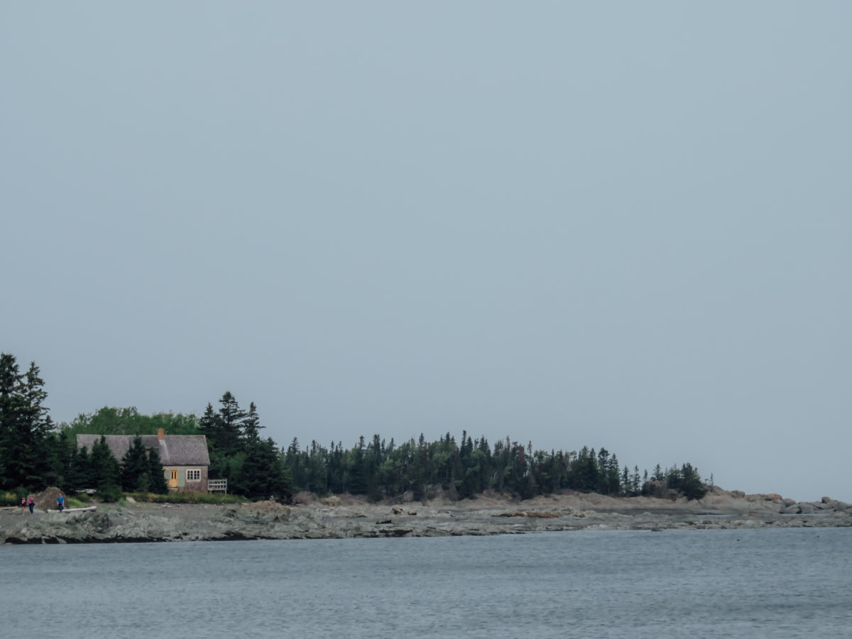
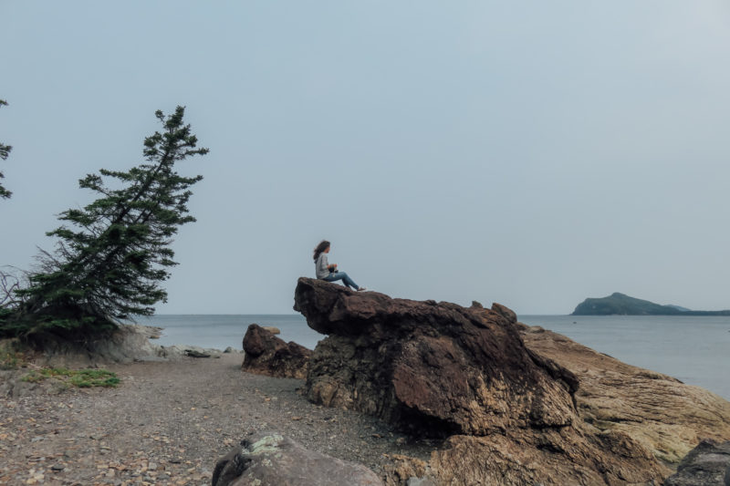
We started our journey by going to Anse-de-Tabatière, the only belvedere on the fjord that is accessible by car. To reach it, you must pass through the famous village of L’Anse-Saint-Jean. This municipality is part of the “Association des plus beaux villages du Québec” (an association for the loveliest villages of Quebec), however, we did not find any charm in this place.


Well, the small café and the surrounding houses of the city’s port are worth a visit, especially if you are interested in taking a trip by kayak or boat on the fjord. The village is not part of the park, so you can go there without having to pay the admission fee.
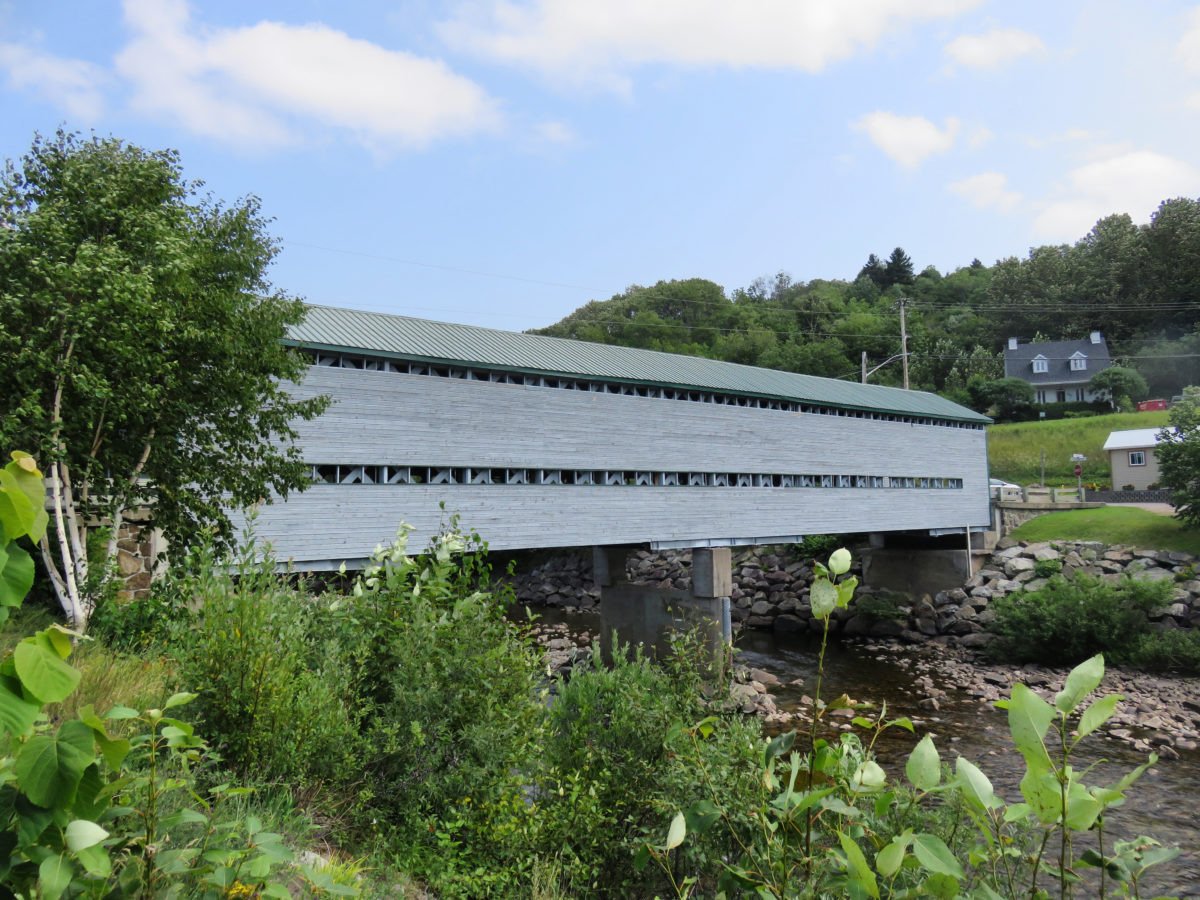
We took the road to Anse-de-Tabatière and we crossed the covered bridge of the city to end up to a small parking lot, after driving a few minutes following the cove. We paid the tax at the entrance of the parking. The charming ranger who watches the reception explained to us that we absolutely had to do the popular Statue hike afterwards. Alright, we had our next step.
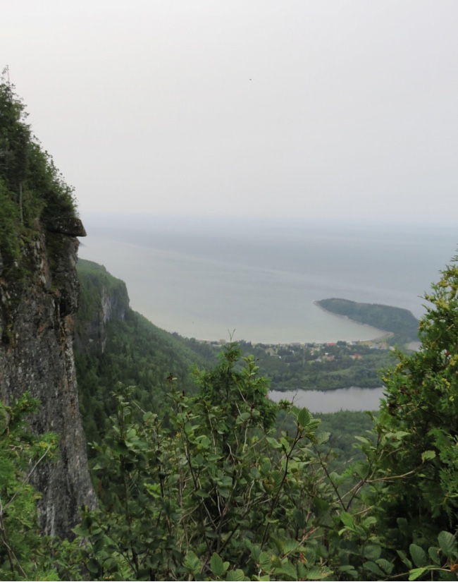
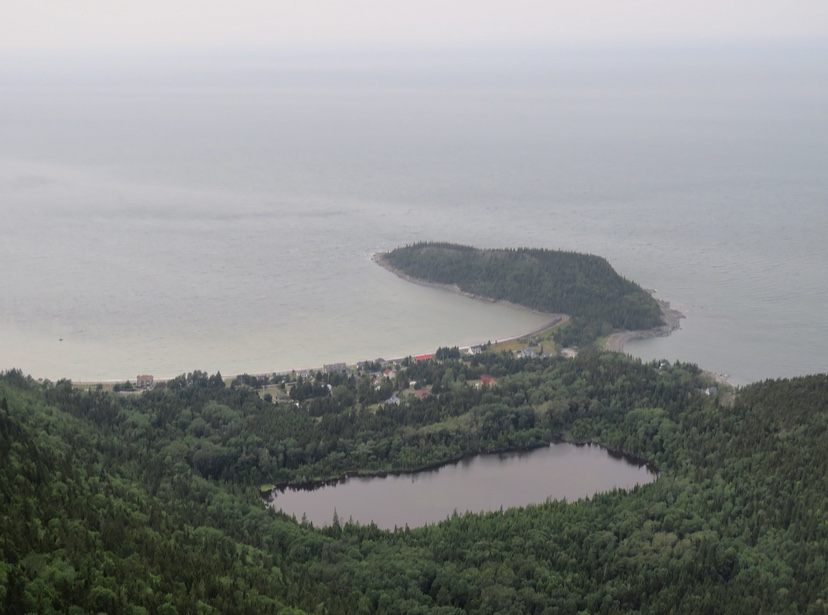
L’Anse-de-Tabatière offers a striking impression of the fjord from the scattered viewpoints along a 200 meters trail. Without effort, we discovered the magnificent colour of the water and the bright green of the surrounding vegetation. Revived by this beautiful show, we then headed to Rivière-Éternité to begin the Statue hike.


We drove to the “Le Fjord du Saguenay Discovery and Service Centre”, which is the starting and finishing point of the hike. In the beginning, we had decided to do half the route to the Bellevue stop (3.6 km round trip), however, following our disappointment with the view from the stop, we decided to continue to the Statue, which gives a route of 7.6 km A/R with a degree of difficulty from intermediate to difficult according to the park’s forecasts.
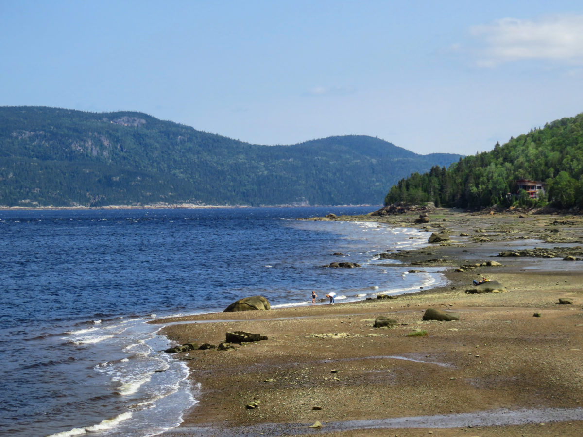
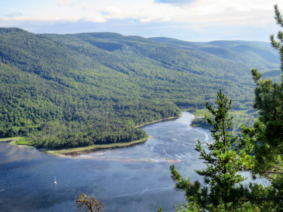
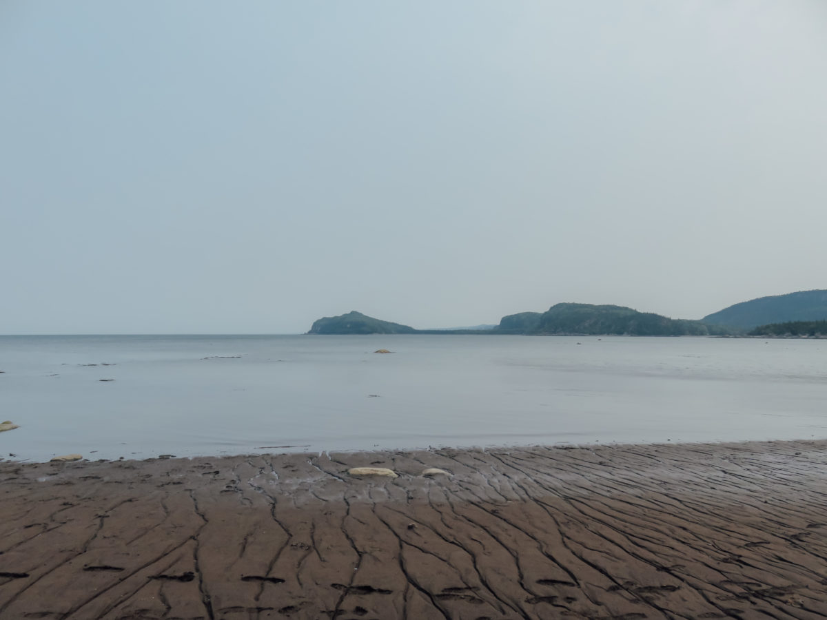
Thus, we began the popular hike by climbing Cape Trinity where the Bellevue stopover (km 1.6) marks the end of the climb which allows pretty views of the bay, especially when the sea retreats and reveals a sandy estuary.

at low tide
at high tide, view on our return from the hike
At this point, several hikers explained that the rest of the route is relatively easy and lasts about forty minutes, nevertheless, we just have to be careful with the snakes that love walking in the woods. Half reassured, we decided to continue and that was when we had disenchanted. It took us more than forty minutes to get to the next stopover, which is a refuge where it is possible to have a picnic (km 2.7).
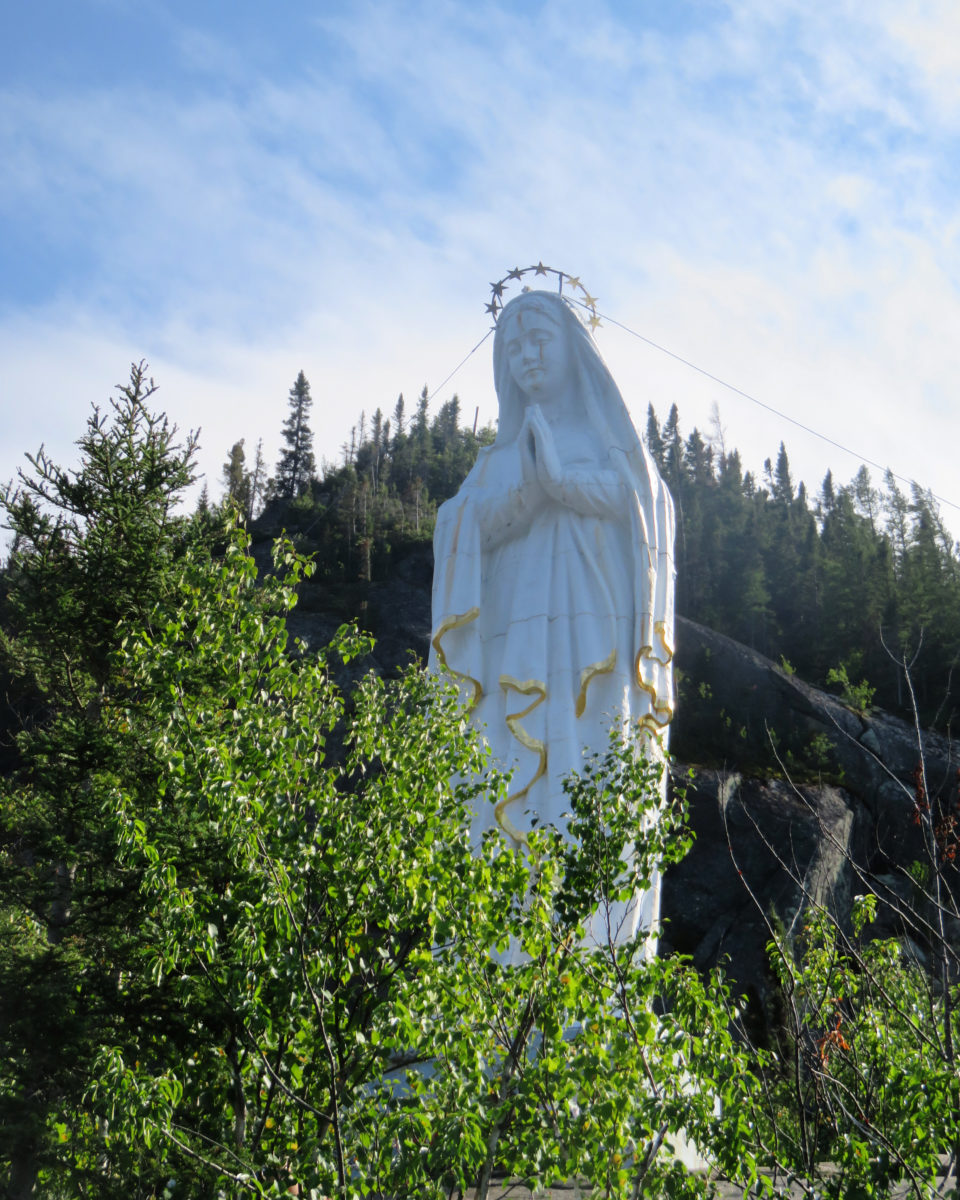
The final stretch arrived, but rather hell began for our knees. Like Dante descending into the circles of Hell in the Divine Comedy, we undertook the 800-meters long descent to the statue of Notre-Dame-du-Saguenay on a path made up of wooden stairs. The ascent to our purgatory will be even more difficult for our poor members.
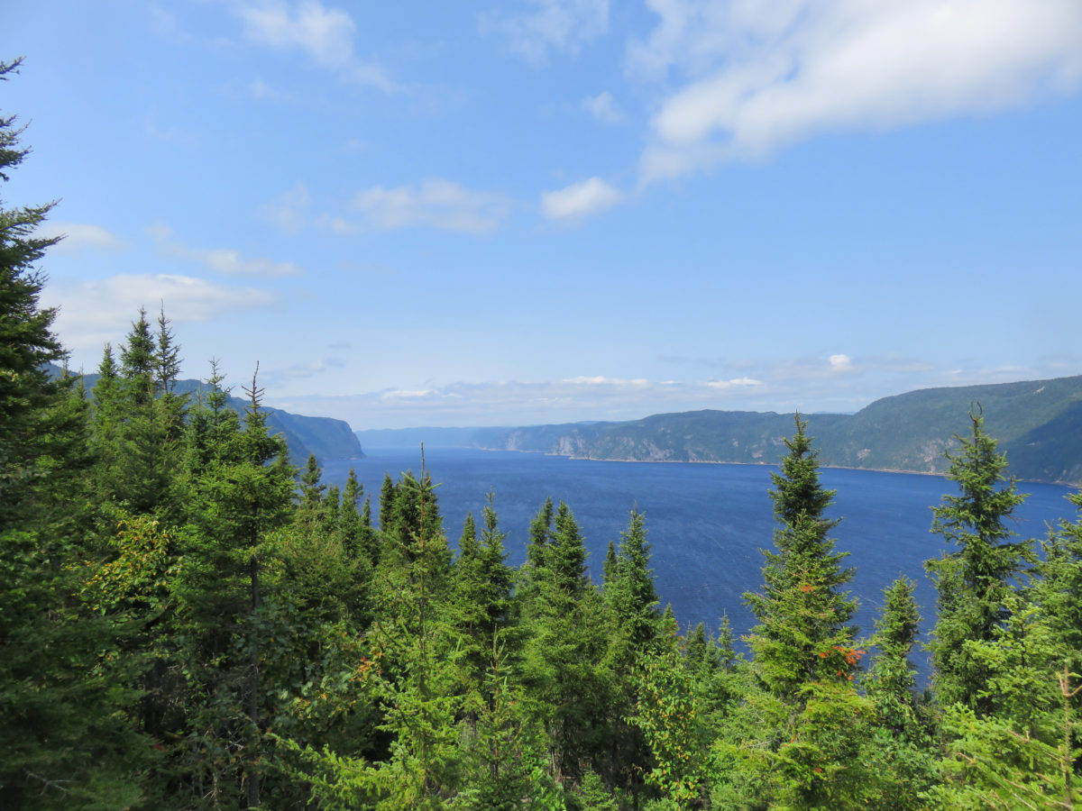
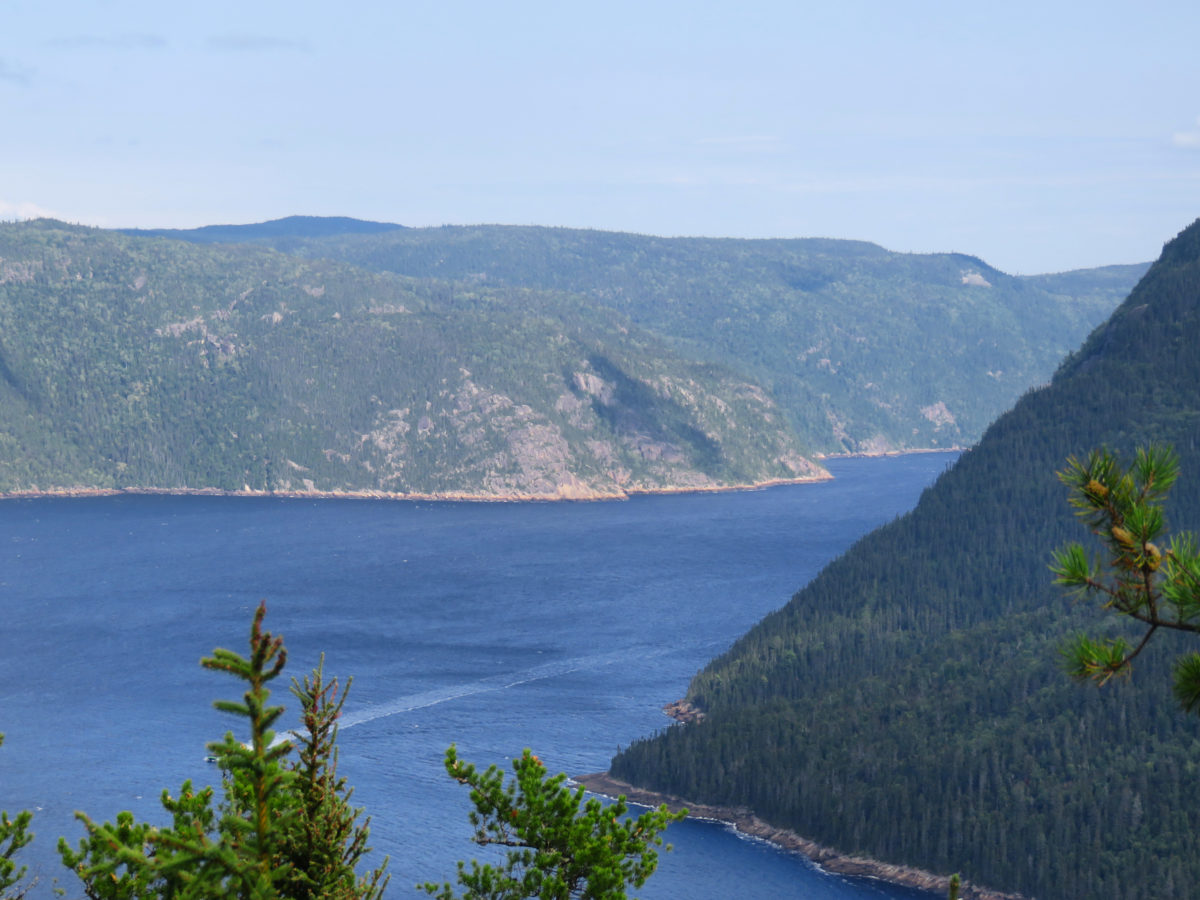
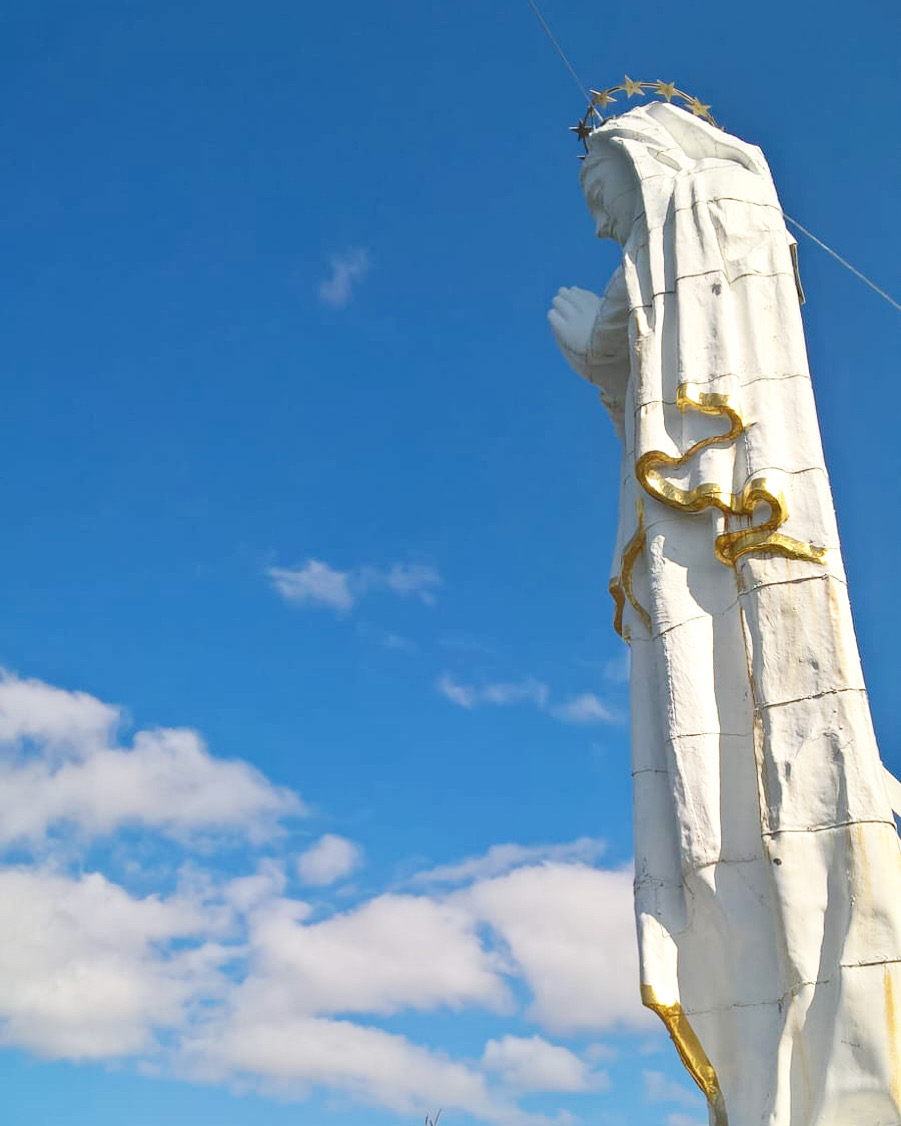
But it was worth it since the panoramic view at the foot of the statue is magnificent over the dark blue waters. We could have seen a global view of the fjord as Cape Trinity dominates Baie-Éternité.

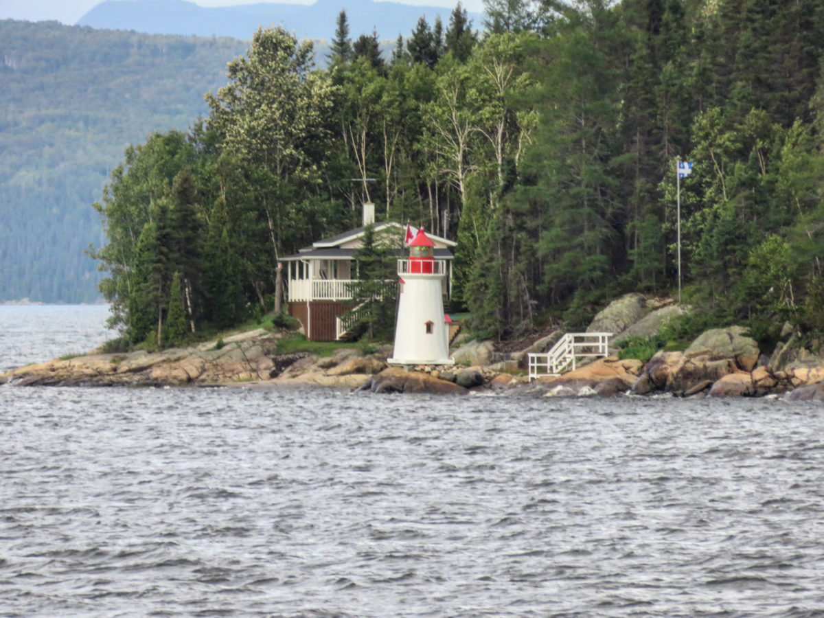
The statue of Notre-Dame-du-Saguenay overlooks and watches over the sailors who have been sailing the waters of the fjord since 1881. It is carved in white pine and was erected on this site following a misadventure of sailor Charles-Napoléon Robitaille since he almost lost his life there. It is said that he begged the “Blessed Virgin” and decided to pay homage to her once he had been saved from drowning.
« stars » of the park
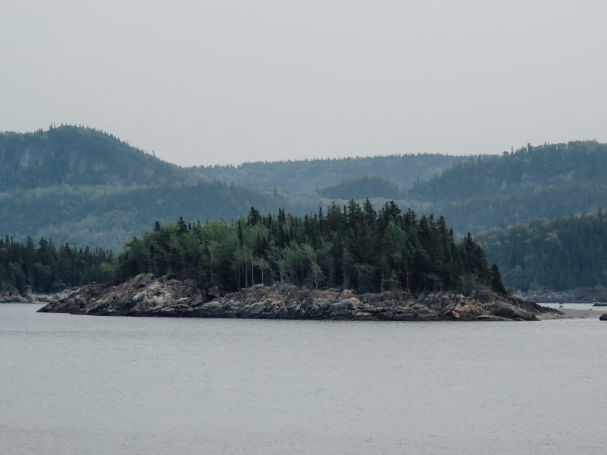
The national park is full of incredible wildlife, both on land and at sea. The forests are inhabited by about twenty species of mammals including wolves, lynxes and mooses. From the shores or while sailing on the fjord, it is possible to see harbour seals, whales (we have seen some in Tadoussac) and belugas. In fact, from La Baie-Sainte-Marguerite sector, naturalist park curators offer observations of the beluga that frequents the waters surrounding the area.
The peregrine falcon is the animal emblem. Once almost extinct, the world’s fastest raptor has been able to benefit from resettlement and protection measures to become a “vulnerable species” nowadays.
accommodation
Many accommodations are available in the park, such as cottages, campgrounds or more rustic refuges. As with all parks, we have opted for accommodation outside the areas where taxes apply.
We stayed for two nights at a couchsurfer’s house in Saguenay. During this trip in Quebec, it was the first time I tried this concept of Couchsurfing, a free type of accommodation offered by residents who invite travellers to sleep at home. It was almost (but this is for a future article) a great experience to meet locals and to be able to share our worldviews or travel stories over a good meal or a delicious beer for an evening or two. I totally recommend someone to experience that kind of way of travelling.

I clearly recommend Anthony as a host in Saguenay!
Moreover, our host in Saguenay allowed us to discover another vision of the fjord by taking us to drink beers on the edge of the cliff. This place is normally located on private property, however, the owners have arranged this space to let visitors enjoy the view and the aspiring climbers climb the cliff and come out on a smooth surface.


Québec National Park: MONTS-VALIN
Having a second day planned in Saguenay, our host advised us to go explore this national park which is much less frequented and especially less recognized. He told us that it is the jewel of the region, a well-kept secret, unlike the Fjord-du-Saguenay National Park. The Monts-Valin offer the highest accessible peaks in the region to hikers in search of landscapes of absolute wild beauty.
Thus, under a downpour, we make our way towards this unknown park, without having any expectations since we didn’t even know it existed. Even in my guidebook, a simple insert describes the park and explains that it is not worth it if you spend two days in Saguenay compared to the Fjord-du-Saguenay park.
Nevertheless, it deserves a little diversion on your itinerary. This park is defined as being on the northern borders and the mountainous landscapes, with their rugged relief and boreal flora, are indeed reminiscent of the more remote regions of Quebec.
Québec National Park: daily rate
Adult 8,75 $
Young (17 years and under) Free
ACTIVITieS
This park is really beautiful in the winter season. Indeed, walking through the Vallée des Fantômes at this time of year, on skis or snowshoes, seems fabulous considering the stories found on various other blogs.
Nevertheless, we were there in the summer and as with the other parks, we let ourselves go for a short hike, as the weather that day, being rainy, didn’t allow us to explore the park any further.
Naturally, if you enjoy a sunny day, you can head towards the Vallée de la rivière Valin by canoe or on foot, with magnificent hikes such as the Tête-de-Chien trail (8 km round trip), the Le Mirador trail (3 km round trip) or even towards the Alexis Bay and Lac Martin-Valin park sectors.
Following a discussion with the ranger at the reception desk, he advised us to undertake the hike called Le Pic de la Hutte which offers an incredible view of the whole park.
There are two options for the visitor to discover this point of view:
- The trail is accessible from the reception desk, 16 kilometres round trip.
- Take the car and drive about 9 km on a slightly winding and poorly maintained road, then walk about 3 km round trip or do the trail in a 5 km loop.
The choice was quickly made, in fact, 16 km round trip did not motivate us much, knowing that it was raining and that the aches and pains of the day before with the stairs of Hell in the Fjord-de-Saguenay park were being felt.
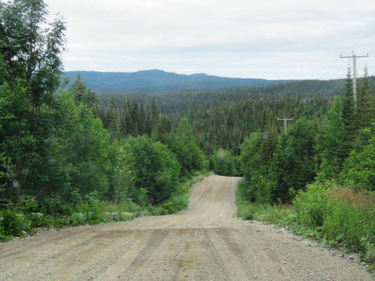
So we got back in the car to head towards the Pic-de-la-Hutte parking lot which is at 840m (which is especially high for Quebec). We were expecting a not very accessible road but not a really badly maintained road. Thousands of holes, hundreds of bends, it’s a real challenge to get our rental car to the start of the walk.
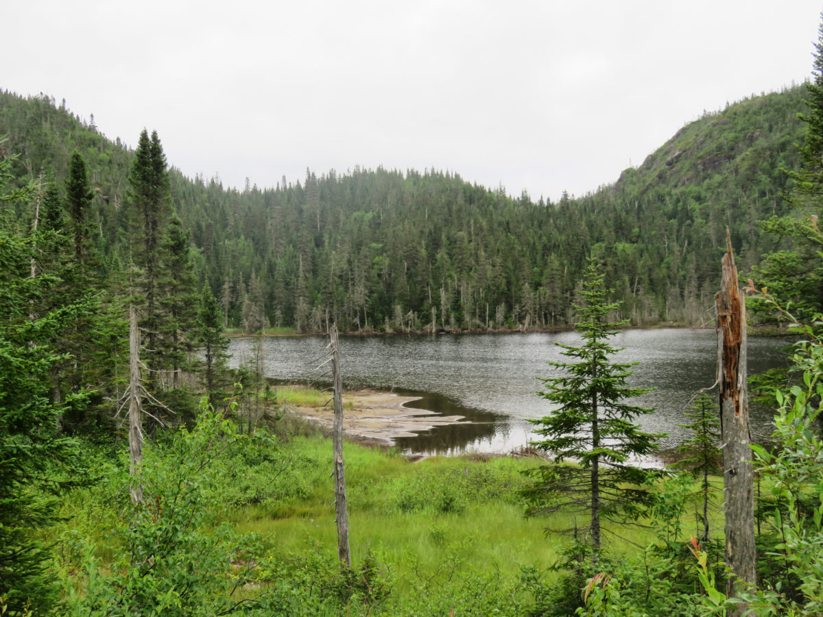
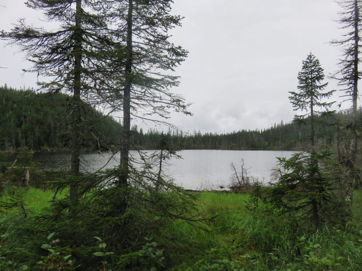
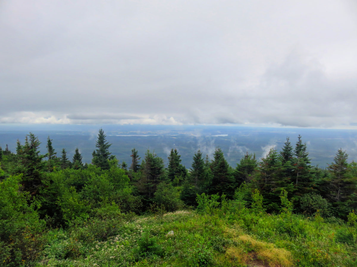
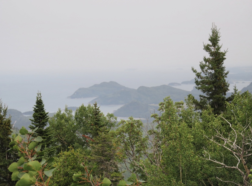
The ascent to the summit (from the hill actually, but the Canadians call it a summit) from the car park is done in about twenty minutes by following the marked trail. We ventured to the edge of a small lake to marvel at the Quebec nature and the reflection of the fir trees in the water. We discovered this boreal forest, full of charm and mysterious with this grey weather, but also different species of blueberries (our bilberries) that grow at ground level and from which we will taste a pie the next day on the road to Tadoussac.
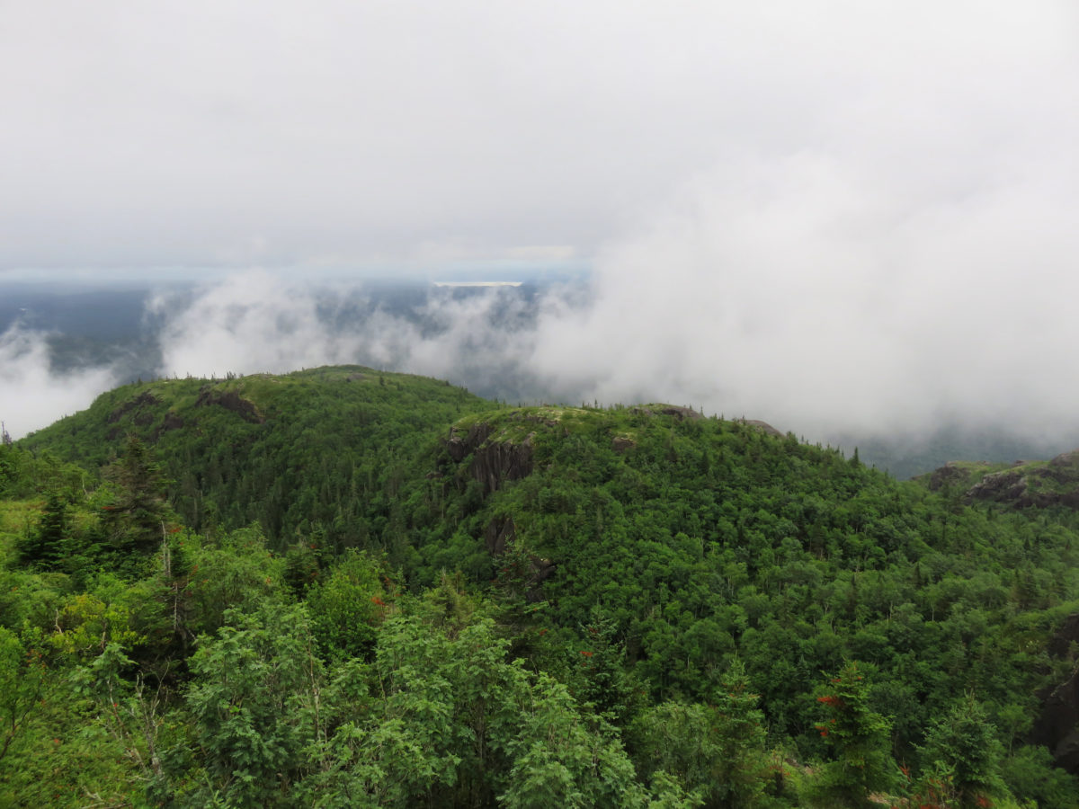


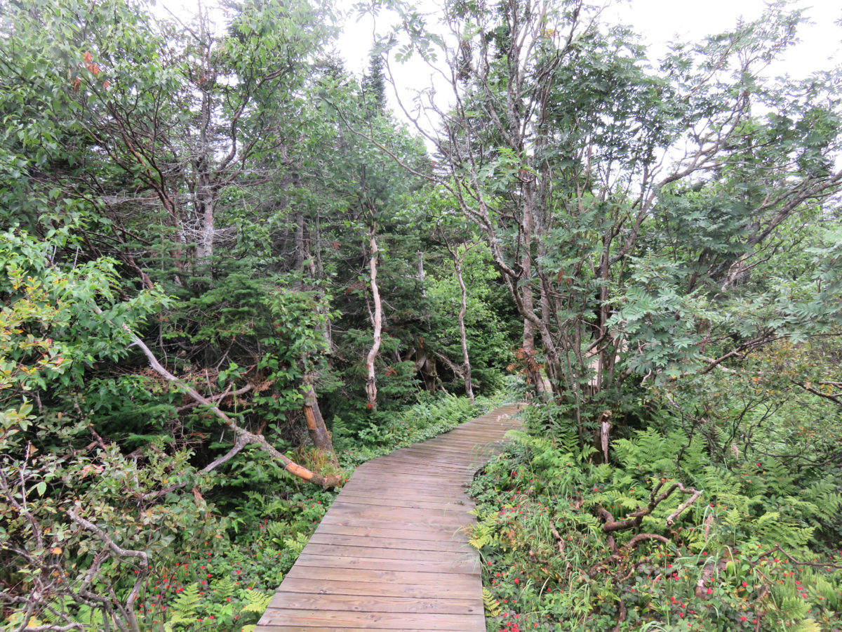
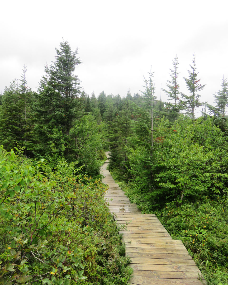
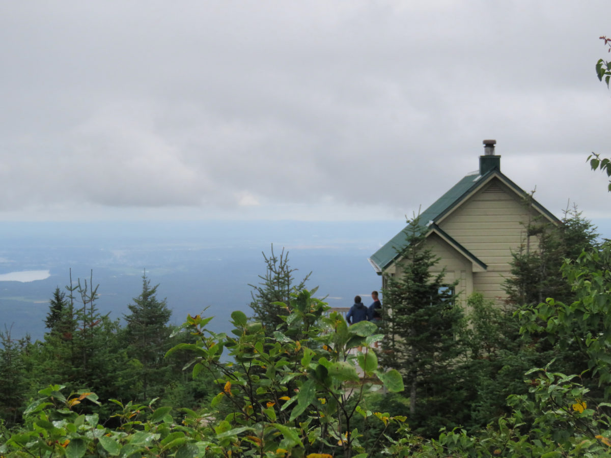
Eventually, we arrived at Le Pic de la Hutte which reaches 900 meters and at this altitude, it allows us to see the magnificent vegetation of the park and the exceptional view it offers on the lands of Saguenay-Lac-Saint-Jean. We could see a large part of the region, but with this weather, we would instead enjoy the wind and the rain. In the end, it didn’t bother us, it was a more mystical atmosphere that was offered to us and it was also a chance to appreciate the splendour of the landscapes in all weathers.

There’s a hut at the top, which is the perfect place to spend a few minutes warming up, even if we were in the middle of August. We only met one family and had the platform set up to enjoy the view only for us. We were practically all alone, only accompanied by all the animals of the forest: birds, frogs and other toads (thanks again for this wonderful rainy weather)!


It was a good way to recharge our batteries in nature, but we were also very happy afterwards to warm up in a nice café in the city of Saguenay.
« stars » of the park:
The Canada lynx is the emblem of the park and clearly the main attraction, as many visitors would like to have the opportunity to see one. The ranger at the reception desk told us that it was the right season to see one, so we were not at all reassured.
This mysterious feline actually leads a quite discreet existence in the heart of the boreal forest. It was explained to us that it is rare to come across one since this big cat often goes unnoticed due to its agility and night-time activities. During our walk, we weren’t being smart alec (we were telling that we wanted to see bears, but when the time came to maybe actually see a wild animal, which is much smaller, we weren’t that confident). At the end (or fortunately), we didn’t have the opportunity to meet this feline.
Québec National Park: Gaspésie
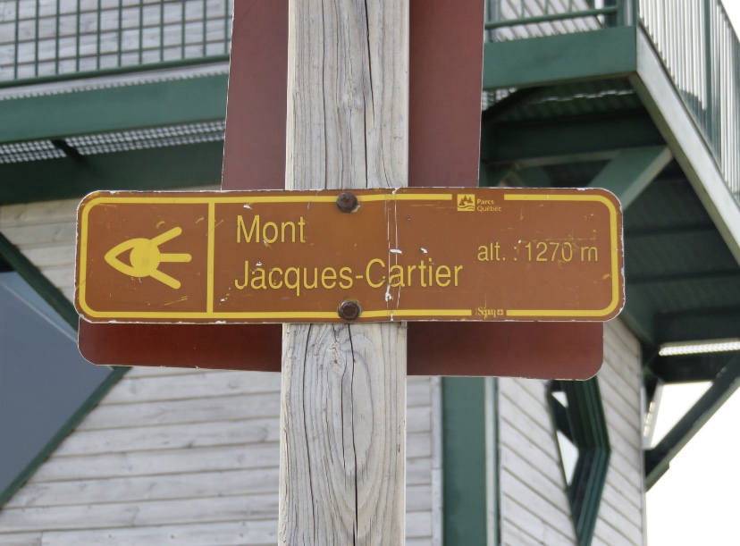
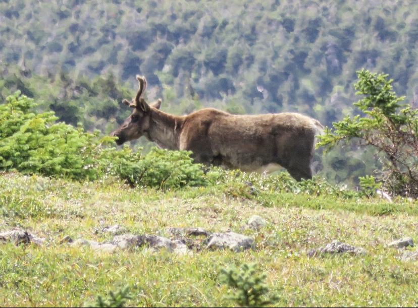
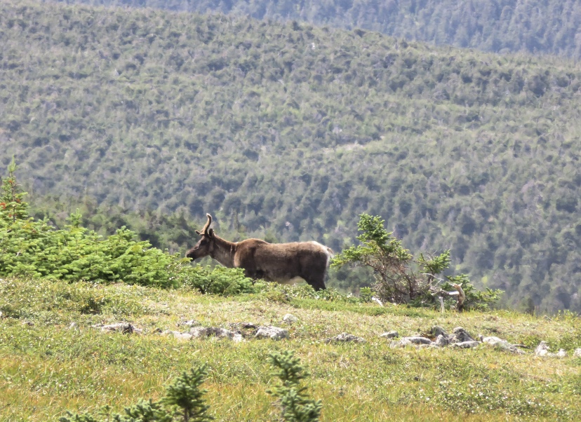
Second oldest national park in Quebec after Mont-Tremblant, which we didn’t have the opportunity to discover, the Gaspésie National Park is major hiking and ski touring destination. It provides access to an exceptional mountain environment that includes the second highest peak in Quebec: Mount Jacques-Cartier as well as 25 peaks over 1,000m with the Chic-Chocs and McGerrigle mountain ranges. The park presents itself as ” this sea of glacier-chiselled mountains is festooned with stone fields, high plateaus, ridges, and deep valleys whose wildlife and flora recall the Far North”.
Indeed, this park is grandiose in its size, diverse beauty and impressive massifs that influence the climate, shape a landscape that is very different from other national parks visited and create a precious wildlife diversity with a tundra climate that is the habitat of a herd of woodland caribou, the last representatives of this species south of the St. Lawrence River.

ACTIVITieS
Like other national parks in Canada and around the world, the Gaspésie National Park is an incredible open-air playground where hiking is the number one activity. The park is huge and features 140 km of marked trails, many of which lead to summits. There are trails for all levels and of varying lengths.
If you have read the various articles on the parks in Quebec, at each park, we arrived with no idea of what activities to undertake. Always preferring the free ones, the ranger at the discovery and service centre, explained to us, after hearing our few desires, to do the Mont Jacques-Cartier hike. However, we had to hurry to get to the beginning of the hike. Start of the countdown, but why?
As I have already told you, this summit is the habitat of a caribou herd and there are restrictions on their preservation. Indeed, the presence of hikers can disturb the animals so it is forbidden to walk on the trail before 10:00 am and after 4:00 pm. In addition, you must park your car in a car park and then follow a ranger who will take you with his big yellow bus at the beginning of the hike. This shuttle is not free of charge, you will have to pay $7.50 per adult for the return trip.
So we were at the discovery and service centre, and the ranger explained that there is a departure every 30 minutes from 10 am to 12 pm. I do not, now, remember exactly what time it was but we had to get to the Mont Jacques-Cartier reception as quickly as possible to take the penultimate shuttle to enjoy a bit of the summit. What we hadn’t imagined was the road conditions to get there. Finally, the road is a big word. It’s a kind of track with varying sizes of stones! So we might as well say that with our rental car we weren’t going that fast and above all we were afraid of the state of the car after this road. The speed limit was 70 km/h but with our car, it was not possible given the condition of the track, so it was a race against time to get to the reception before the shuttle left.
We finally arrived 2 minutes before 11:30 am, I let my friend park and jumped out of the car to go and get the tickets from the reception desk at the ranger. I thought I had time to go to the toilet, but I didn’t have time for it! I’ll have to wait for the beginning of the hike after 10 minutes in the shuttle and do that in a small hut full of bugs… Aww, nature…
We found ourselves on the bus with about ten hikers, and the ranger explained to us the rules governing this hike. He also explained to us that we have to be very careful with our time because the last departure for the car park is at 4 pm. So for information, off-trail walking is forbidden during this hike.
“Keep your senses alert!
From here, you breathe the same air as he does.
Your footsteps land on the same stones.
If by some happy chance your eyes meet this beautiful animal,
greet him with eyes only, discreetly, crouching,
let the sovereign of the summits pass by!“
I recently found this quote, translated from French, which was currently written on a sign at the entrance to the trail and it perfectly summarizes the ranger’s recommendations.
Finally, we could start walking, to arrive about 1:30-2 hours later at the summit, at more than 1’000 meters of altitude.
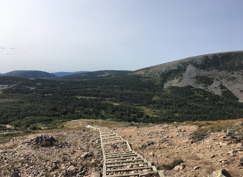
It’s a very tough climb on a rocky path, so be prepared your knees will be sore. However, the sun was there to enjoy the hike and then to discover that as we got higher, the vegetation was giving way to a more austere terrain.
Even though we had opened our eyes, there was still no caribou on the horizon, which was enough to make us a little desperate knowing that we had been going up for almost 2 hours. Afterwards, the slope was much less pronounced but was still difficult with a staircase of stone landings.
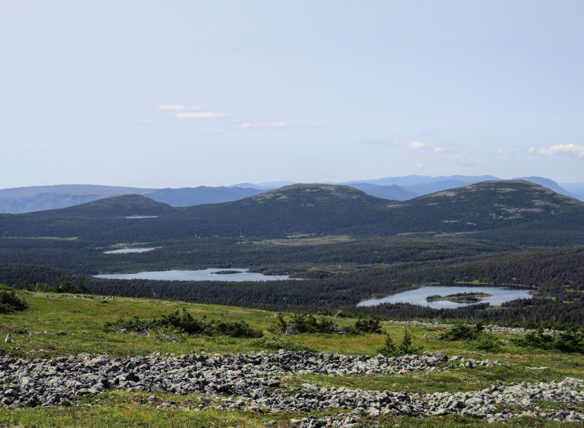
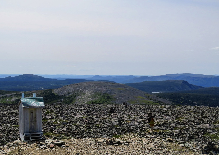
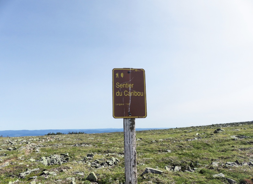
At the top, the temperature dropped a few degrees but the view was worth it. Indeed, we discovered a landscape quite different from the green forest where the shuttle dropped us off. We took the Caribou Trail which will lead us for 1 kilometre to the panoramic tower at the top.

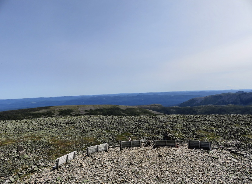
Mont Jacques-Cartier offers arctic bioclimatic conditions at its summit covered by frost-bearing rocks and tundra. Thus, the 360° view is impressive and changes from what we had the opportunity to see since the beginning of our stay in Quebec. The diversity of this province fascinates me. We rested for a few minutes and ate our picnic on wooden chairs set up in the shape of deckchairs at the foot of the watchtower. We were hoping to see caribou, but at that moment, the counter was still at zero.

We will end up seeing two caribous and especially by following a few hikers on various trails at the summit, since each time we heard them say that they had seen the animals so we wanted to see them too (yes, we assumed we were following like sheep)… But well, it wasn’t the case, we lost a bit of time before going back down, but it allowed us to explore more of this tundra.
The descent will be a bit fast as we didn’t want to miss the last bus. It will also be partly on the buttocks considering the number of times we slipped because of these small rocks or simply by inadvertence we will say.
« stars » of the park
The creation of this national park in 1937 was intended to permanently protect the caribou, making it the emblem of the park. Indeed, the large massifs of coniferous forest provide this animal with shelter and food. Seriously endangered, its observation allows the park rangers to ensure its protection and preservation while allowing it to live in the wild. The Gaspésie caribou population has been monitored annually since 1983, and in 2018, it is estimated that 75 caribou of this species remain in the wild.
accommodation
Sainte-Anne-des-Monts is the ideal place to sleep before going for a walk in the Gaspésie National Park since it is 17 km away from the park. We slept one night in a motel and the town itself is not very interesting. However, it was finally time to taste my first poutine (and not my last one, considering how delicious it was) at the Auberge Chez Bass which also serves as a hotel and where we wanted to spend the night, but the last room for our dates was booked a few minutes before our reservation (the hazards of booking on the spot).

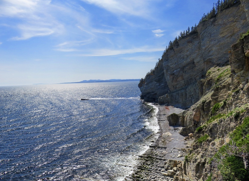
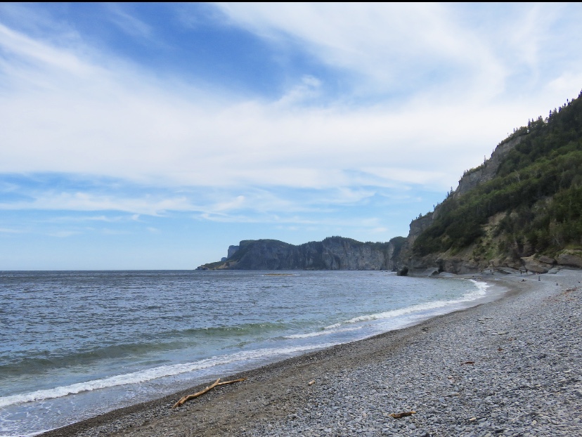
Québec National Park: Forillon
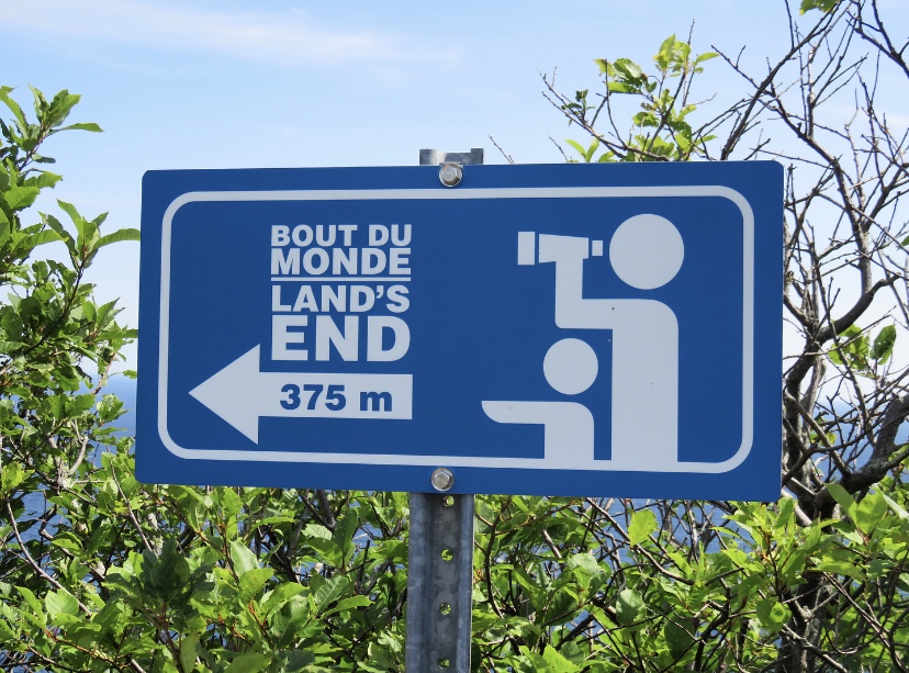
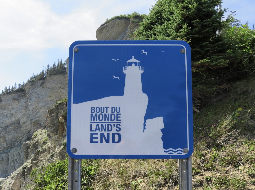
Clinging to the tip of the peninsula, the Forillon national park is a vast natural space and clearly one of the most beautiful places in the Gaspésie! Between land and sea, these two elements intertwine perfectly and create magnificent landscapes. Here, everything indicates this famous end of the world that has been sold to us since we arrived in the Gaspésie. In fact, the extreme tip of the peninsula is located in the park and I will take you there further down in this article.
The park covers 245 km2 between the Gulf of St. Lawrence and Gaspé Bay. It is part of the Canada parks. It is, therefore, a national park and you will find information about it here.
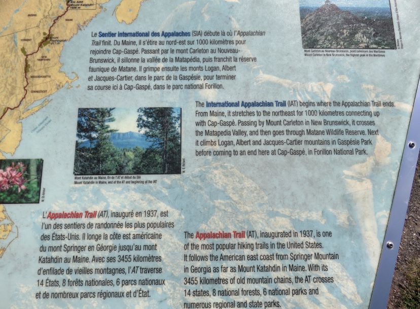
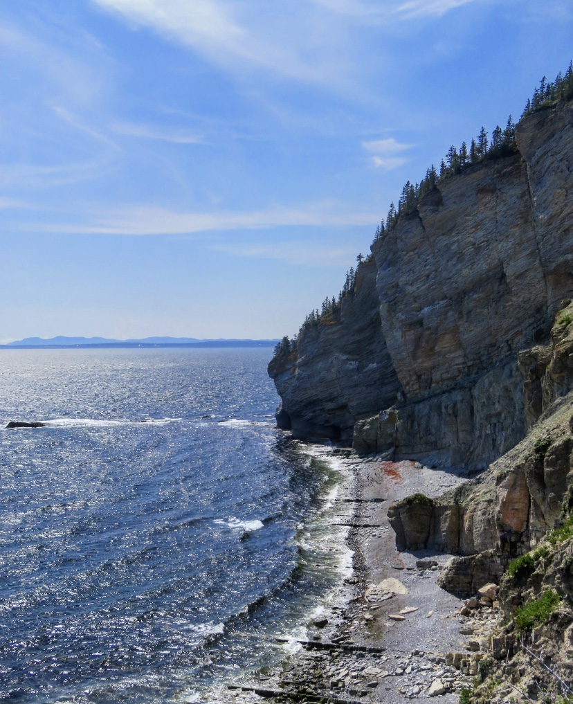
The nature is green, wild and the wildlife incredible! If you want to see maritime landscapes between steep cliffs sculpted by the sea, pebble beaches, coves and capes, but also a particular forest since it is there that the famous Appalachian Trail ends, well, its Canadian extension, it is definitely at the park of Forillon that you have to go to!
Québec National Park: daily rate
In 2018, the price was $ 7.80 for an adult.
ACTIVITieS
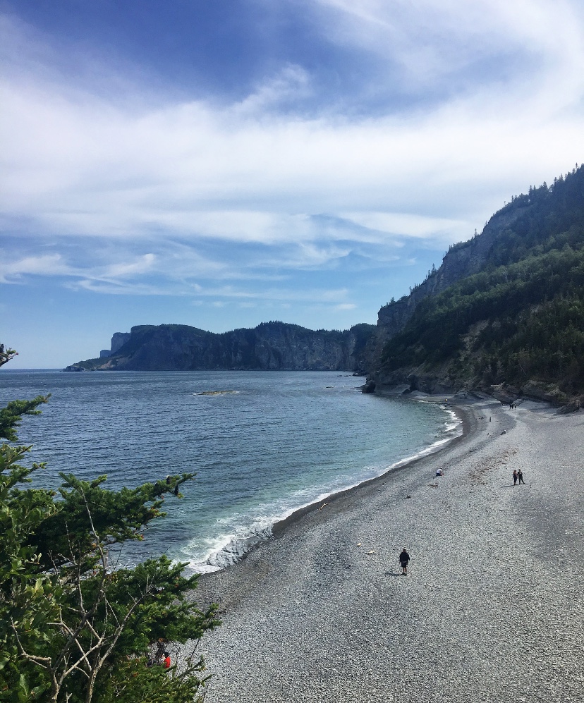
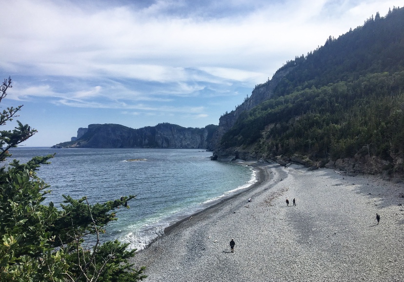
We have inevitably gone in for hiking, the first way to discover all the diversity of the national park. As usual, we stopped at the Discovery Centre to see the range of hikes available to us. Having heard a lot about this famous end of the world, we wanted to walk to it. And then, we heard that we could see whales, many animals and especially bears.
So, we decided to hike the Graves Trail (8 km return) that goes from the southern sector of the park to L’Anse-aux-Amérindiens, then continue through the forest, on the official path, to reach Cap Gaspé, the famous end of the world. This trail allows you to go along the Gaspé Bay, and to see whales, but as usual, we will not see any animals.
We had arrived around 10:00 am when the park was starting to welcome numerous visitors. So it was not easy to find a parking spot at the beginning of the hike, but luckily we were able to park as close as possible, which saved us hundreds of meters on foot (everything is good to take, at your 5th park in a short time). And then, we could see a van fitted out by a family from Vaud (where I live in Switzerland) and to see this, awakened our desire to leave, one day, to live a nomadic life like this family.
Well, we put this dream in a corner of our heads and we started the hike, first on the path that cyclists can take. At the beginning of the hike, we were careful with the slightest noise as we thought we were dealing with bears! And yes, when we read in the park guide that the black bear population in Forillon was stable, we were impressed by the numbers and happy to see that this animal thrives in the park (it lives in total freedom), then the statistics said that there are about 3 bears/10 km2, and that’s when we started to get the shock of meeting one.
However, it could have been an intriguing opportunity to discover this emblematic animal in its natural habitat. According to the rangers at the reception, he’s easy to see because he doesn’t hide from people. However, as we are dealing with a wild animal, moreover on its territory, a few recommendations are to be read before undertaking a hike in the park. I put these below:
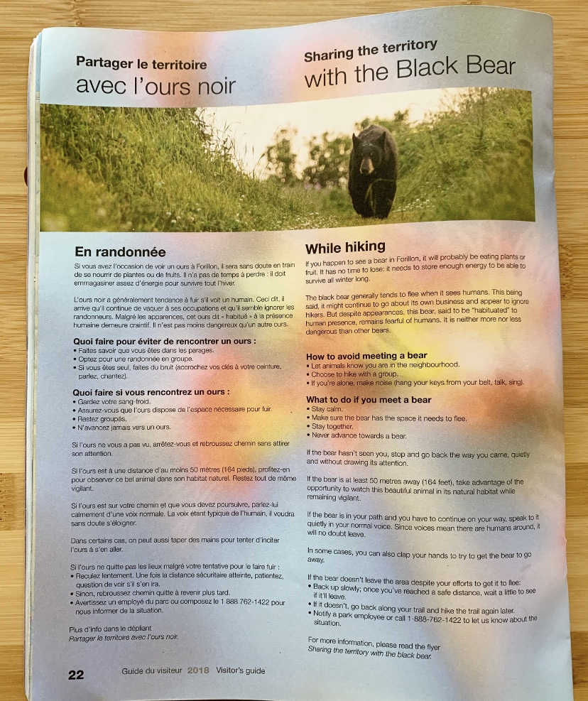
So, after reading this, to avoid coming face to face with a bear, we started singing to make noise. Well, we thought that we were a bit ridiculous, that the bear, if we came across one, wouldn’t hurt us, that it would even be incredible to come across one, etc. so we went on our way, talking normally. We ended up leaving the road, to take the path on the cliff, which runs along the Gaspé Bay.
Along this path, there is a possibility of observing marine mammals, but just like bears, we will not see any. However, with each slight movement in the water, we were on the lookout, hoping to see a whale or a rorqual whale.

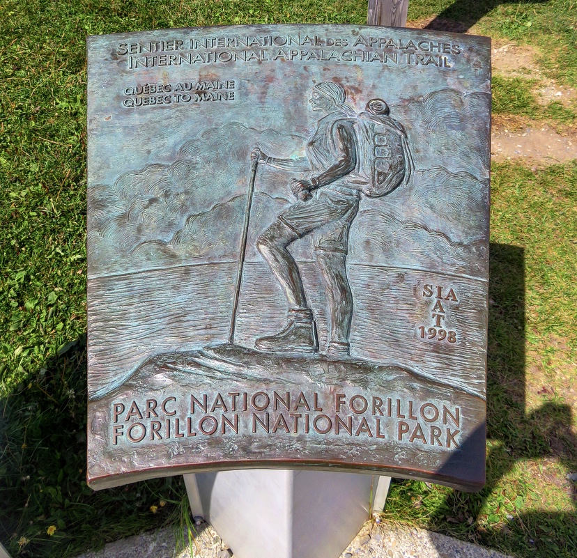
The path allows for a leisurely walk to L’Anse-aux-Amérindiens, where we left the ocean shore to venture into the forest. I was very excited because I was taking the International Appalachian Trail (IAT) as soon as we left the ocean to venture into the forest. Since 2015, a long-distance hiking route (GR) has been integrated into North America: the GR A1. Indeed, this international trail, links the one simply named Appalachian Trail, which is about 3’510 km long and entirely in the United States. The section we took connects Mount Katahdlin, in the American state of Maine, to Cap-Gaspé, our final destination.
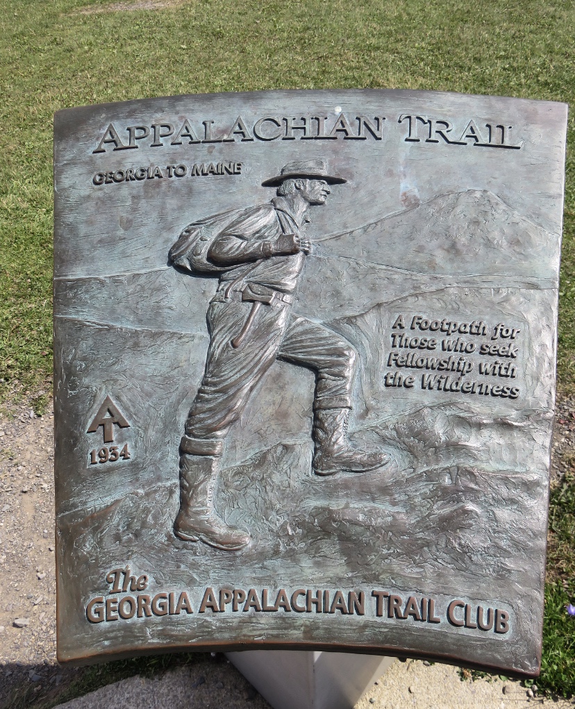
After devouring Cheryl Strayed’s book Wild (about her adventure on the Pacific Crest Trail, another hiking legend) and especially Bill Bryson’s A Walk in the woods (about his Appalachian Trail adventure), I thought it was crazy to be able to walk on a world-renowned trail, knowing that I would like to do it one day as well.
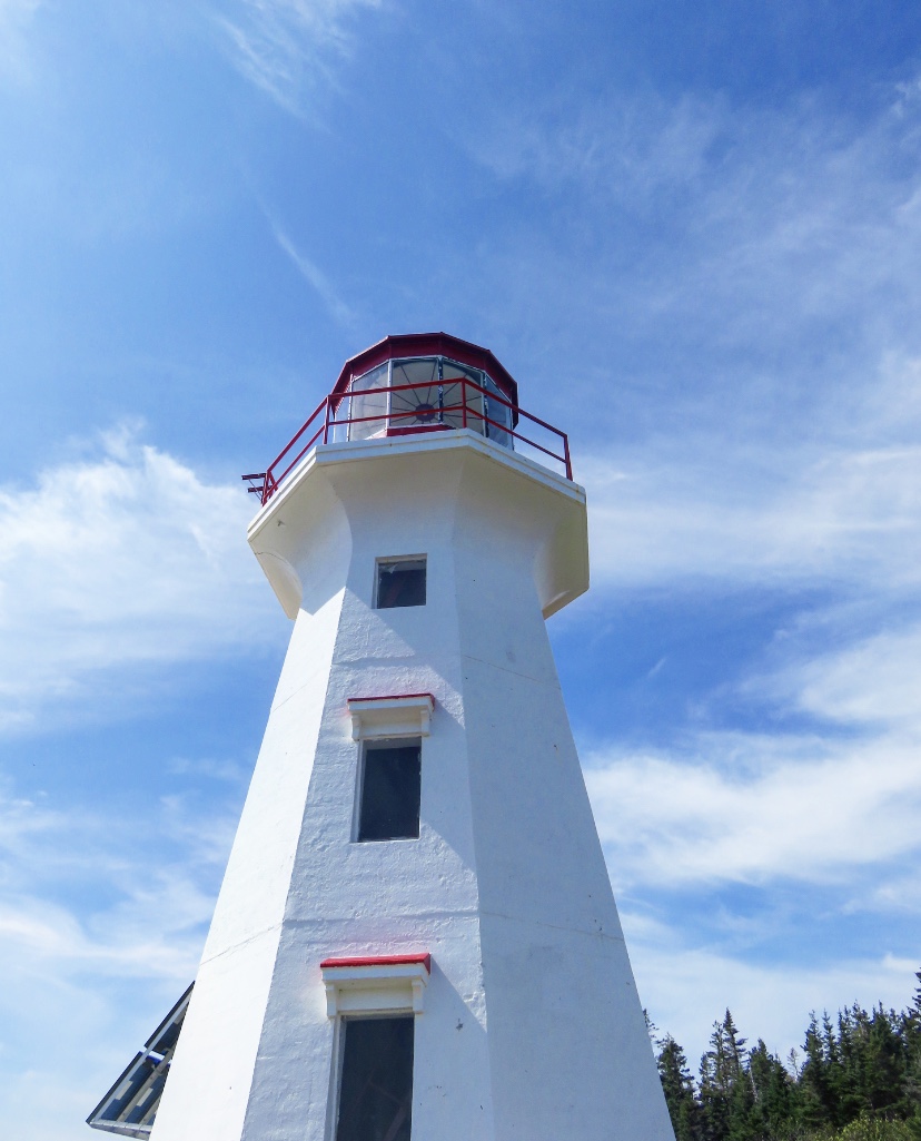
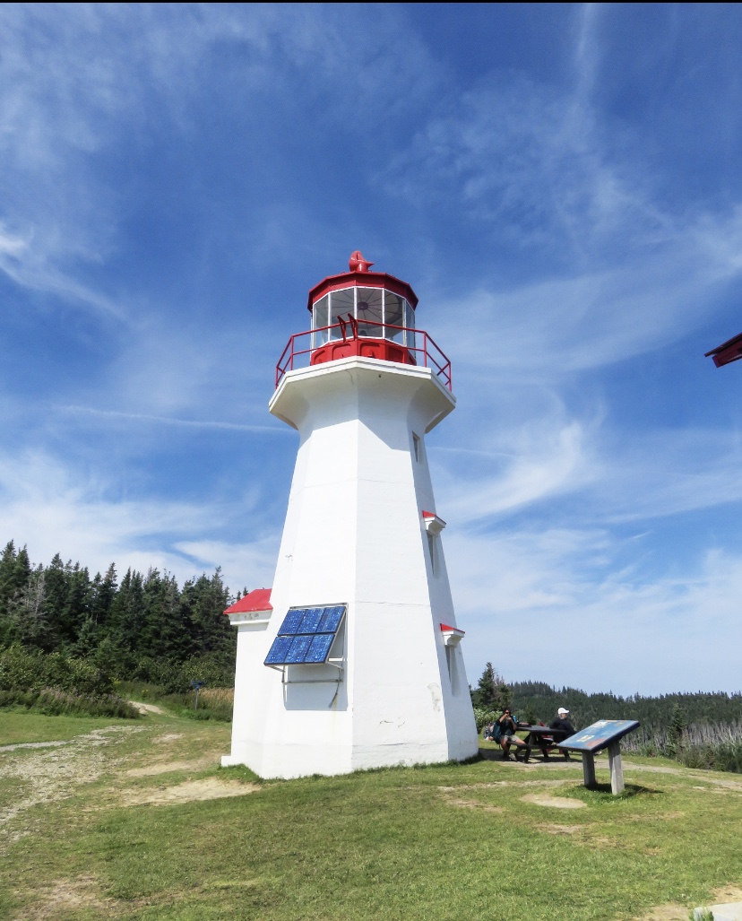
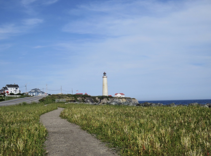
So let’s get back to the trek. We finally arrived at the Cap-Gaspé lighthouse which is splendid, red and white, and measures 12 meters. We made a small stop to eat and then we took the road again to reach: this famous end of the world.
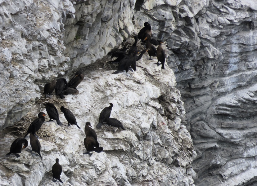
As we were descending, we began to feel the speed and violence of the wind, and on the Belvedere, it was even worse. But what a panorama! Even if we protected ourselves from the wind, the view was incredible on the cut cliffs, on this majestic ocean and on all these birds flying (or trying to regarding the wind). Another magical moment to capture with her eyes before going back up, to begin the way back.


Having still some time before going shopping to make dinner for our host, we decided to go to the northern sector of Forillon Park, to see the cliffs of Cap-Bon-Ami. This place is famous for its magnificent sunsets, but also for representing this sea and cliff show where animals are the stars. Naturally, apart from hundreds of birds that I could not name, we did not see any animals. But the panorama is incredible with a huge pebble beach and steep and majestic cliffs. Really take the time to contemplate this landscape.


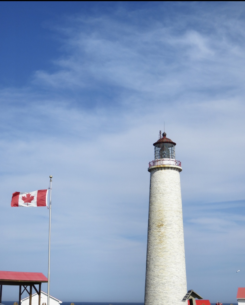
Returning by the northern road, just outside the park, we passed by Cap-des-Rosiers and its magnificent lighthouse which is also worth the trip. It is the oldest lighthouse in Gaspésie and especially the highest in Canada with its 34m.
accommodation
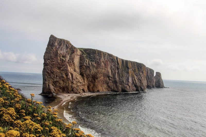
A must-see on a road-trip in the Gapésie, this wild and beautiful site owes its fame to its renowned rock. And when one says famous rock, it means, unfortunately, that it is under the influence of tourists. It is the most touristy place we’ve ever been to in the Gaspésie and it was impossible during the high season to find a hotel where the cost per night was no more than $200.
As a result, we decided to go Couchsurfing again, at the only resident of Percé who offered this option (in 2018, it may have evolved since then). A novel could be written about our adventures at his place for 2 nights and the story of our meeting with this gentleman is, by far, my best anecdote of this trip (maybe of all my trips). To make a long story short, and let you imagine what we went through, here is a range of keywords: yurt, doll’s house, hens, insalubrity, permaculture, suspicions of murder…
Québec National Park: BIC
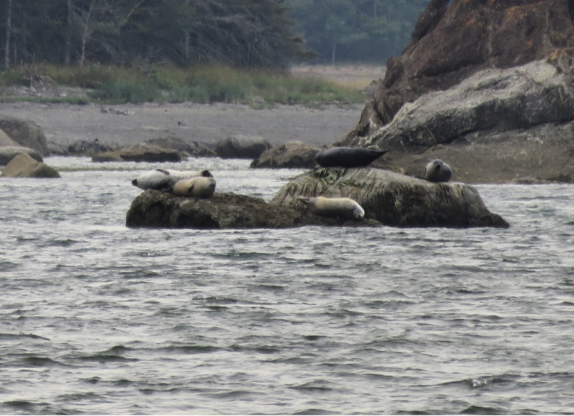
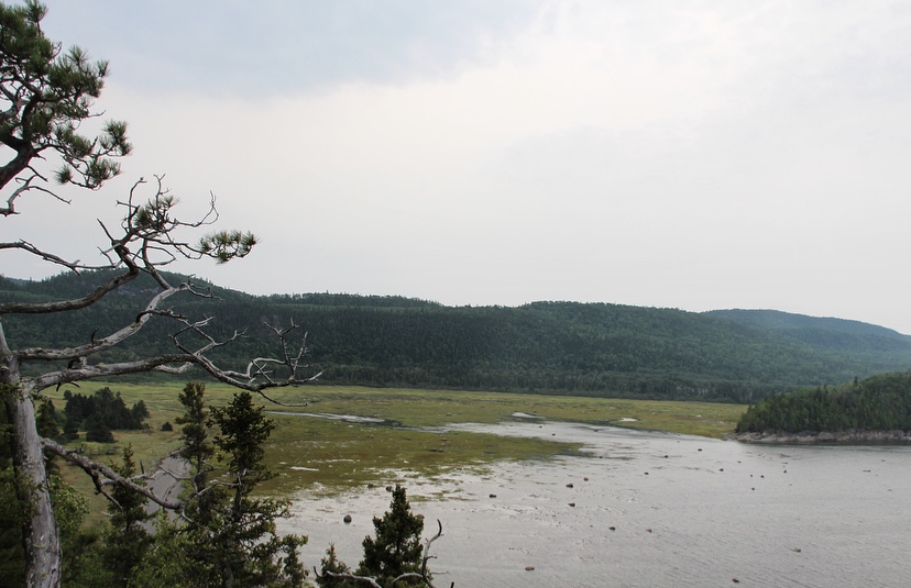
The Bic National Park is considered to be the small jewel of the Bas-Saint-Laurent, small since it covers only 33km2, of which 14.4km2 are in the waters of the river, this to protect the seals which are the emblem of the national park.
It is a real coastal-marine park where the land stretches out to form bays and peninsulas embracing the river. At the rhythm of the tides, many activities are offered to everyone, even if the weather is not always fine. On our side, we were not lucky during our day spent in the park. Nevertheless, we keep a nice souvenir in this incredible natural space.
daily rate in 2018
Adult – 8,60 $
ACTIVITieS
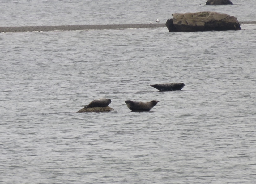
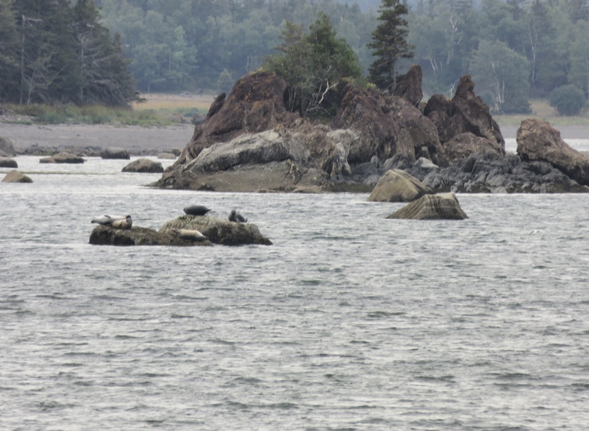
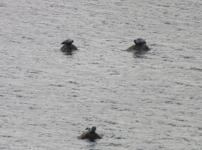
As usual, we favoured hiking and observation points, however, we were determined to observe seals. To do so, you can go on kayak outings or take advantage of the experience of naturalists, but this has a cost and given the bad weather, we went on two short hikes and a viewpoint (from which we saw seals!!).


After having parked at the Discovery and Service Centre – Ferme Rioux, we started on the Chemin-du-Nord trail that runs along the coast and the sea, sometimes winding through the forest. It’s a very easy 4km loop. We had learned that a nice café opened at 10:30 am, which seemed to us the best way to “start our day” by enjoying a good coffee with a view of Cap-à-l’Orignal. Beautifully called “La Rose du Nord” (The Northern Rose), this café looks like a cosy chalet surrounded by an enchanting décor. On the way back, we walked a bit off the path to weave our way from bays to beaches in the rocks.
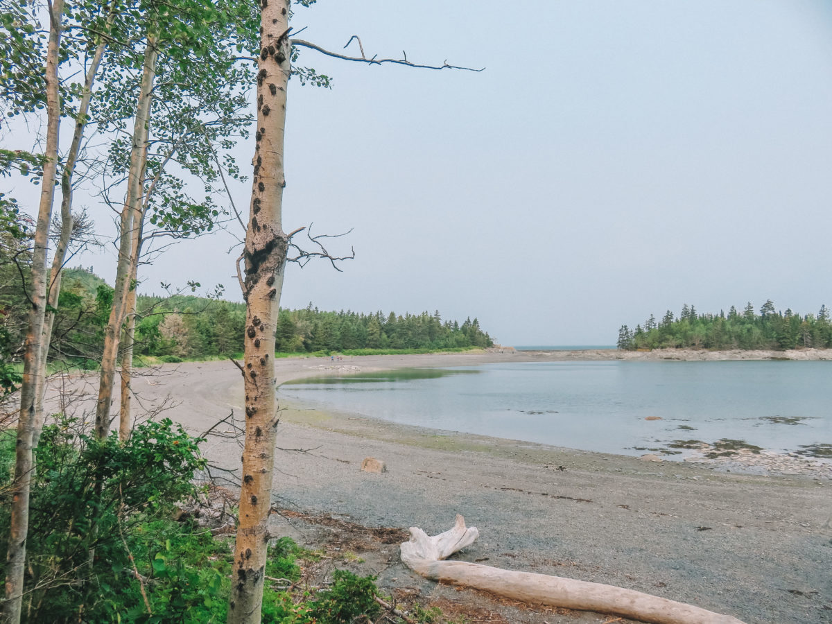
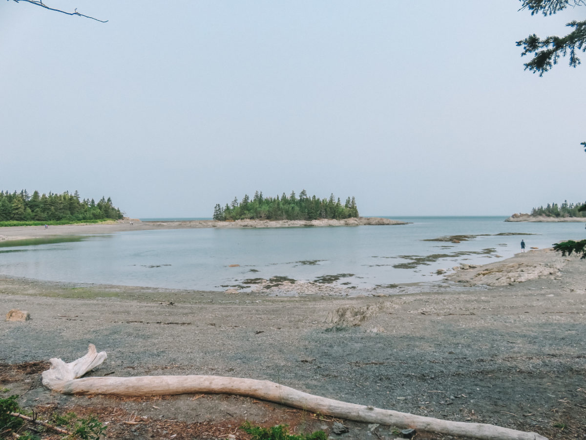

We then headed to the Pointe aux Épinettes from where the view of Anse à l’Orignal is superb. After ten minutes of climbing up the hill, we arrived at a viewpoint from where we finally spotted seals! It was not easy to distinguish them from the rocks on which they were resting.


Finally, we decided to take the afternoon’s flagship hike in the park, the one to Pic Champlain. I will nevertheless give you a little historical reminder since Samuel de Champlain is the French navigator and explorer who founded Quebec City in 1608.
Peak Champlain, which is at an altitude of 346m, is the highest peak in the Murailles massif. It is the park’s flagship hike since a magnificent view of the surroundings from the belvedere is on the programme. Indeed, a belvedere has been set up with a 180° view over the Bay of Ha! Ha! (yes that’s the real name of this bay).

We parked at the Pic-Champlain parking lot and started our climb in the woods. According to the park’s information, the length of this walk is 6km and takes about 2 hours, but for the lazy ones, a shuttle goes up there every 30 minutes, but count on $10 per return.
There is no need to be afraid of this walk, although the trail climbs through the forest. The difficulty is noted as intermediate, but we found it quite easy. Thus, the ascent is done in the forest with sometimes some breakthroughs on the bay of Ha! Ha! Accompanied by the squirrels and chipmunks that populate the forest, we finally arrived at the top and discovered a not so breathtaking view. The panorama is not so clear and the rendering is a bit disappointing, maybe it was because of the bad weather.

I come back to the interesting name of the Bay of Ha! Ha! that we already discover from the road before arriving at the discovery centre. Indeed, its name is the object of various legends and interpretations. Here you can find the origins and meanings of this term (in French). I still think that the name I prefer is that of l’Anse à Mouille-Cul (literally “ass wet”)… the meanings are also numerous but I’m sure you must have a little idea. You will find the answers in French here.
Quebecers are fond of funny names and they have even named activity in the park “Completely Seal Wolf”.
« stars » of the park
The harbour seal is the emblem of the park and its territory is a privileged habitat for it. The harbour seal population has been monitored since 1998 in collaboration with the Marine Mammal Observation Network. Conservation is very important for all Quebec national parks.
Approximately 200 harbour seals and 50 grey seals love to rest on the boulders found in the coves and bays of the park.
To observe them, it is absolutely necessary to respect the signs indicating the limit of the observation area, because if you get too close, they may feel threatened and then leave their resting area. So, to observe them, I recommend the above-mentioned Pointe aux Épinettes, at mid-tide to high tide. At low tide, you will have to go to Cape Caribou.
accommodation
We spent two nights with couchsurfers from Rimouski. The atmosphere in this flat was great and they allowed us to discover the microbrewery Le Bien, le Malt.
There are many other parks to visit in Quebec, but we had chosen these in our itinerary. They were all great surprises, especially those we didn’t know about like the Monts-Valin park. And you, have you ever visited one of these parks? What other parks in Quebec would you recommend?

This is an awesome, easy to read blog, with lot of information to our favorite travel destination. We were in Quebec in August-September 2020 on a rented motorized RV as a precautionary measure against COVID-19. We visited the following parks:
1. La Mauricie National Park, maintained by Parks Canada
2. Parc national des Hautes-Gorges-de-la-Rivière-Malbaie, maintained by Sepaq
3. Saguenay – St. Lawrence National Marine Park, maintained by Parks Canada
4. Parc national du Fjord-du-Saguenay maintained by Sepaq
We will be back in Quebec in the summer of 2021 and we will surely have lot of takeaways from this blog.
Regards,
Suhail
Hi Suhail
Glad to hear that you went to the beautiful province of Quebec!
Thank you for your lovely comment. 🙂
Enjoy!!