On Reunion Island, the Mafate cirque is one of the island’s most captivating natural treasures. Nestled in the heart of this lush cirque, you’ll discover unspoilt nature, breathtaking scenery, and an authentic Creole culture. To explore this natural wonder, without going there, there are two exciting activities, each offering a unique experience.
In this article, I present these two options for discovering the cirque de Mafate, whether you’re a seasoned hiker or looking for a more peaceful adventure.
HIKE TO CAP NOIR TO DISCOVER the CIRQUE OF MAFATE
Well, I’ve already extolled the beauties of Réunion Island here, and you’ve begun to understand that the island is renowned for its spectacular scenery, towering volcanoes and picturesque (and challenging) hiking trails.
Among the many excursions on the island, the Cap Noir hike is a must for outdoor enthusiasts and nature lovers. This hike offers panoramic views of the island’s west coast, the surrounding mountains and the Indian Ocean.
Although you might think not, the Cap Noir hike is already in the Mafate Cirque, as the viewpoint is at its “entrance”. The starting point for this hike is Dos d’Ane, a small village in the La Possession area, about 30 minutes by car from Saint-Denis, the island’s capital. From here, hikers can choose between two routes: one leading to Cap Noir and the other to Cap Jaune. Both offer magnificent views, but with my sister, we opted for the one leading to Cap Noir, which is the better-known and offers the prettiest glimpse of Mafate.
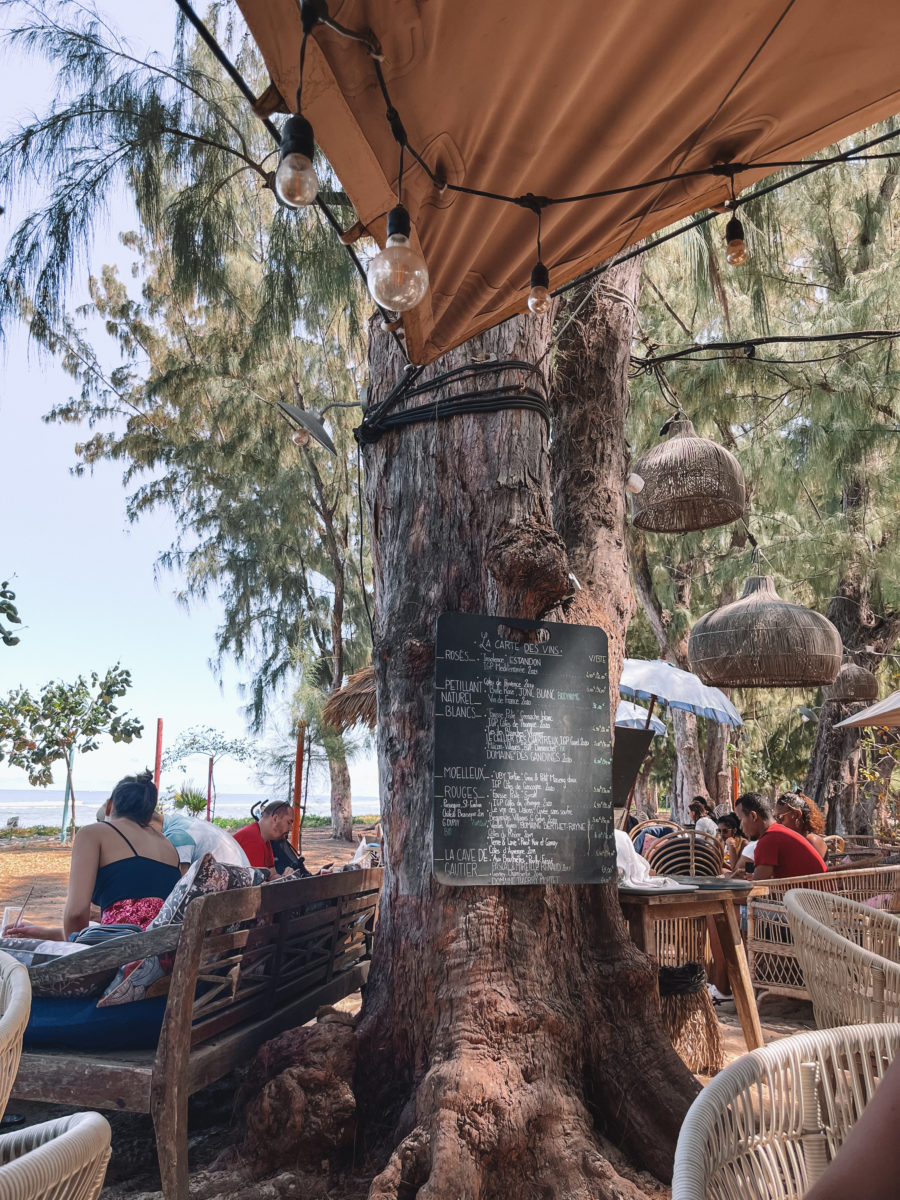
Cap Noir and Roche Verre Bouteille
The Cap Noir hike is considered moderate in terms of difficulty and can be achieved in around 2 hours, in a loop. The trail is well-marked, making it an accessible option for most hikers.
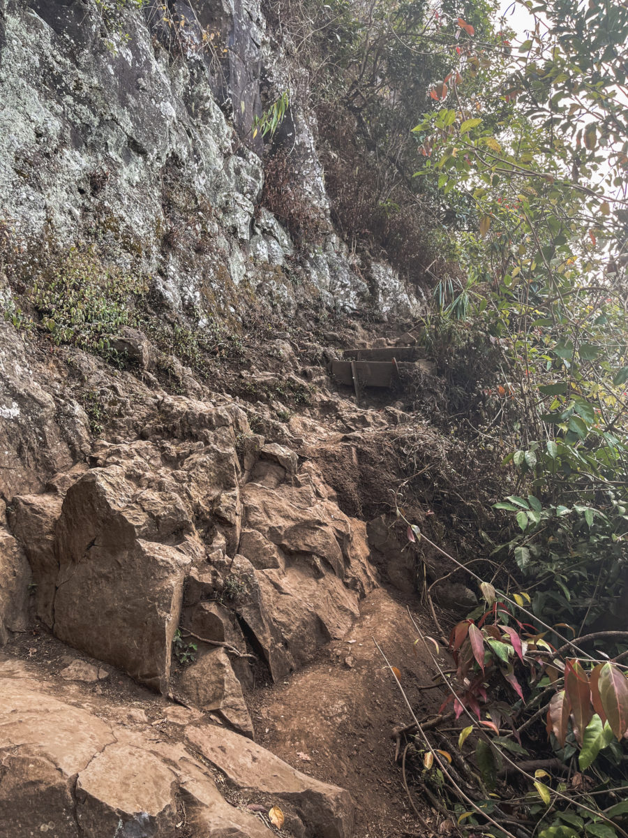
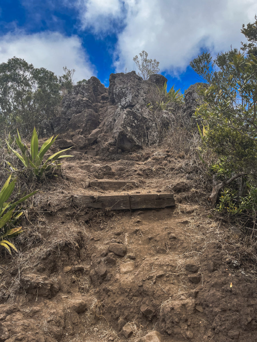
Don’t be fooled by the impression of a long descent in the photo below, the hike is accessible to all and not very difficult. In my opinion, it all depends on which direction you take it. We technically took the path in the opposite direction, wanting to go straight to the Cap Noir viewpoint, as we weren’t too sure about the weather for the rest of our walk. That’s why I advise you to start at the first crossroads on your right, in a sort of plant tunnel in the forest. This was a wise choice, too, because, on the way back, you’ll save yourself a strenuous ascent, made difficult by the high stone steps (in my eyes, easier to do on the way down, even for my weak knees).
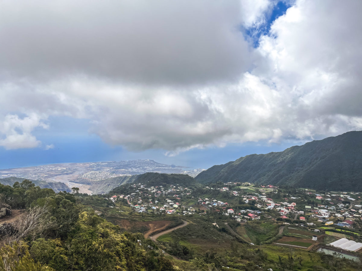
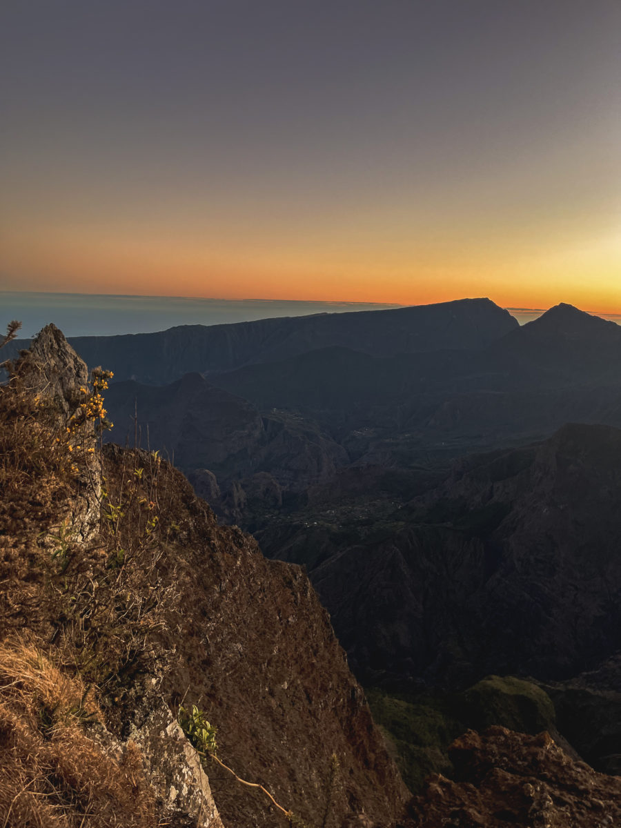
From this point onwards, the path leads us through a dense forest of tamarinds and filaos, trees characteristic of Réunion Island. On the other side of the Rivière des Galets, we can clearly make out the canalisation des Orangers, which we’ll use a few days later for our hike in Mafate. Once we reached Cap Noir, the panorama was simply breathtaking, especially as this was our first glimpse of the Cirque de Mafate for both my sister and me.
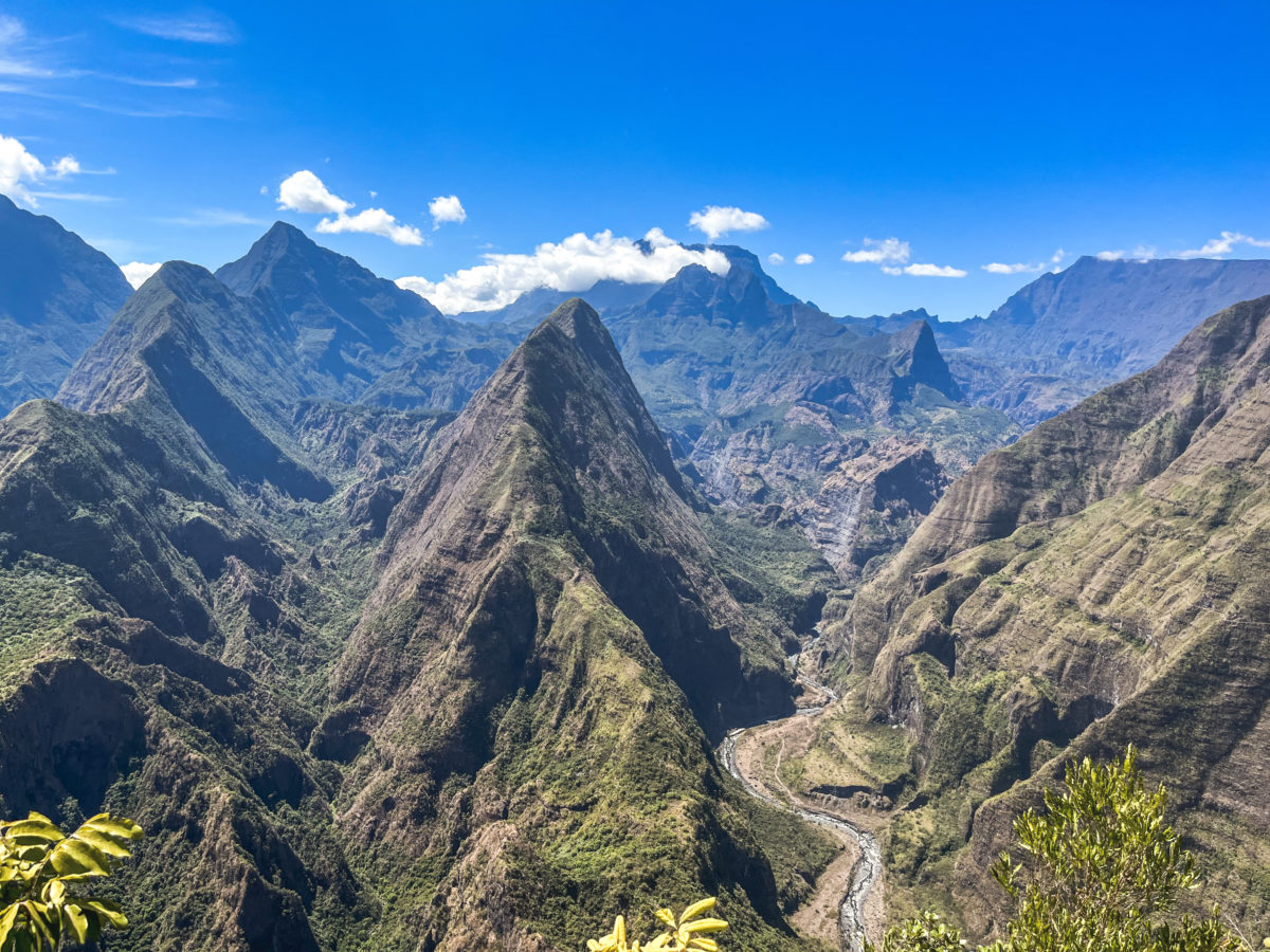
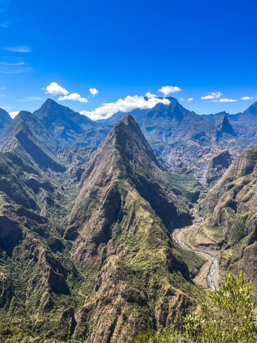
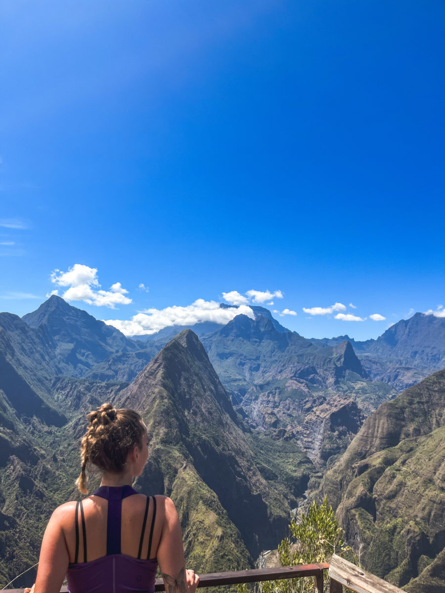
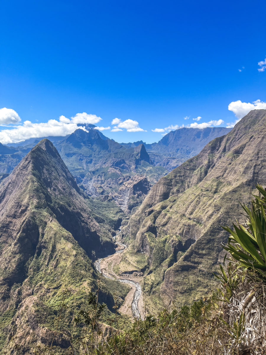
It’s a breathtaking landscape that promises some truly wonderful adventures. Indeed, here you’ll have the chance to contemplate the immensity of the Cirque de Mafate as it unfolds before you. Just below, the Rivière des Galets meanders along the impressive ramparts, creating a memorable view.
We spent a few minutes discovering the names of the peaks and hamlets, whose terms inevitably give rise to rich anecdotes – if you understand French. If you’d like to have lunch, there’s a kiosk where you can relax in the shade too.
Once you’ve reached the Cap Noir viewpoint, you can retrace your steps, or continue to make this hike a loop. You’ll then climb up to the bottle-shaped promontory (well, I have to say I haven’t seen or imagined a bottle, but that’s where the name Roche Verre Bouteille comes from). This part of the trail is more fun if you can call it that, since it’s made up of two ladders and a few passages that are a little more vertiginous, but quite suitable for everyone. To be honest, these are small ladders, and never in a vacuum.

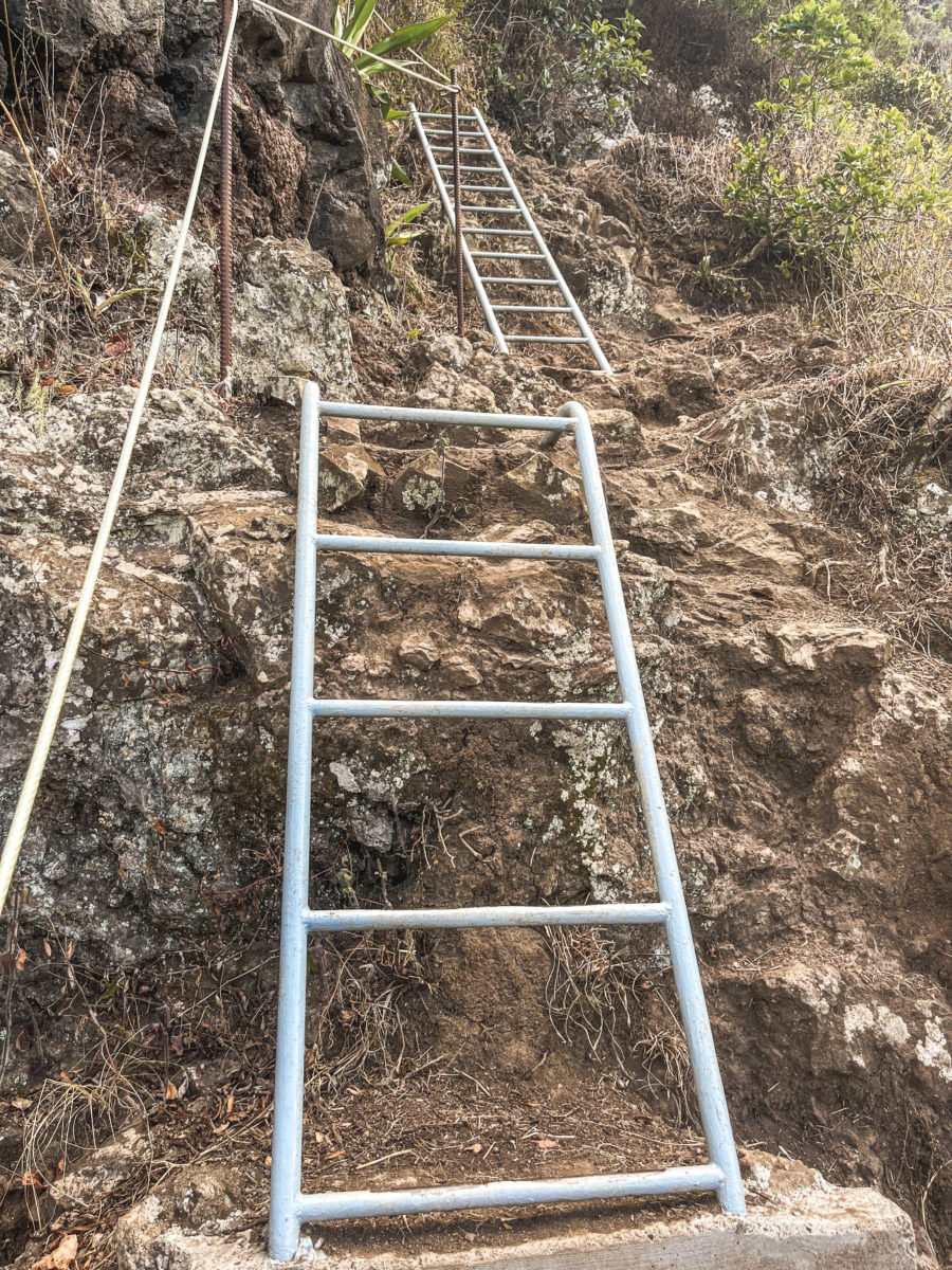

We then finally reach the top of the ridge, which offers a magnificent view of Mafate and Dos d’âne, with the ocean in the background. The descent to the car park is easy, with a few ladders that are more decorative than useful for the hike.


I enjoyed the descent and the walk in this direction, since as we descended, the little cirque of Dos d’Ane became more and more visible, with its dwellings and market gardens taking up all the space, taking our view to the ocean.
PRACTICAL INFORMATION
To reach the start of the hike, take the road (D41) leading to Dos d’Ane from the Route du Littoral. Take the RN1 towards La Possession, passing through Saint-Paul, then enter the village of Rivière des Galets. Follow the signs to Dos d’Âne. Once in Dos d’Âne, continue past the church, following the signs to Cap Noir. Follow the road to Chemin du Cap Noir, where a car park welcomes visitors.
As this is a very accessible hike, you’ll probably have to park your car along the road if you’re not among the first to get up. I’ve already mentioned this for the Mafate hike, but never leave valuables in your vehicle, as theft is notorious on Réunion Island, especially on the outskirts of well-known hiking trails.
Kar’Ouest bus line 8A takes passengers from Le Port bus station to the Cap Noir stop dedicated to hiking.
Rando Pitons provides excellent advice for hikers and has written a short article on this particular hike. Here’s the link.
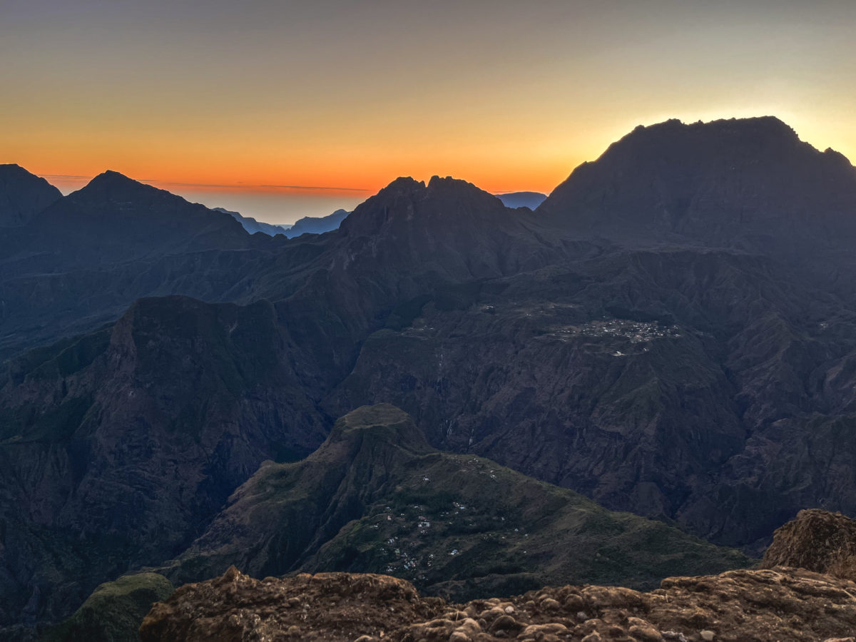
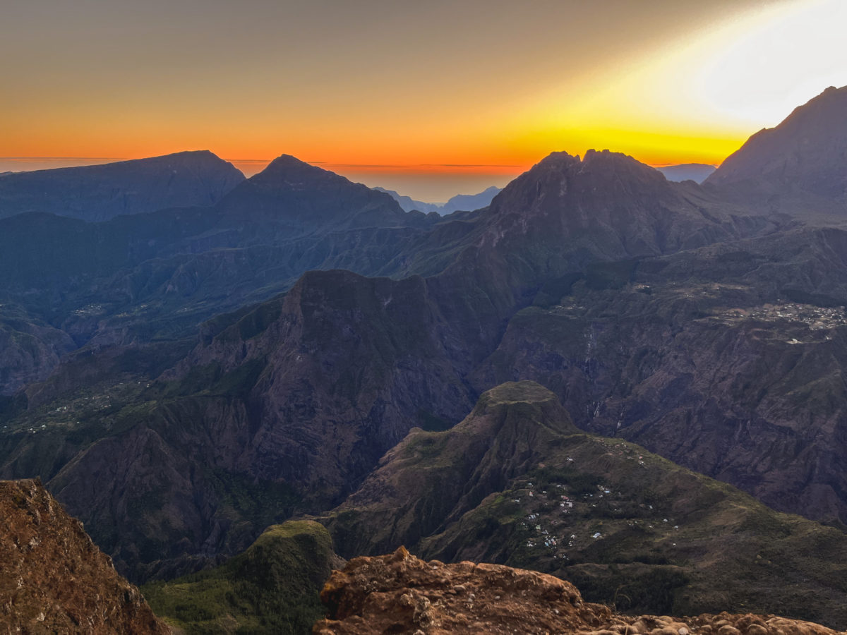
SUNRISE OVER MAFATE CIRQUE FROM PITON MAÏDO
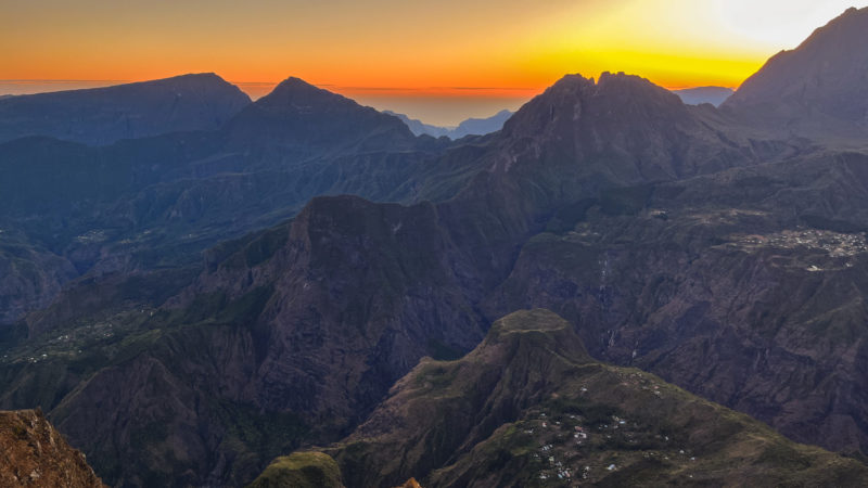
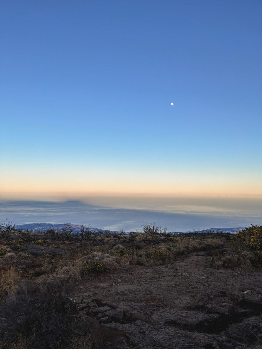
Sunrise over Mafate from Piton Maïdo is an authentic and unforgettable experience, even if you have to get up (too) early. Nestled atop the ridge overlooking the Cirque de Mafate, the Piton Maïdo offers one of the most spectacular views on Réunion Island.
Rising to an altitude of 2,200 metres at the summit, the rampart of the Piton Maïdo offers a breathtaking view of the Cirque de Mafate and surrounding mountains. As it is frequently shrouded in clouds in the late morning, we opted for an early approach to maximize our chances of admiring this magnificent landscape, arriving before sunrise. Every morning, when the first rays of sunlight pierce the horizon, it’s as if nature itself is awakening.
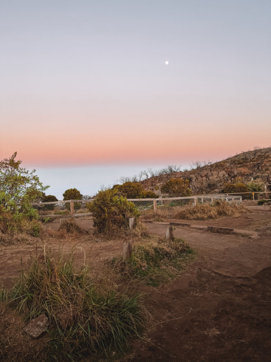
We set off along the winding road towards Maïdo, either early in the morning (waking up at 3:30) or late at night, and it was in a very bad state of awakening that we made our way into the Hauts tamarind forest, still shrouded in a mysterious mist. Needless to say, I was already imagining a very gloomy story in this dark setting where only the shadows of the trees could be seen, enough to completely wake up my parents who were still a little asleep. And then, in the light of the headlights, the landscape became less and less gloomy, and already predicted many companions at the summit for this unusual start to the day.
Having parked a little way back, given the large number of cars already there, we walked a hundred metres or so to the wooden balustrade, where we elbowed our way up and admired the spectacle that had already begun. Naturally, I wished I’d had a thermos of hot drink to hand and a thick blanket, as the temperature was as low as my blood pressure as we made our way through the tamarind forest. Well, I found a suit that would do the trick to keep me warm but remember to bundle up before you reach the summit.
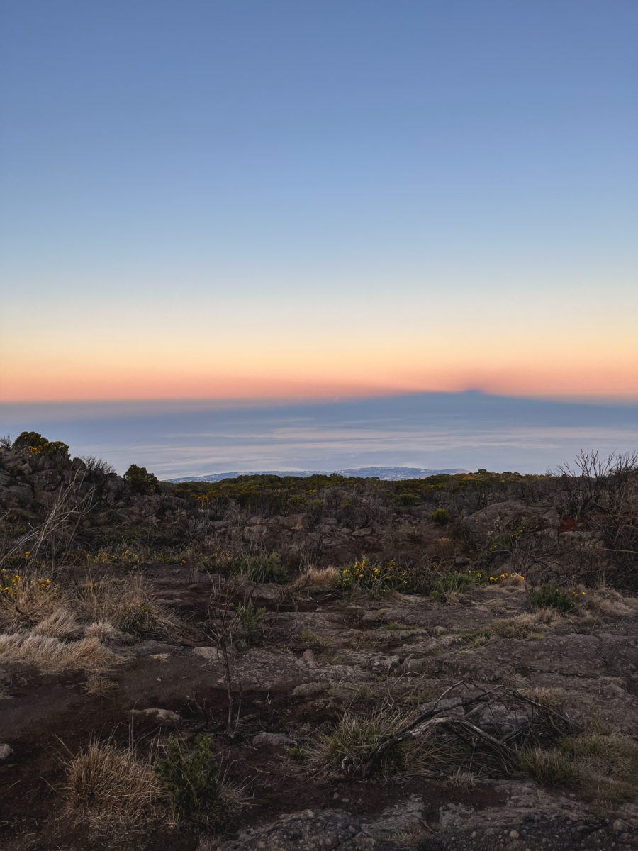
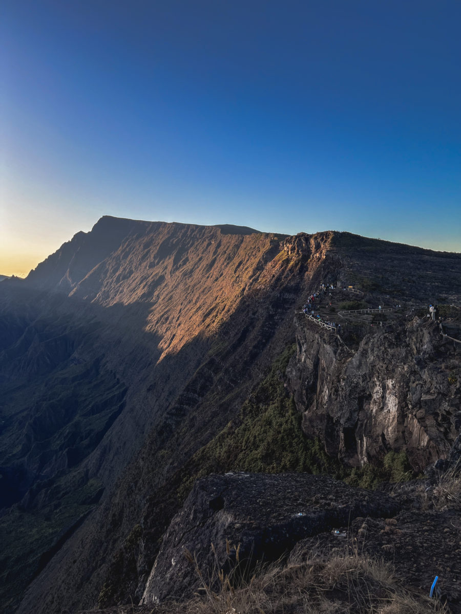
The truth is, it was quite a magical moment. The mountains loomed in shadow over a sky that changed from deep black to shades of pink, orange and purple. The clouds took on golden hues, and the valley below gradually came into view. Admittedly, I wasn’t alone in this experience (there are a lot of visitors, so come early). But who cares? It was a moment of pure serenity, a communion with nature, and a celebration of the raw, authentic beauty of Réunion Island.
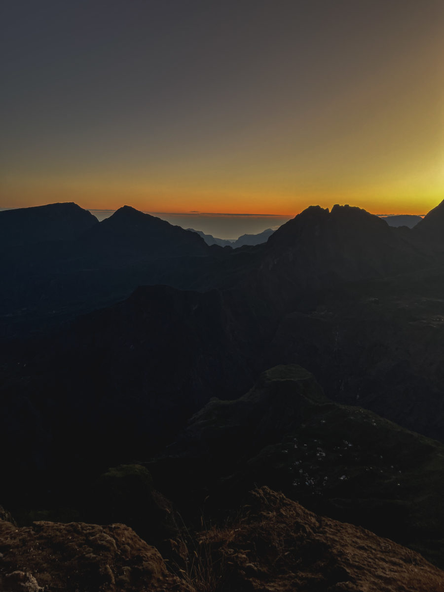
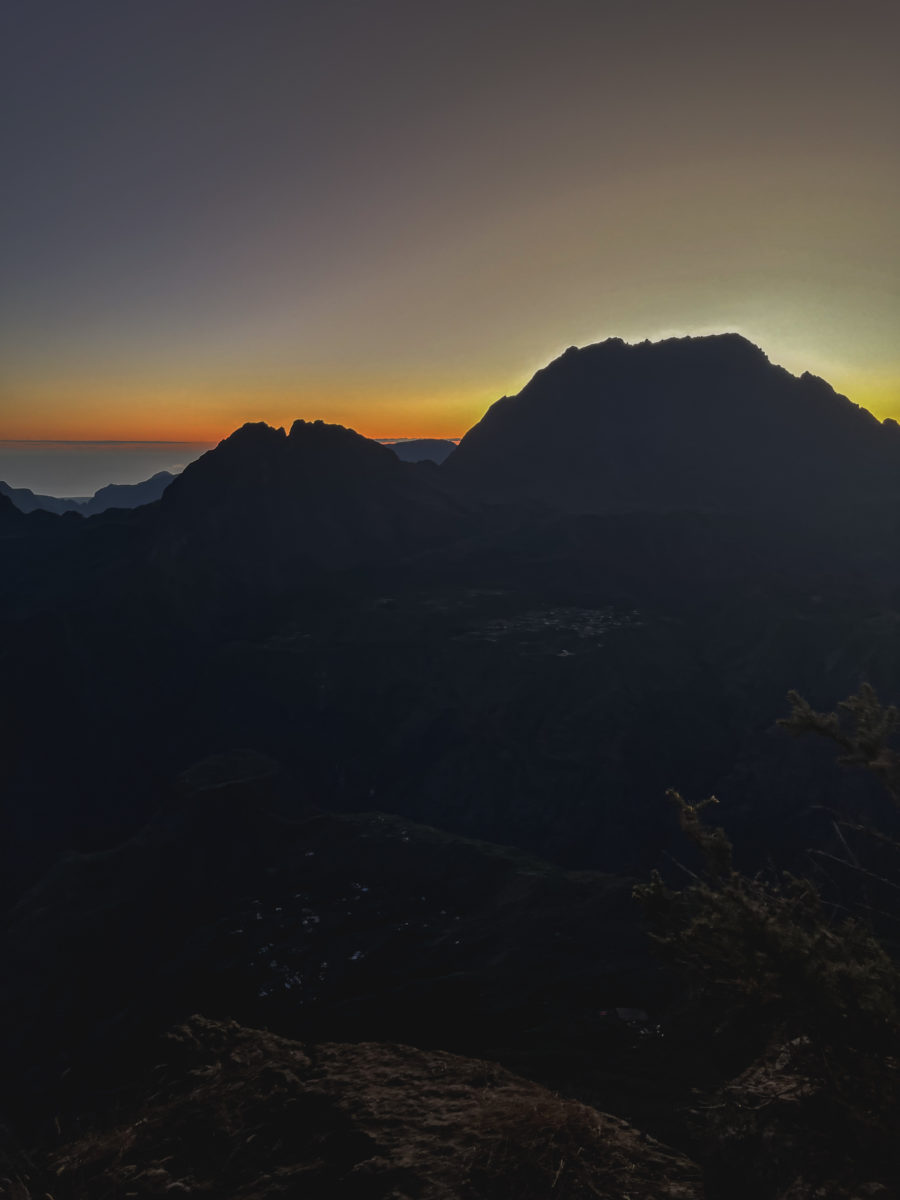

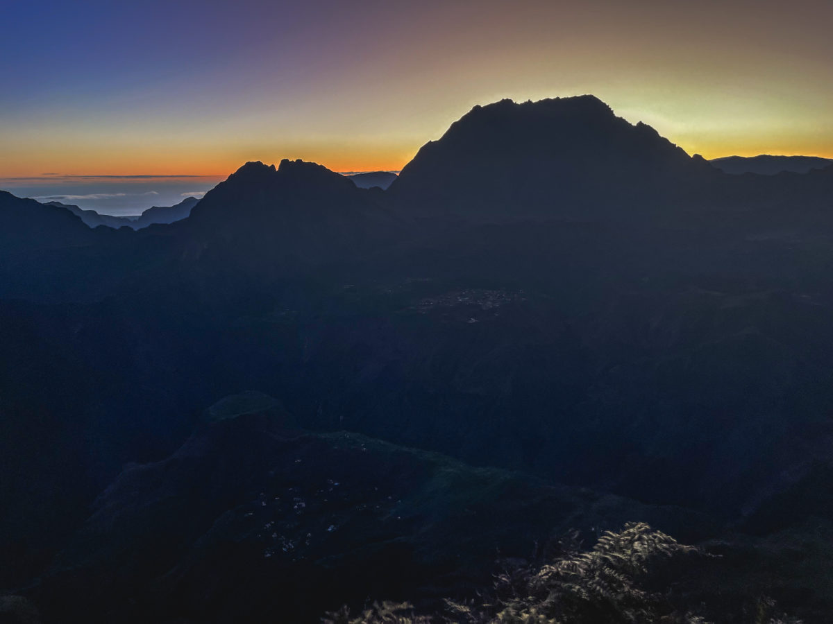
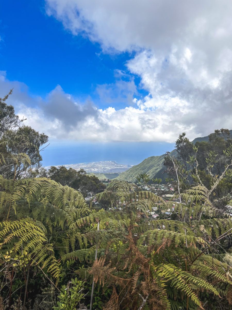
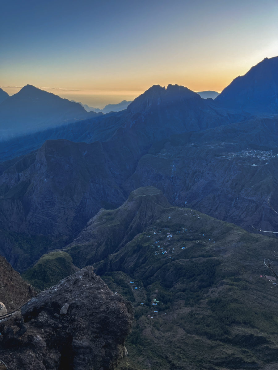
As I walked a few meters further, I could make out on my right the imposing silhouette of the Piton des Neiges and the towering summit of Gros Morne, which dominate the landscape. The conical peak of the Piton de la Fournaise could be seen in the distance. And then, gradually, below, the cirque of Mafate, Réunion’s most isolated cirque (I wrote about it here), came into view, revealing the islets nestling in the heart of this spectacular amphitheatre.
Even though the very early wake-up call had shaken us a little, we were delighted to have had the opportunity to witness a magnificent sunrise at the summit of the Piton du Maïdo.

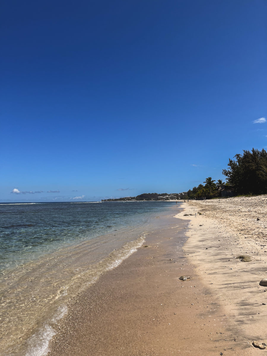
But that kind of activity whets the appetite! We headed for the shores of the Indian Ocean to enjoy the beach and a well-deserved breakfast. I recommend the following address: Les balançoires in Saint-Gilles-les-Bains.
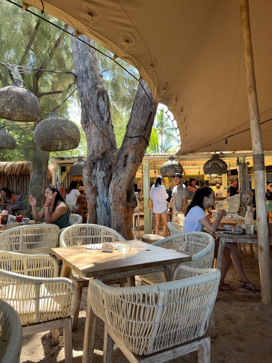
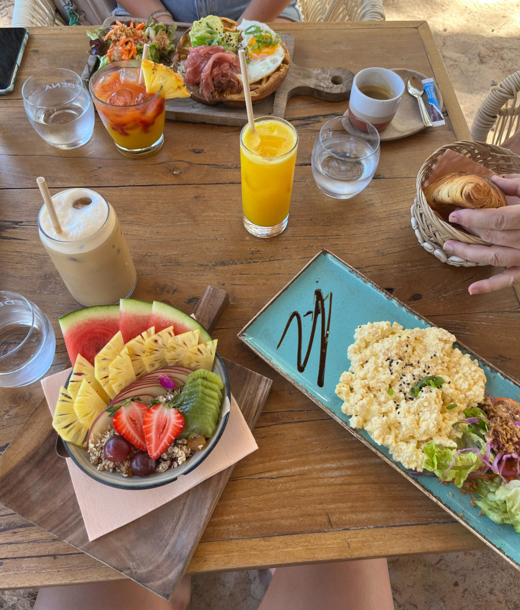

Don’t forget to book during the tourist season, as this is a very trendy place on the island, with its Western menu and sumptuous, almost waterfront setting.
PRACTICAL INFORMATION
You’ll need your means of transport to get to Piton Maïdo. Similarly, for any stay on the island, we recommend renting a car, for greater flexibility. There is, however, a public transport option.
Head for Saint-Paul, a town on the island’s west coast. This is the starting point for reaching the Piton Maïdo. In Saint-Paul, follow the signs for “Piton Maïdo” or “Maïdo.” The route forestière du Maïdo (RF8) takes you up into the mountains towards the cirque de Mafate.
The road climbs in altitude and can be winding, so be careful, especially early in the morning or at night, although it is generally well maintained.
Don’t forget to check the weather conditions before setting off, as the weather can be unpredictable in the mountains, especially on Réunion Island. It’s also advisable to arrive early to get a good spot, as the Piton Maïdo is a very popular spot to admire the sunrise over Mafate.
By bus, line 61 de Kar Ouest from the Saint-Paul bus station runs to Maïdo. However, be sure to check the timetable in advance at www.karouest.re