If you’re planning to spend a few days in Lucerne, I’ve put together an itinerary that will allow you to hike while relaxing in the turquoise waters of Lake Lucerne. Although I didn’t have the chance to do the whole itinerary when I lived in Lucerne, as a keen hiker I think the one I’ve put together is suitable for anyone who enjoys walking. However, to make the most of your time and avoid too many trips in a single day, it’s best to have accommodation in Lucerne (or Zurich or Zug).
To sum up, I’ll be taking you on a magnificent panoramic walk offering breathtaking views of Lake Lucerne, then exploring the lake directly back to Lucerne by boat.
START OF THE WALK: GO TO STOOS
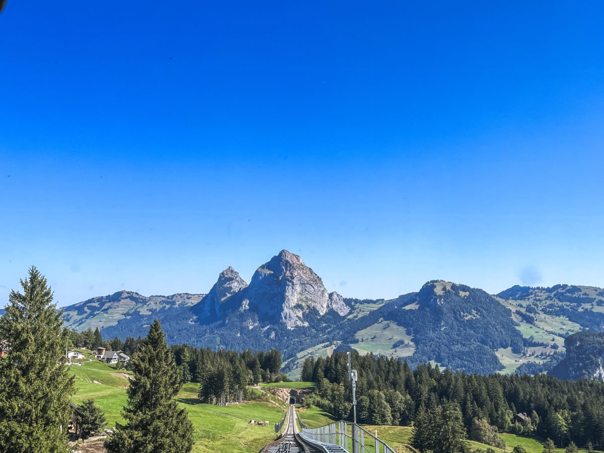
Today’s trail begins in Stoos, a pedestrian village in the canton of Schwyz. If the name rings a bell, the most likely reason is that this village can only be reached by the strength of your calves (you can expect to climb 800m depending on the route you take), by cable car from Morschach or by technological innovation: the “Stoosbahn” funicular railway, which holds the title of the steepest funicular railway in the world. This alone is worth a stopover in Schwyz on the way to Stoos.
From Lucerne, many trains go directly to Schwyz station, or you may have to change to Arth-Goldau. Then, either from Arth-Goldau (popular for climbing the Rigi) or from Schwyz station, there are buses to the Schwyz funicular stop, Stoosbahn. The easiest way is to use the SBB timetable application.
From the bus stop, it’s just a short walk to the funicular station. There is a car park here if you are arriving by road. It’s at this point that I should point out that the hike that follows is very, very popular with Swiss-German hikers, as it’s not very complicated and offers a magnificent panorama. As a result, many people go there at weekends or during the school holidays. So much so, that when I reached the summit, I called the hike “the Sunday hikers’ highway“.
On my first visit to Stoos, on a weekday at the end of August, I did not get this feeling of human oppression, but on my last visit, on a Sunday in September, in glorious sunny weather, there was almost single-file queuing on the ridge, as well as at the funicular station to buy tickets. So plan to buy your tickets online, or, if like me you have a general season ticket (with the SBB), you can cut the queue. In the end, we did not have to wait and could take the first funicular to Stoos.
I mentioned that it has been named the steepest funicular in the world. And I’m not going to lie to you, when you see it from the station rising to the very top of the mountain, you can’t help but be impressed, as if the funicular was simply clinging to the wall. To achieve this, the funicular has been designed in an unprecedented way, with four round cabins.
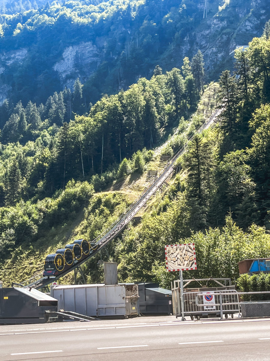

The Stoos funicular is a remarkable example of unusual technology. This funicular boasts a unique design: it is made up of four perfectly round cabins. Inaugurated in 2017, at its steepest point the gradient reaches an incredible 110%, which is indicated inside the cabins by a level displayed on the glass. However, once inside, the incline is barely noticeable, which is quite remarkable!

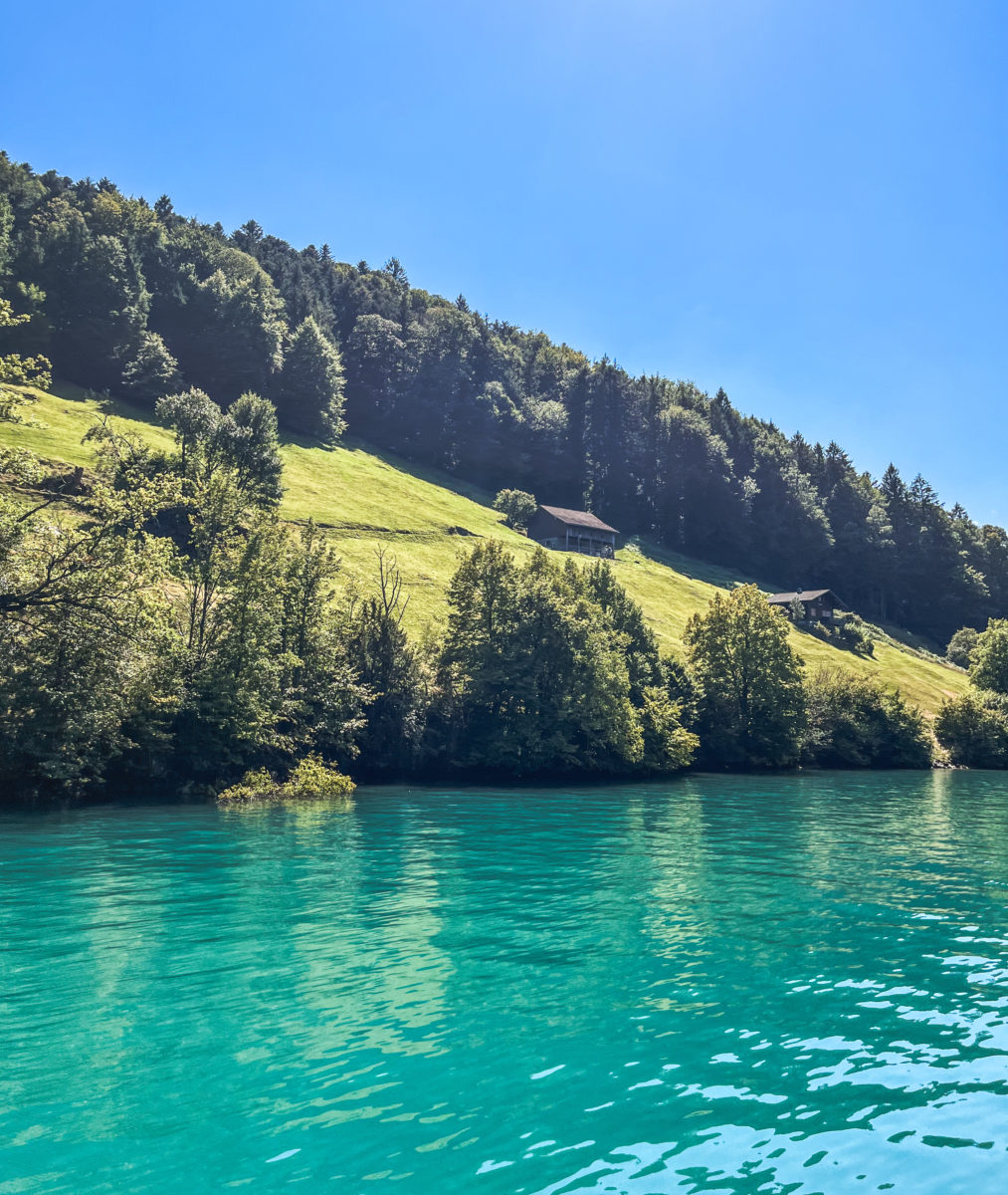
Indeed, the idea behind this sphere-shaped design is that the spheres rotate according to the inclination of the slope, ensuring that passengers always remain in an upright position, without feeling the gradient. In just 4-5 minutes, we arrive in Stoos, and once through the tunnel, we have the impression of emerging into a truly authentic (and admittedly clichéd) Swiss landscape, with green meadows, mountains at every glance and cows grazing peacefully.
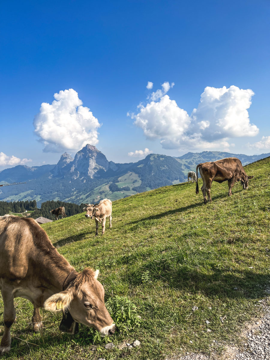
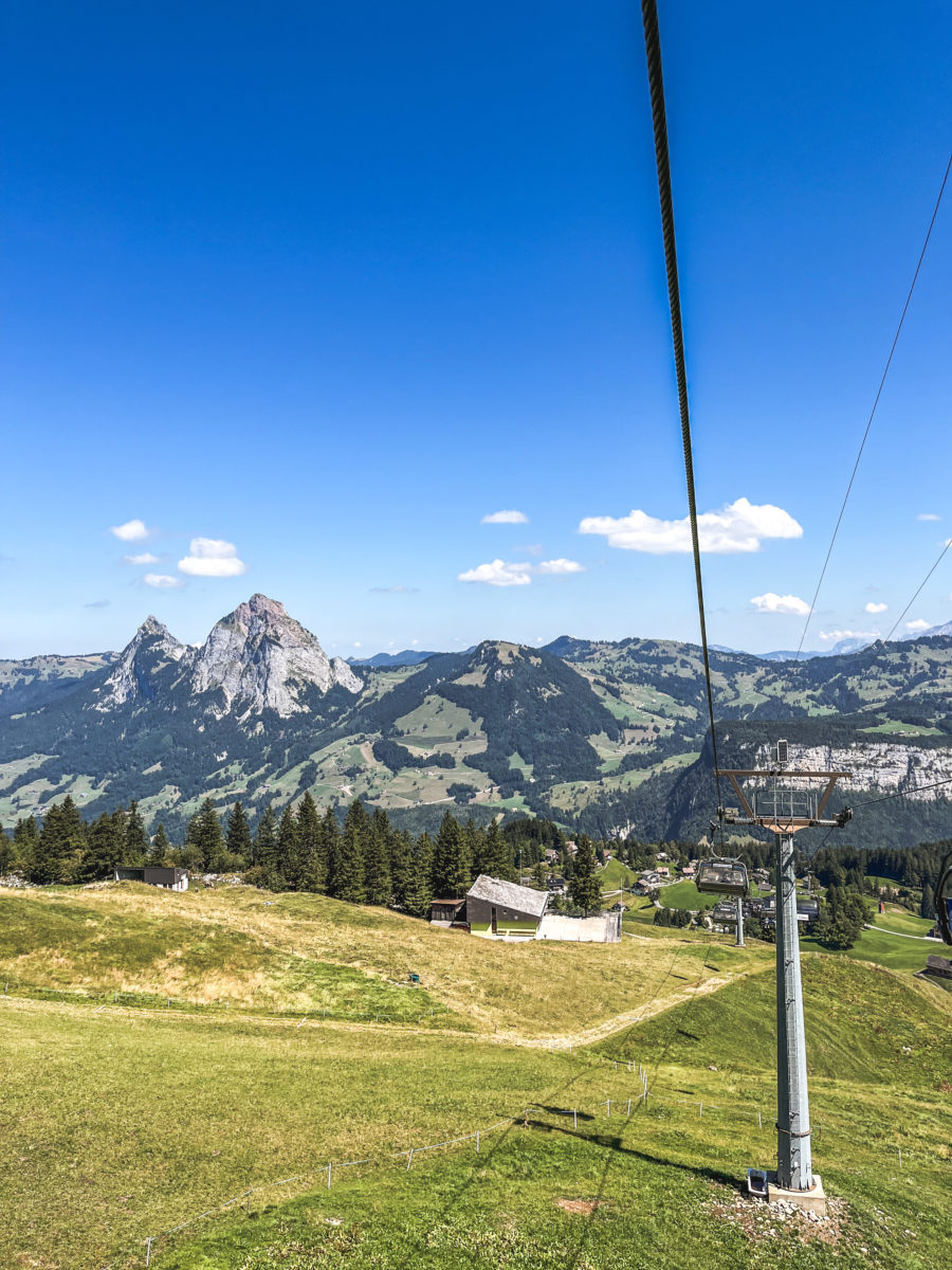
Stoos is therefore the starting point for several hikes. It’s also a charming little village, with a few inhabitants and several hotels, overlooking the Grosse Mythen, a famous mountain in the area.
For this walk, we’re not going to be original or go off the beaten track, as the route I’m proposing is the most popular. However, I doubt that it is very well known among the French-speaking Swiss, as the people around us only speak Swiss German, and sometimes a little Italian. The train stops in Schwyz and Arth-Goldau are on the same line as the train that runs from Basel-Lucerne to Lugano, making it possible to reach the mountains of Schwyz in just a few hours.
Well, here are the necessary directions and an insight into a walk in the heart of our magnificent country on a grassy ridge overlooking a lake reminiscent of the Norwegian fjords, or the Saguenay fjord in Canada.
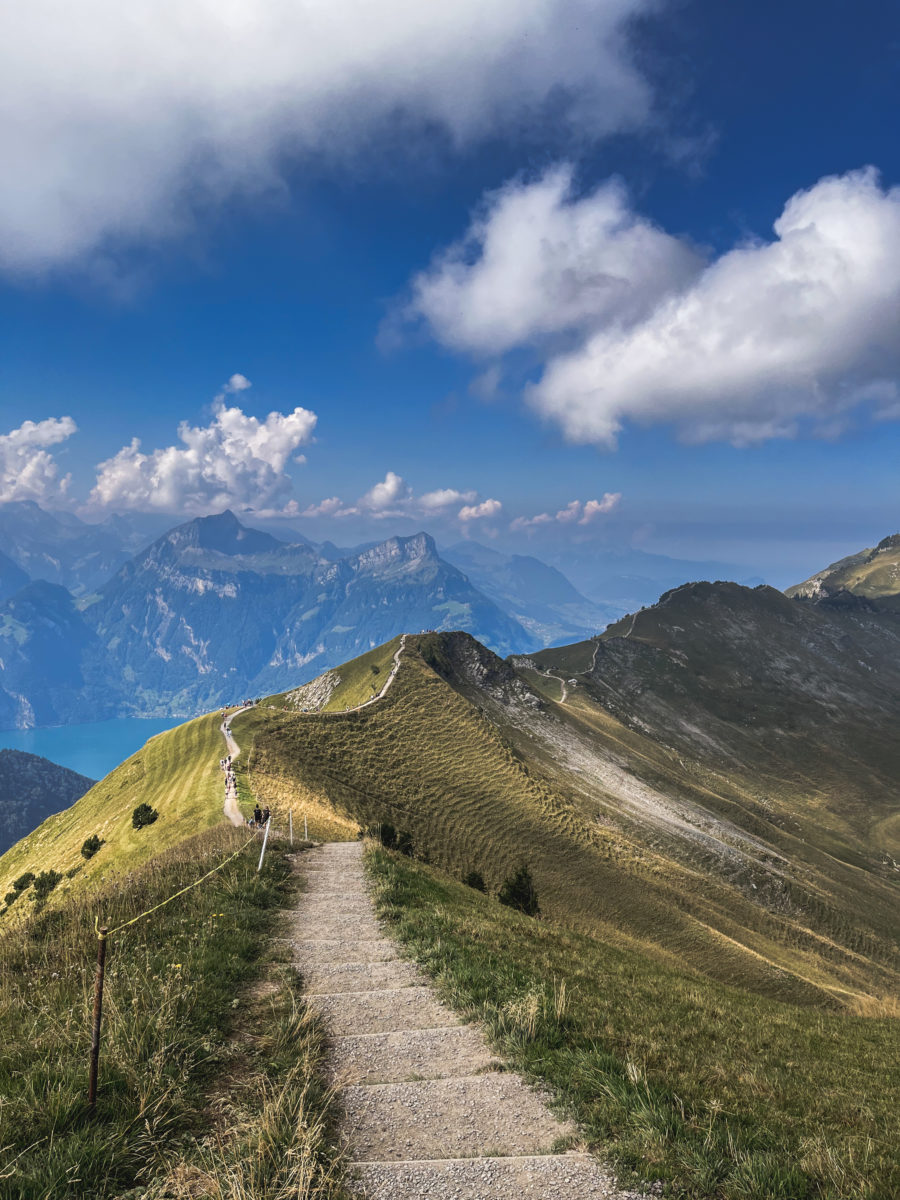
I’ve already explained the route, but it’s not very difficult – just follow the red and white markings. There is, however, a stony section and a few steps to negotiate (a chain helps just in case), but this path presents no real technical challenge.
FROM STOOS TO KLINGENSTOCK
From Stoos, the most popular option is to take the Klingenstock chairlift directly to the ridge path. It takes around ten minutes to get to the chairlift, taking the stairs on the left as you leave the funicular.
Naturally, taking a chairlift is a rather expensive option. But boy, my knees thank me for paying CHF 20. However, for that price, only one trip is counted! We had decided to walk down when we arrived at Fronalpstock. Needless to say, I should have listened to my instincts, which told me that my knees would be in agony (yes!) on the way down, but psychologically I told myself that it would be fine, as I didn’t want to pay CHF 31 for a return journey.
Some packages include the funicular ascent, for example. All the general information can be found on the Stoosbahn website here.
Tickets for chairlifts can be purchased directly from the chairlift departure point. The chairlift takes visitors to the top of the Klingenstock in just under 10 minutes, where they can begin their walk on the ridge. It operates throughout the summer from 9:00 to 16:00, so please bear this in mind. The same applies to the Fronalpstock chairlift. Timetables can be found here.

THE STOOS RIDGE ROUTE, FROM KLINGENSTOCK TO FRONALPSTOCK
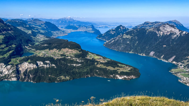
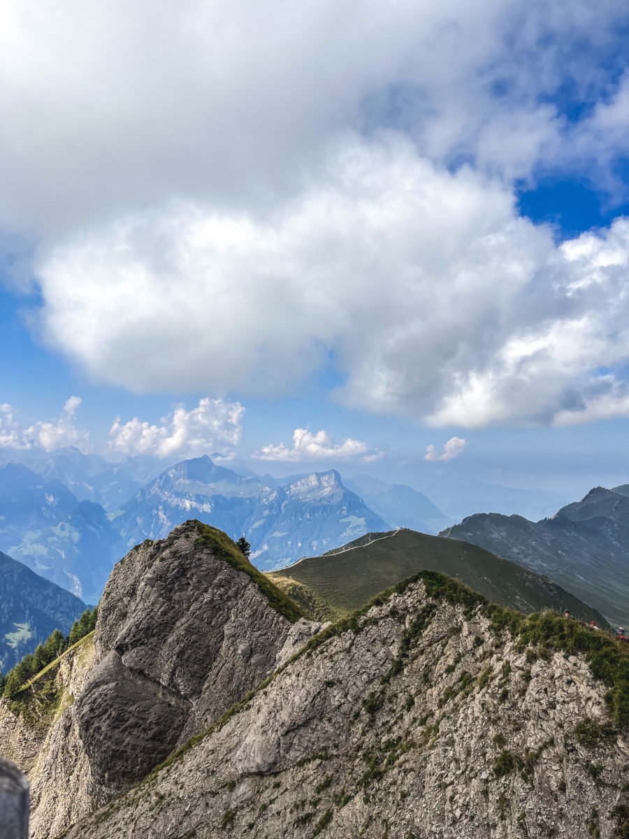
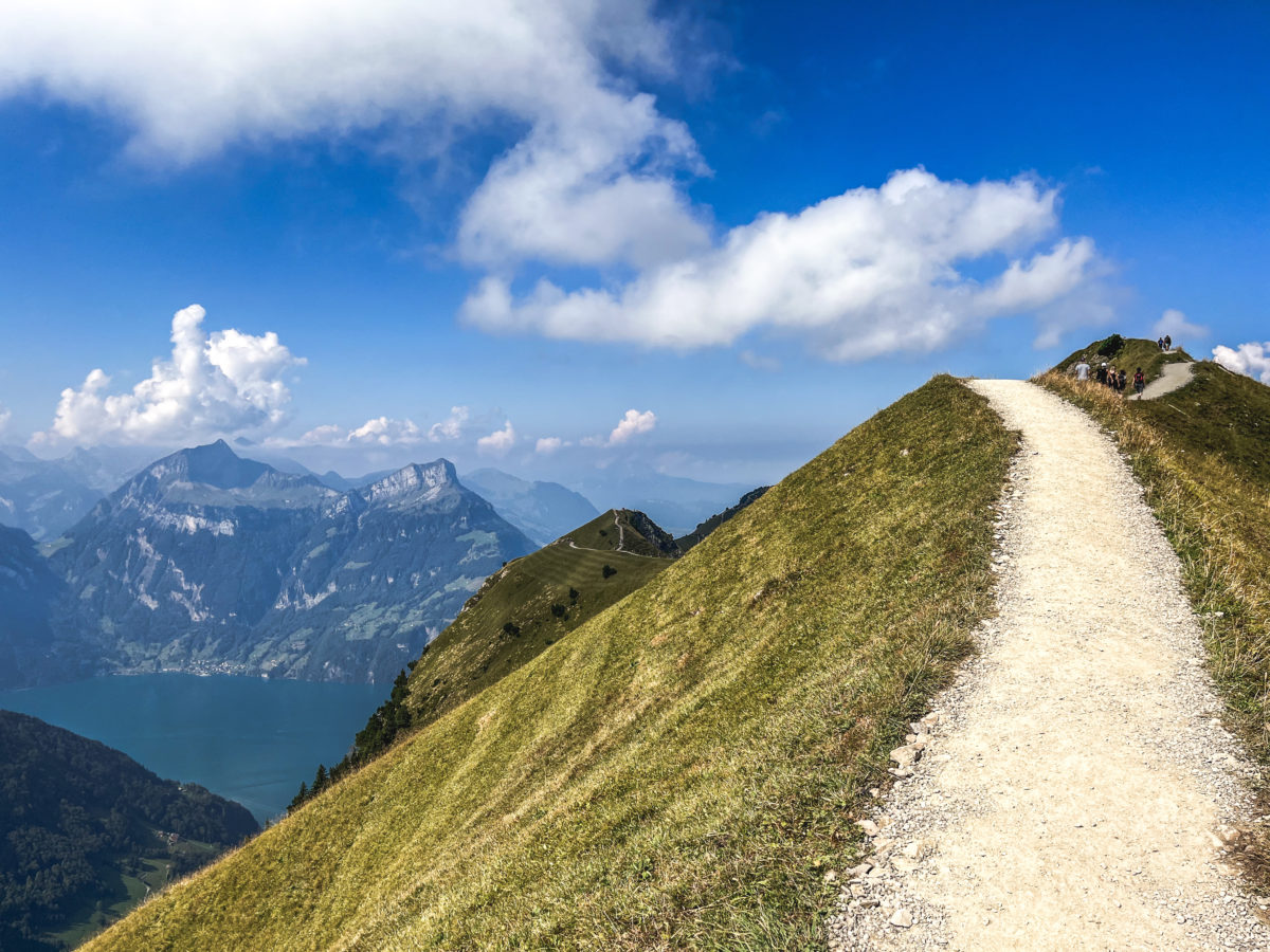
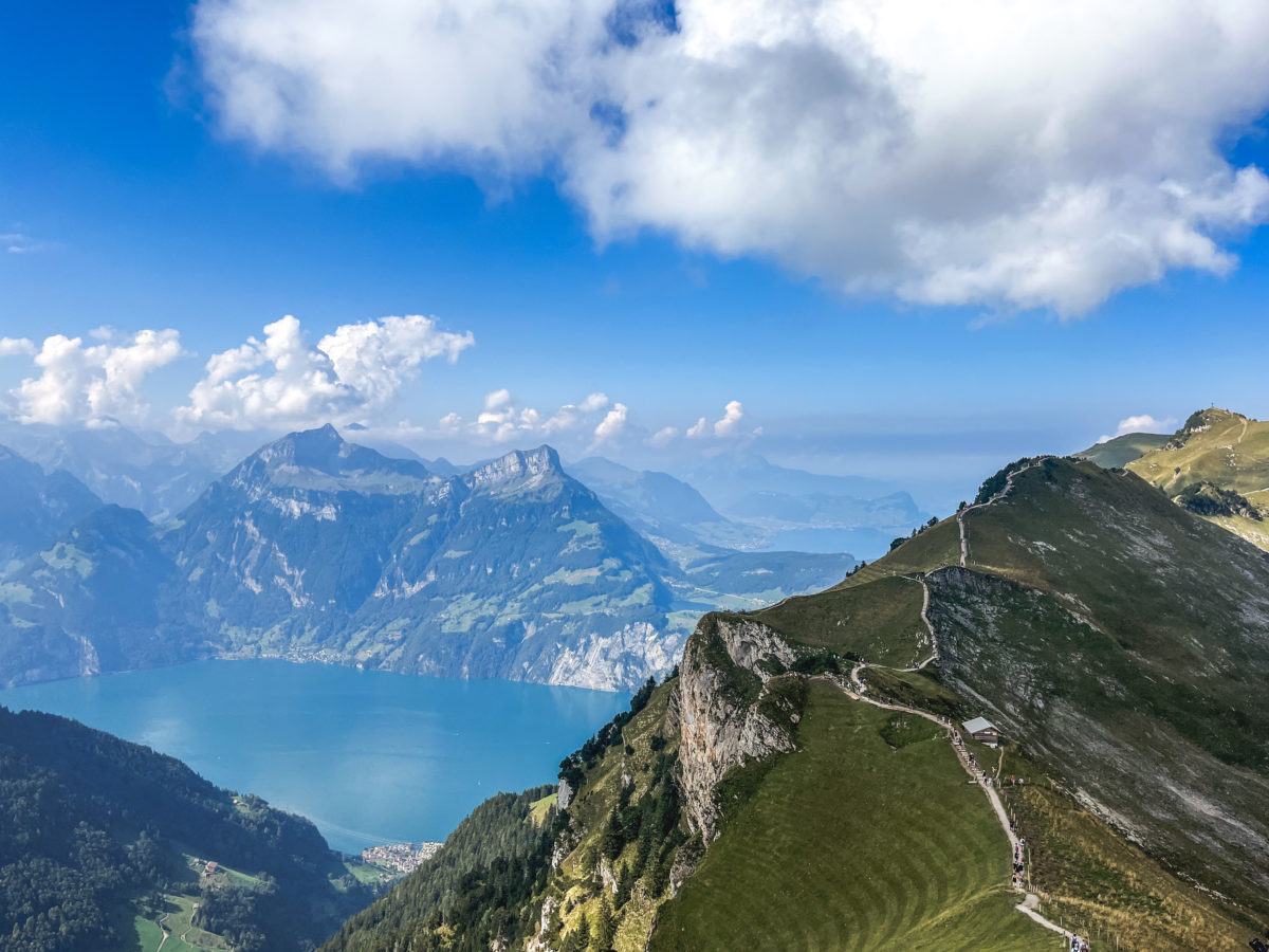
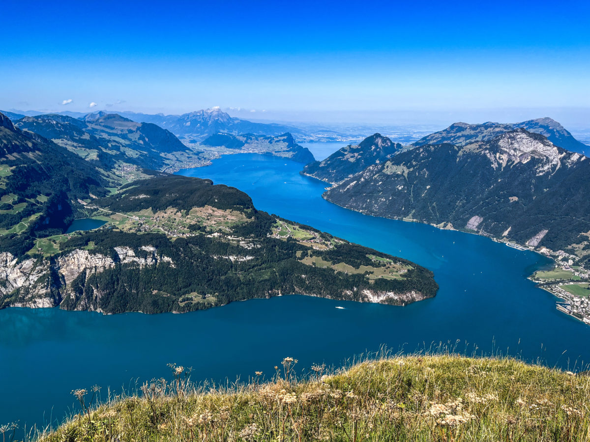
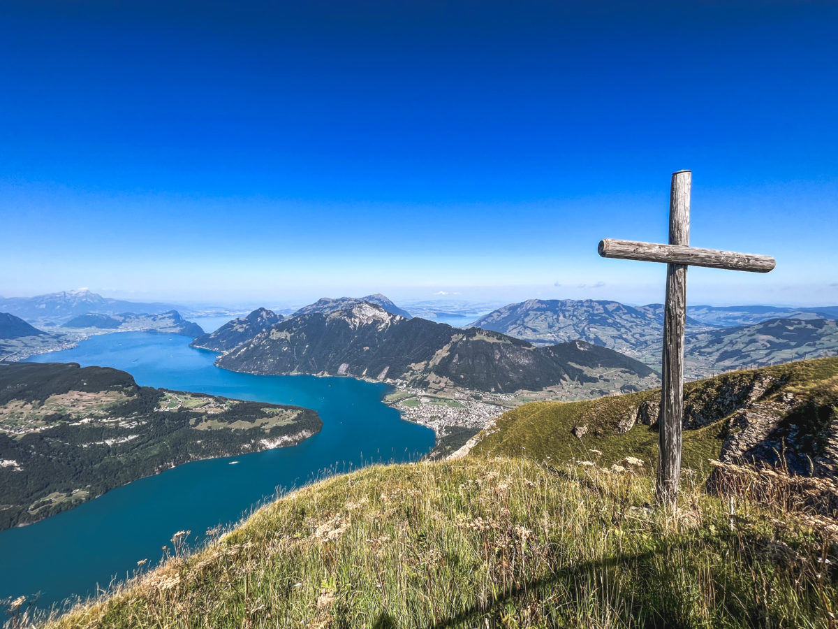
Arriving at the summit, we marvelled at the 360-degree panorama before moving on to the ridge and congratulating ourselves on having undertaken the walk in this direction, with the lake to our left and the Schwyz Alps with the Grosse Mythen to our right. At no point will the lake be at our backs.
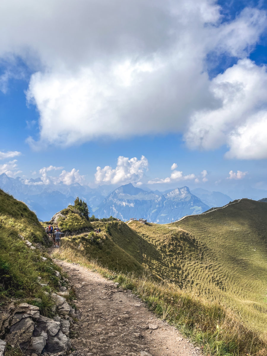

We think we’ve made a phenomenal discovery, but when we see the dozens and dozens of other hikers moving in single file in the same direction, we end up congratulating ourselves on our good instincts. The instinct to have come on a sunny Sunday in September is not a good one, as it was impossible not to spot a walker on the ridge.
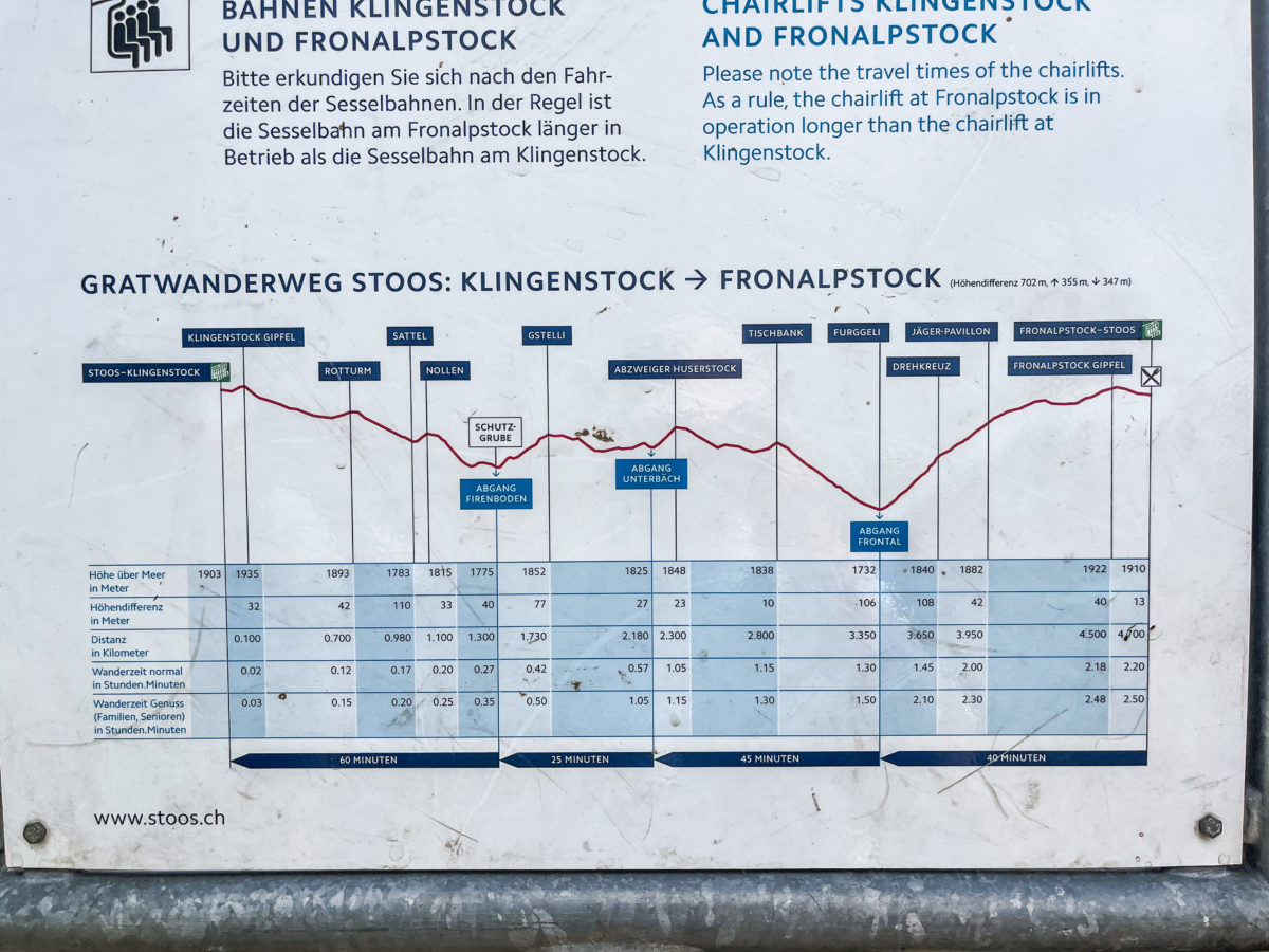
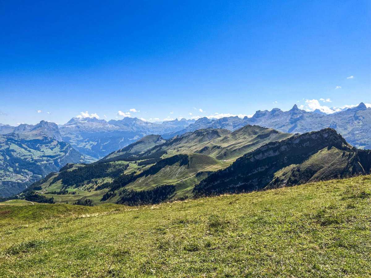
And so, we began our walk, which lasted about 2 hours (not counting our picnic break about halfway along the route) and covered 4.5 km (+ and – 400m difference in altitude).

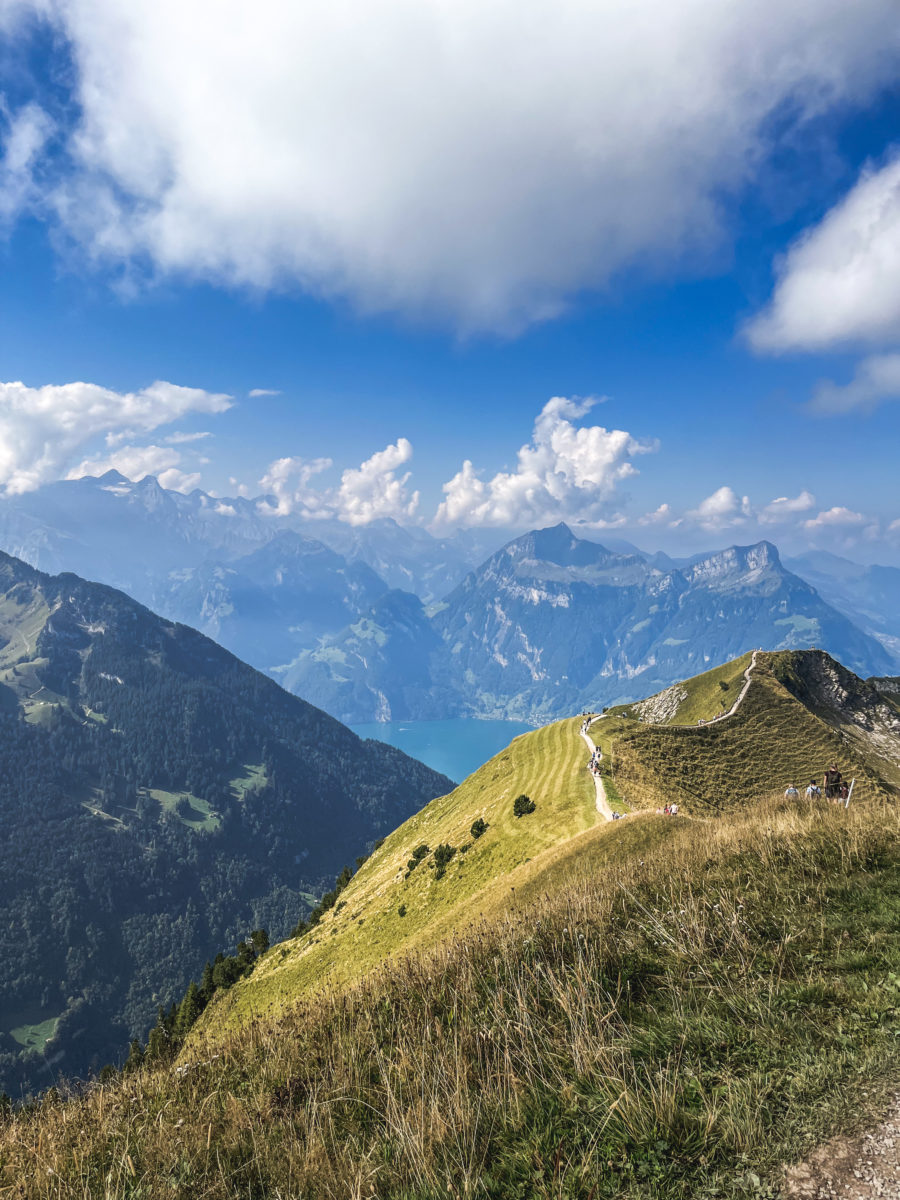
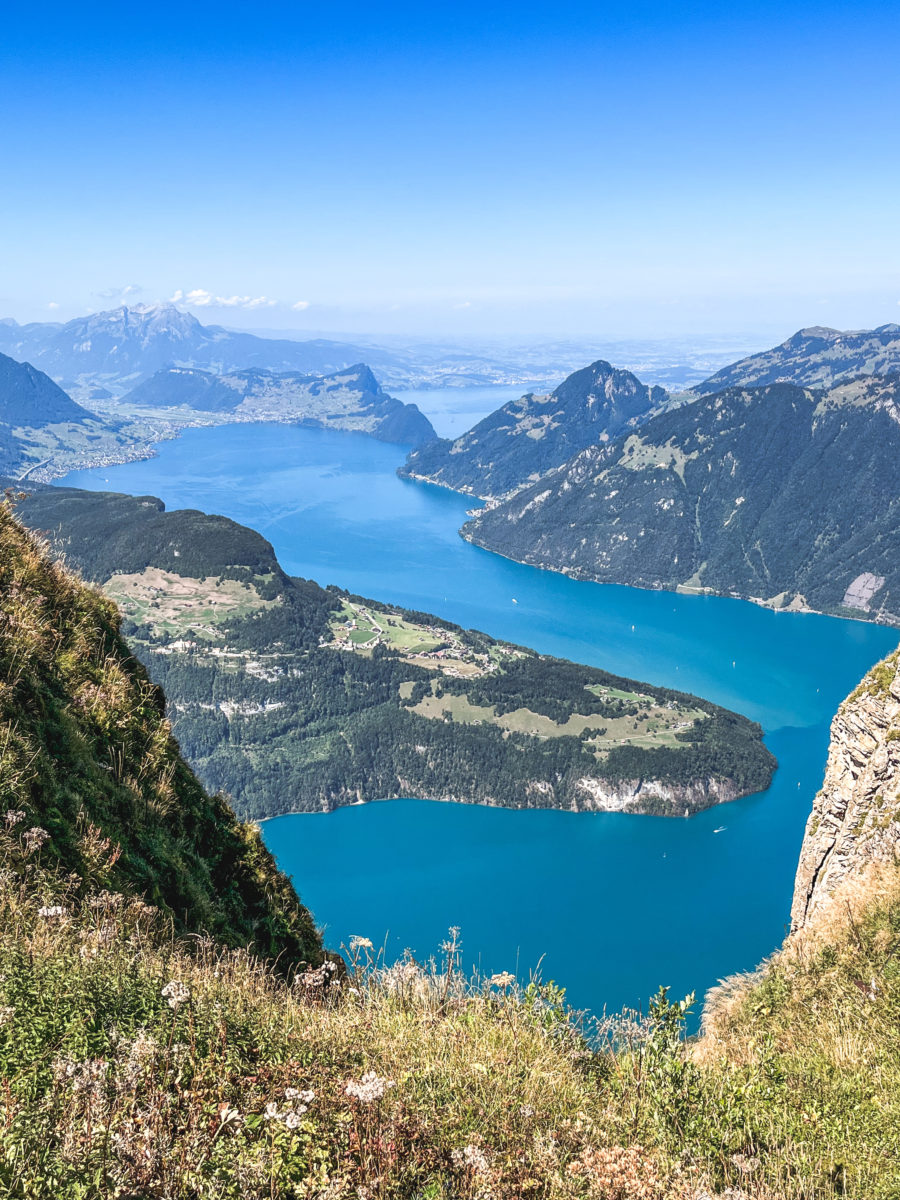
The lake can be seen after a few hundred metres on the left. Lake Lucerne has a rather unique configuration, characterised by its many arms that extend in different directions, giving the lake a singular shape.
The lake, known as Vierwaldstättersee in German, is one of Switzerland’s most famous and picturesque lakes due to its strategic location in the heart of the country and its cultural history, being surrounded by the cantons of Lucerne, Uri, Schwyz and Unterwalden. It occupies a central position in the country, making it an essential meeting point between different Swiss regions.
In keeping with tradition, delegates from Uri, Schwyz and Unterwalden gathered on 1 August 1291 on the “Grütli” meadow (which can be seen from the ridge and the boat) to consolidate an alliance that would mark the birth of the Swiss Confederation.

The further you go, the more you see the magnificent colours (on a clear day) of the lake, revealing some magnificent scenery. However, I must mention one essential point. I mentioned above that the difference in altitude, positive and negative, is around 400 metres. Honestly, it’s not as flat as I thought. There’s a succession of ascents and descents, so it doesn’t feel flat, but, indeed, the effort isn’t difficult and the ride is pleasant. However, I wasn’t expecting the climb to the Furggeli to be difficult enough to reach the last section before arriving at the Fronalpstock. And that’s when it hit me! Or rather, my knees took a beating, heralding an unpleasant and painful end to the walk (the descent) for my poor bruised knees.
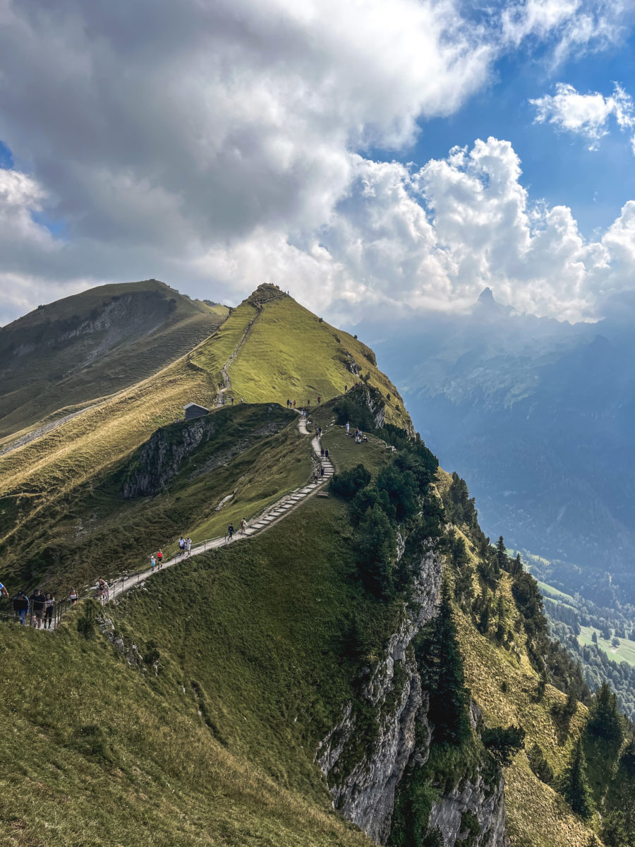
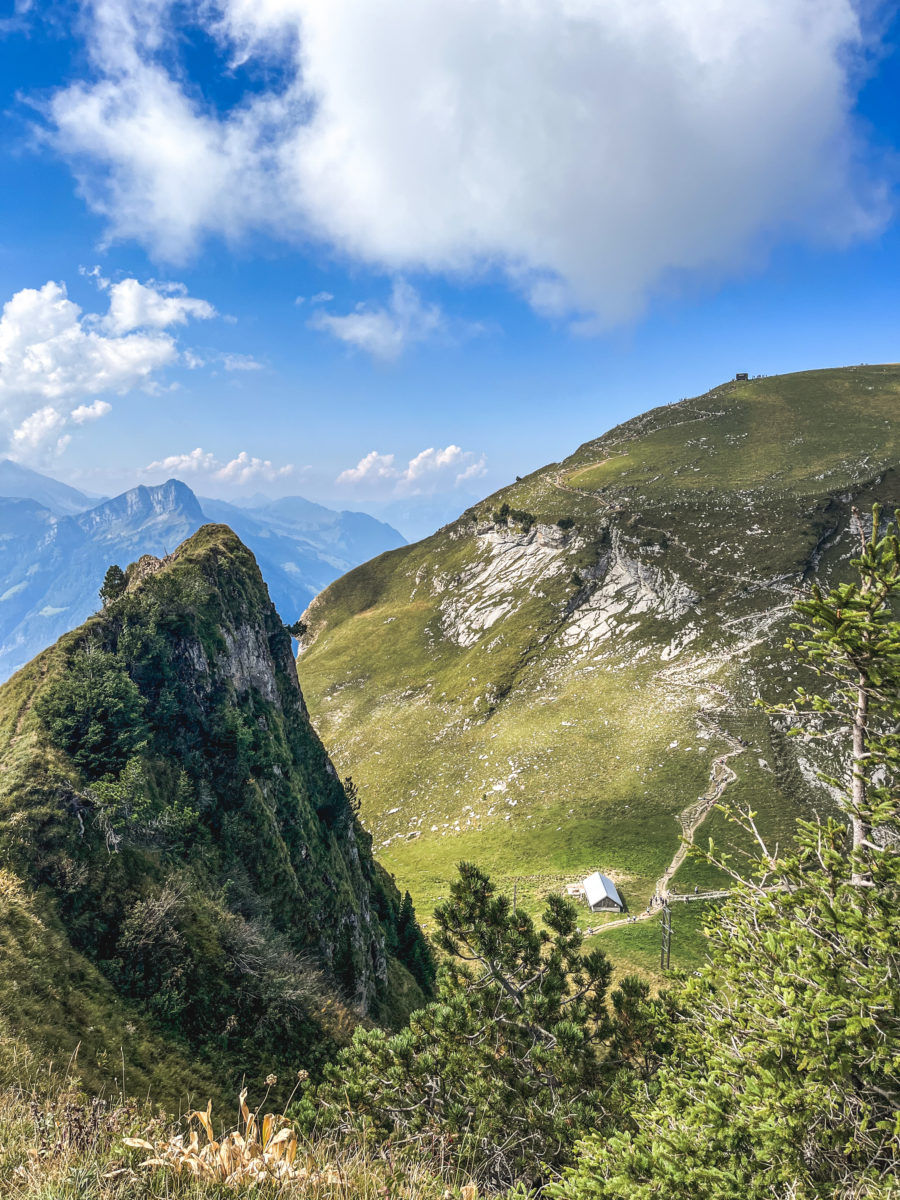
That’s the only negative point I have about this magnificent route (and it’s a personal one, given my physical condition), as the surrounding scenery is so magnificent! What’s more, the images can sometimes give the impression that the trail is extremely exposed, but in truth, it is quite wide and safe. However, the perception of safety can differ from one person to another depending on their sensitivity (just like the physical sensations in the knees).

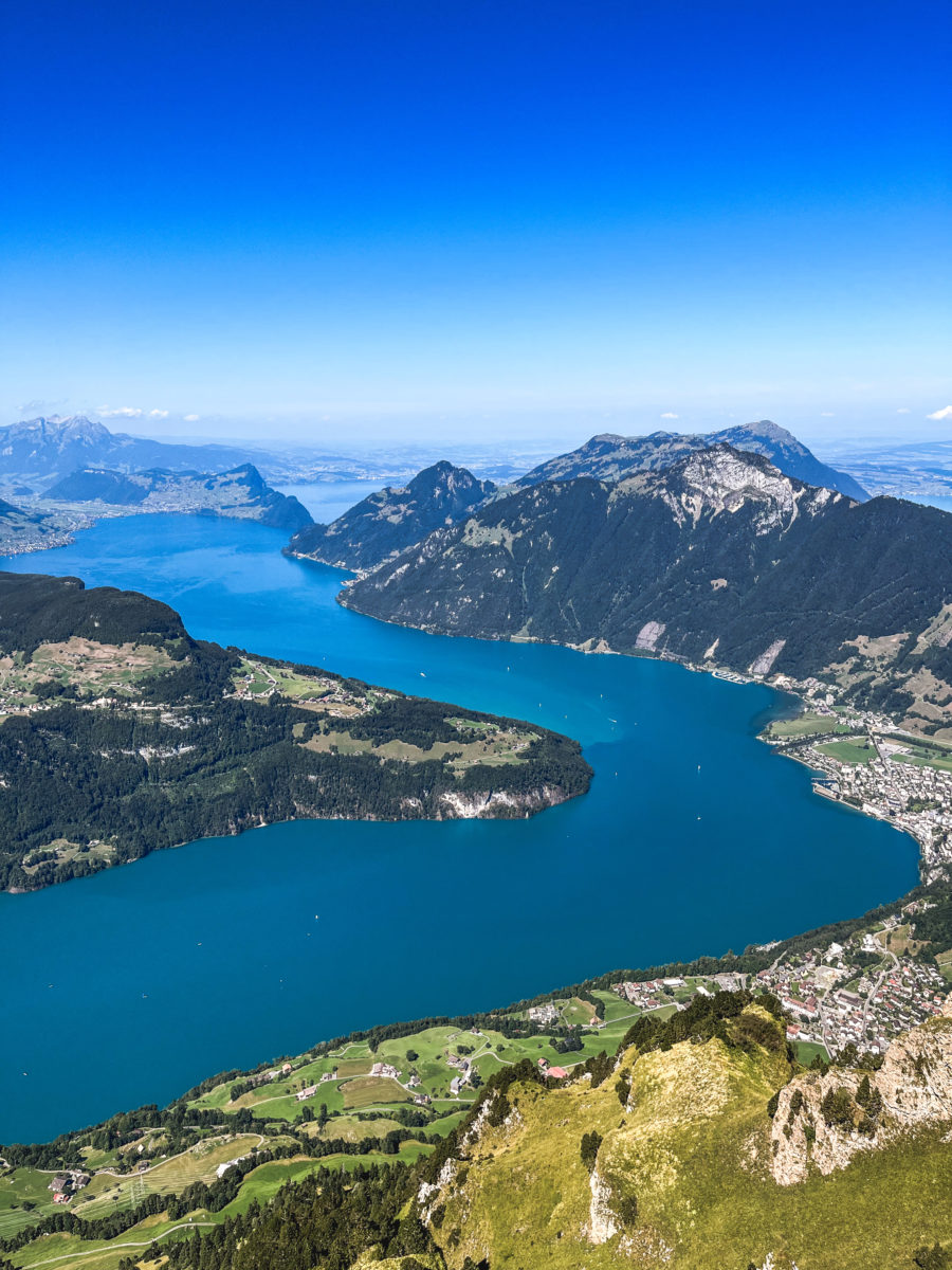
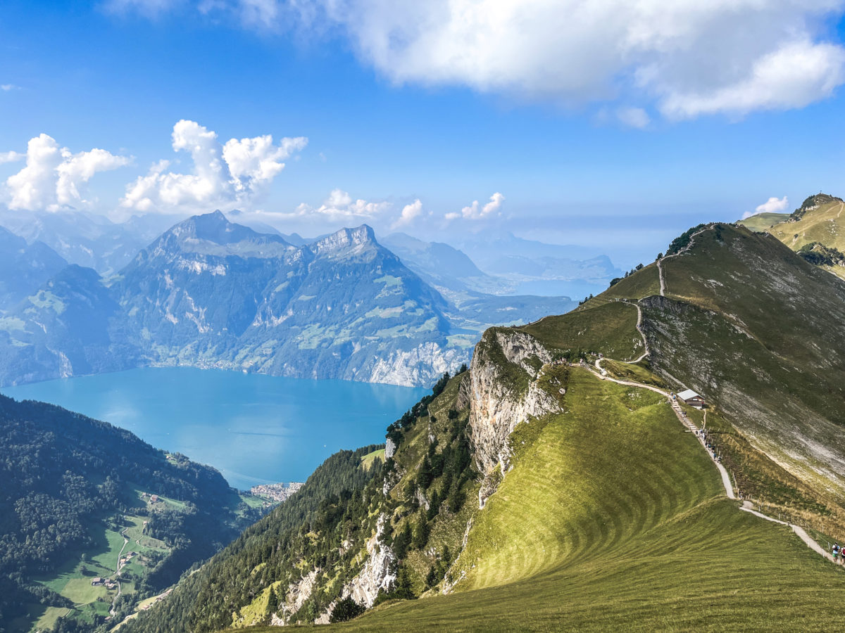
The viewing platform at the Fronalpstock overlooks Brunnen (the village from which we will later take the boat). From here, the view stretches from the arms of Lake Lucerne to the Black Forest, if it’s uncluttered.
From the summit of Fronalpstock, you can also see many Swiss landmarks, such as the Glarus mountains of Glärnisch and Tödi, the Uri Rotstock, the mountains of Central Switzerland, Pilatus and the two Mythen. The panorama also includes several lakes, as well as an impressive bird’s-eye view of the Rütli, the famous place where Switzerland is said to have been founded in 1291.
FROM FRONALPSTOCK TO STOOS
Arriving at the Fronalpstock, we rested for a few minutes in the cool grass before starting the descent on foot to Stoos. This summit is very popular, making it less pleasant to be alone in contemplating the landscape. It is accessible without walking, attracting visitors who come simply to enjoy the view and eat (or even spend the night) at the inn next to the chairlift.
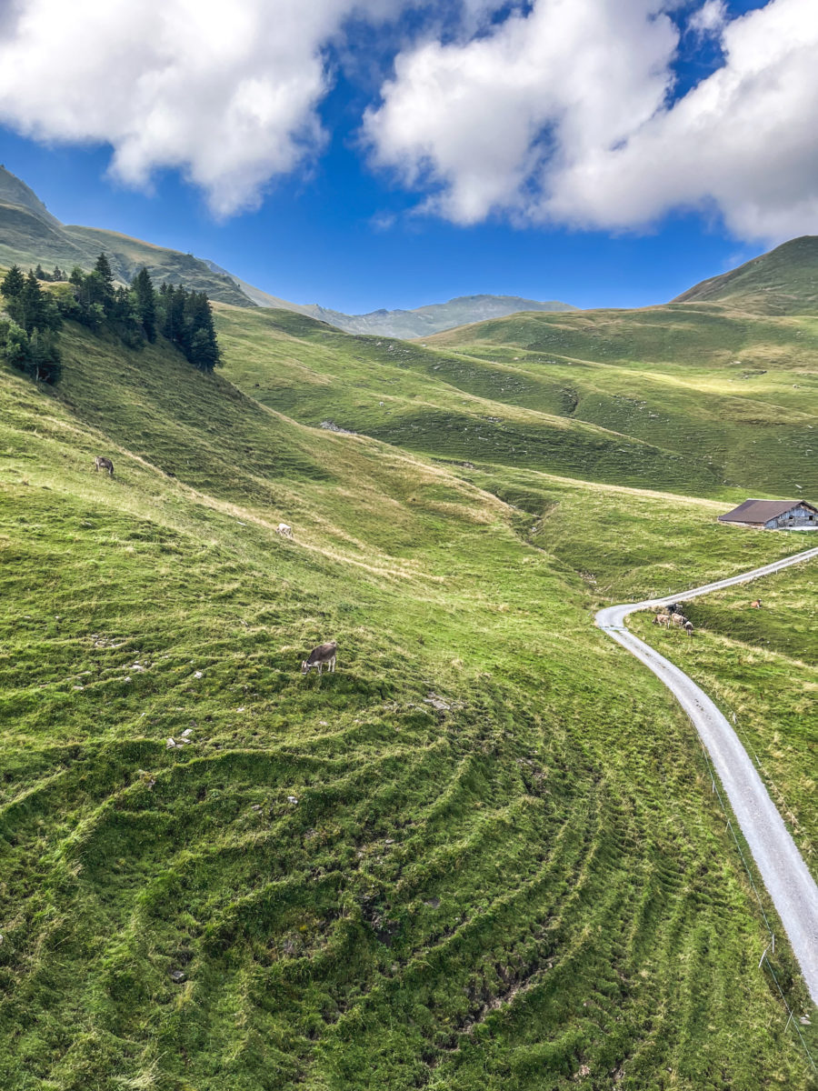
The descent to Stoos is quite pleasant, if you don’t suffer from any aches and pains such as bad knees. It was the beginning of the ordeal for me, whereas it was a relative walk in the park for my companion. Fortunately, she’d brought her poles with her, which saved me and enabled me to walk (almost) normally and arrive (almost) within the 1:30 time limit for this route. The path is relatively wide, and you will also have to pass through the cows (but please leave them alone! The number of hikers who get too close is regrettable!).
STOOS TO BRUNNEN
In around 45 minutes, you can reach the shores of Lake Lucerne at Brunnen, a pleasant little stopover before returning to Lucerne. To do this, you will need to change transport a few times. One option is to take the funicular to Schwyz, Stoosbahn, and then the bus to the Schwyz Zentrum stop. There you change for a direct bus to Küssnacht am Rigi and get off at Brunnen See (the 502). From Stoos, you can also take the cable car back down to Morschach (free with the GA travel card), then take a direct bus to Brunnen and get off at Brunnen See (504).


I preferred to take the funicular back down so that I could also experience its steepness on the way down, but it would also be interesting to take the small cable car back down, which would save ten minutes and a change from the option presented first. In any case, the SBB website provides timetable information here.
taking the boat from BRUNNEN TO LUCERNE
Brunnen is a popular tourist destination in Switzerland. Situated on the shores of Lake Lucerne, the town offers spectacular views of the lake and surrounding mountains.
For me, it’s the perfect place to hop on a boat and explore the turquoise waters of Lake Lucerne (especially in summer) to Lucerne. Inevitably, the boat can get very busy, but nothing beats the fresh air, with your hair blowing in the wind, as you lean against the rail and peacefully cruise the waters. A boat trip on this lake promises an unforgettable experience lasting over two hours.

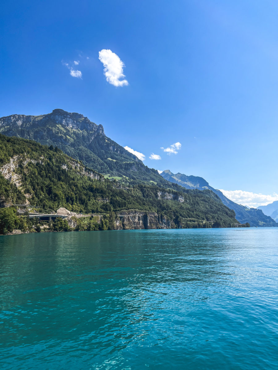
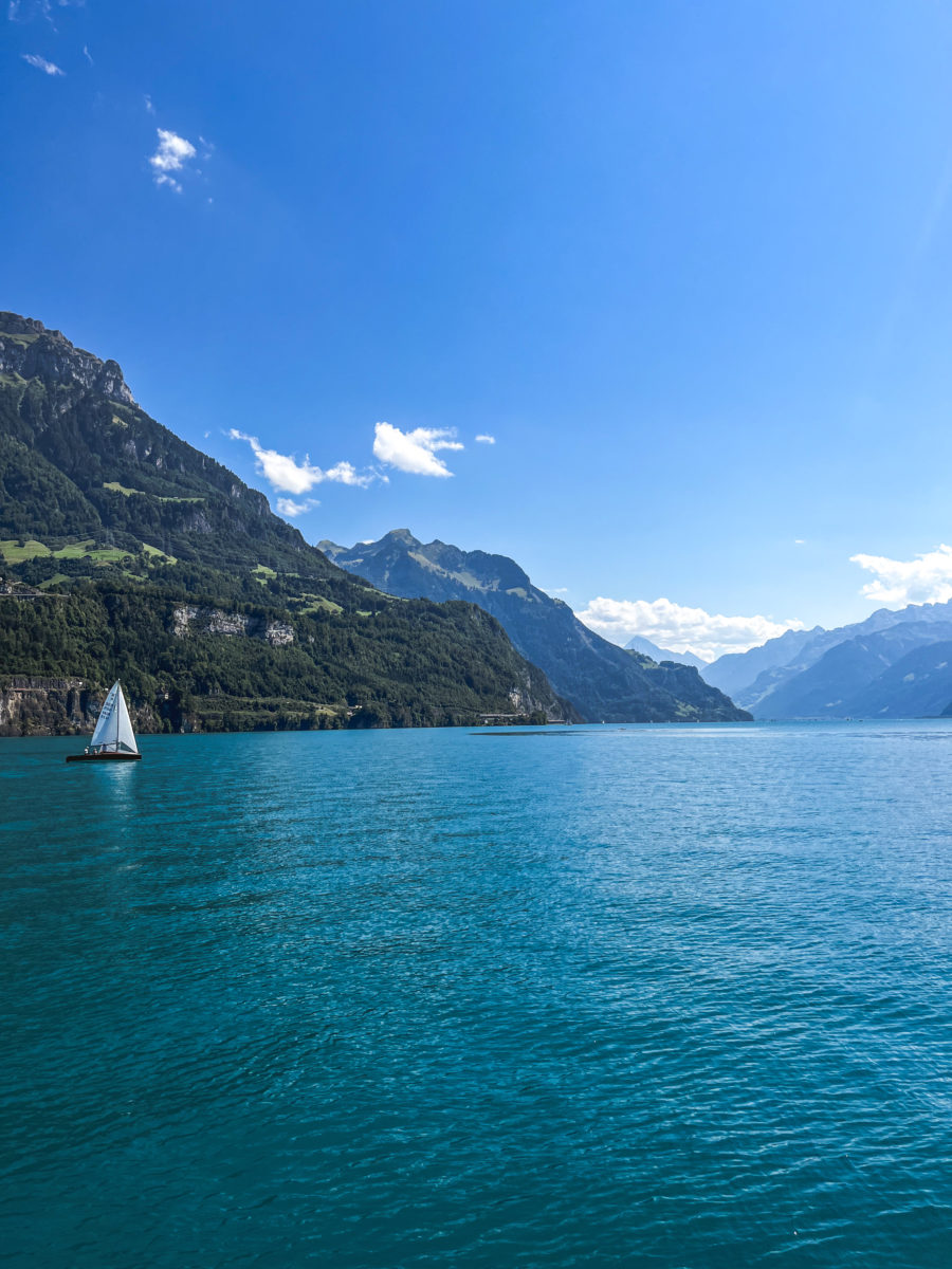
Magnificent mountains, lush green forests and charming Swiss villages border the shores of the lake. There are a few possible stop-off options, but I would strongly recommend taking the direct route to Lucerne, especially if you have managed to get a seat along the side of the boat. However, if you intend to visit Mount Rigi using its historic funicular railway, the first in the world, then Vitznau would be a strategic stop to consider. Afterwards, you can explore Weggis, where you can admire the mountains reflected in the crystal-clear waters of the lake. On your left, you will also see the famous Bürgenstock (with its panoramic lift that costs an arm and a leg) and, against the backdrop of this landscape, Mount Pilatus.

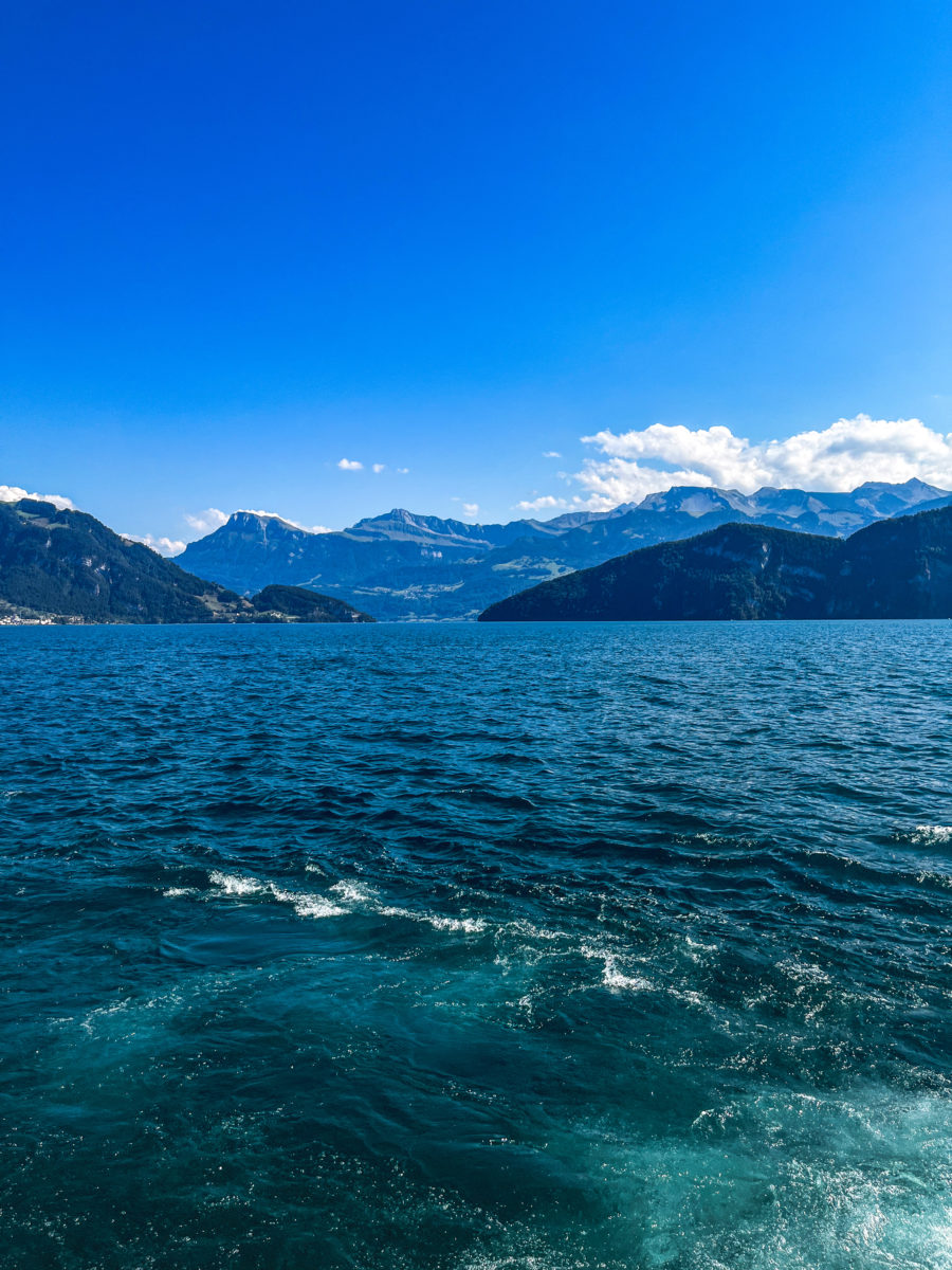
All in all, this boat trip on Lake Lucerne will allow you to admire some of Switzerland’s most breathtaking scenery, discover charming towns and soak up the peaceful atmosphere of this magnificent Alpine region.
thanks for the great article, keep up the good work
this article is very useful, thank you for making a good article
great place to visit, thank you for creating this article